- Mendeltna, Alaska
-
Mendeltna
Bendilna’— CDP — Location of Mendeltna, Alaska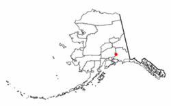
Coordinates: 62°3′35″N 146°26′20″W / 62.05972°N 146.43889°WCoordinates: 62°3′35″N 146°26′20″W / 62.05972°N 146.43889°W Country United States State Alaska Census Area Valdez-Cordova Area - Total 457.1 sq mi (1,183.8 km2) - Land 447.6 sq mi (1,159.4 km2) - Water 9.4 sq mi (24.4 km2) Elevation 2,441 ft (744 m) Population (2000) - Total 63 - Density 0.1/sq mi (0.1/km2) Time zone Alaska (AKST) (UTC-9) - Summer (DST) AKDT (UTC-8) Area code(s) 907 FIPS code 02-48200 GNIS feature ID 1866962 Mendeltna (Bendilna’ in Ahtna) is a census-designated place (CDP) in Valdez-Cordova Census Area, Alaska, United States. The population was 63 at the 2000 census.
Geography
Mendeltna is located at 62°3′35″N 146°26′20″W / 62.05972°N 146.43889°W (62.059604, -146.438981)[1].
According to the United States Census Bureau, the CDP has a total area of 457.1 square miles (1,184 km2), of which, 447.6 square miles (1,159 km2) of it is land and 9.4 square miles (24 km2) of it (2.06%) is water.
Demographics
As of the census[2] of 2000, there were 63 people, 23 households, and 14 families residing in the CDP. The population density was 0.1 people per square mile (0.1/km²). There were 33 housing units at an average density of 0.1/sq mi (0.0/km²). The racial makeup of the CDP was 92.06% White and 7.94% Native American.
There were 23 households out of which 30.4% had children under the age of 18 living with them, 47.8% were married couples living together, 17.4% had a female householder with no husband present, and 34.8% were non-families. 30.4% of all households were made up of individuals and 8.7% had someone living alone who was 65 years of age or older. The average household size was 2.74 and the average family size was 3.53.
In the CDP the age distribution of the population shows 33.3% under the age of 18, 4.8% from 18 to 24, 31.7% from 25 to 44, 17.5% from 45 to 64, and 12.7% who were 65 years of age or older. The median age was 37 years. For every 100 females there were 90.9 males. For every 100 females age 18 and over, there were 110.0 males.
The median income for a household in the CDP was $30,000, and the median income for a family was $28,750. Males had a median income of $22,083 versus $8,750 for females. The per capita income for the CDP was $11,289. There were no families and none of the population living below the poverty line, including no under eighteens and none of those over 64.
References
- ^ "US Gazetteer files: 2010, 2000, and 1990". United States Census Bureau. 2011-02-12. http://www.census.gov/geo/www/gazetteer/gazette.html. Retrieved 2011-04-23.
- ^ "American FactFinder". United States Census Bureau. http://factfinder.census.gov. Retrieved 2008-01-31.
Municipalities and communities of Valdez-Cordova Census Area, Alaska Cities 
CDPs Chenega | Chisana | Chistochina | Chitina | Copper Center | Copperville | Gakona | Glennallen | Gulkana | Kenny Lake | McCarthy | Mendeltna | Mentasta Lake | Nelchina | Paxson | Silver Springs | Slana | Tatitlek | Tazlina | Tolsona | Tonsina | Willow Creek
Unincorporated
communitiesCategories:- Census-designated places in Alaska
- Populated places in Valdez–Cordova Census Area, Alaska


Wikimedia Foundation. 2010.