- List of Interstate and U.S. Highways in Washington
Infobox road
marker_
state=WA
highway_name=Numbered highways in Washington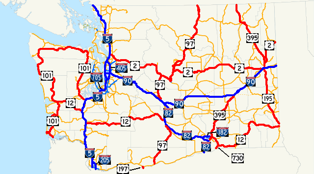
map_notes=This map shows all current Interstates and U.S. Routes.
Interstates are in blue, and U.S. Routes are in red.
Concurrencies between Interstates and U.S. Routes
are not shown.Three systems of
numbered highway s are present in theU.S. state ofWashington : theInterstate Highway System , the U.S. Numbered Highways, and the Washington state route system. The Interstate Highway System and U.S. Highway System are nationwide systems with a subset of the highways passing through Washington. All numbered highways in Washington are maintained by theWashington State Department of Transportation , commonly known as WSDOT. There are currently convert|771.83|mi|km of Interstate in Washington and convert|1821.85|mi|km of U.S. highways in Washington, which combines to make convert|2593.68|mi|km of numbered highways in Washington.Washington State Department of Transportation , [http://www.wsdot.wa.gov/mapsdata/TDO/PDF_and_ZIP_Files/HwyLog2006.pdf State Highway Log] , 2006]Washington State Department of Transportation . " [http://www.wsdot.wa.gov/NR/rdonlyres/87105CAD-83A9-49A7-80F3-5719637C1E2D/0/FrontMapBig.pdf Official State Highway Map] " [map] , 2008-2009 edition, Official State Highway Maps. (2008) Retrieved onJuly 31 ,2008 ]WSDOT, established as the Washington State Highway Board and the Washington State Highways Department, created the first system of numbered roads in Washington in
1923 , with the establishment of the State Road system. When the U.S. highway system was established in1926 , many U.S. highways were co-signed with the existing state roads. [cite web |url=http://www.wsdot.wa.gov/Centennial/1905-1920.htm |title=WSDOT History (1905-1920) |author=WSDOT |accessdate=2008-07-31] Later in1937 , another system, the Primary state highways and Secondary state highways took effect and increased the number of state-maintained roads in Washington. [cite web |url=http://www.wsdot.wa.gov/Centennial/1921-1940.htm |title=WSDOT History (1921-1940) |author=WSDOT |accessdate=2008-06-16] A new system, the current State Route system, took effect in1964 , shortly after the creation of theInterstate Highway System . [cite web |url=http://www.wsdot.wa.gov/Centennial/1941-1960.htm |title=WSDOT History (1941-1960) |author=WSDOT |accessdate=2008-07-31] [cite web |url=http://www.wsdot.wa.gov/Centennial/1961-1977.htm |title=WSDOT History (1961-1977) |author=WSDOT |accessdate=2008-07-31]The Interstate highway with the longest segment in Washington is I-90, at convert|296.92|mi|km, and the Interstate highway with the shortest segment in Washington is I-705, at convert|1.50|mi|km. The U.S. highway with the longest segment in Washington is U.S. Route 12, at convert|430.80|mi|km, and the U.S. highway with the shortest segment in Washington is
U.S. Route 197 , at convert|3.18|mi|km. The longest Washington state highway isWashington State Route 20 , [cite map |publisher=Google Maps |title=SR 20 Overview Map |url=http://maps.google.com/maps?f=d&saddr=WA-20+%4047.987814,+-122.886368&daddr=48.480204,-121.508789+to:US-97+%4048.411060,+-119.513880+to:WA-20+%4048.591390,+-118.187580+to:WA-20+%4048.665470,+-117.475950+to:WA-20+%4048.207193,+-117.064262+to:WA-20%2FW+Walnut+St+%4048.184034,+-117.044082&hl=en&geocode=14465331844282224964,47.987814,-122.886368%3B13433695717176385689,48.411060,-119.513880%3B11573222720205184507,48.591390,-118.187580%3B3382576660373117686,48.665470,-117.475950%3B9723890516125057339,48.207193,-117.064262%3B9627659935565309058,48.184034,-117.044082&mra=dpe&mrcr=0&mrsp=1&sz=7&via=1,2,3,4,5&sll=48.319734,-122.277832&sspn=2.213478,4.570312&ie=UTF8&ll=48.69096,-120.410156&spn=4.394576,9.140625&z=6 |cartography=NATVEQ |year=2008 |accessdate=2008-08-01] at convert|436.12|mi|km, and the shortest Washington state highway isWashington State Route 433 [cite map |publisher=Google Maps |title=SR 433 Overview Map |url=http://maps.google.com/maps?f=d&saddr=Lewis+and+Clark+Bridge+%4046.104670,+-122.961870&daddr=46.126527,-122.941561&hl=en&geocode=16102804938595702695,46.104670,-122.961870&mra=mi&mrsp=1,0&sz=15&sll=46.126675,-122.940917&sspn=0.009012,0.017853&ie=UTF8&ll=46.118347,-122.950058&spn=0.036054,0.071411&z=13 |cartography=NATVEQ |year=2008 |accessdate=2008-08-01] at convert|0.94|mi|km.Washington State Department of Transportation , [http://srview.wsdot.wa.gov/ State Route Web] ]Several former U.S. highways previously existed in Washington:
U.S. Route 10 ,U.S. Route 95 ,U.S. Route 99 ,U.S. Route 295 ,U.S. Route 410 , andU.S. Route 830 .cite web |url=http://www.ushighways.com/usbt.htm |title=U.S. Highways : From US 1 to (US 830) |author=Droz, Robert V. |accessdate=2008-07-31]Primary Interstate highways
 I-205 on the
 Glenn L. Jackson Memorial Bridge over theColumbia River towardsVancouver
 ">
">
I-182 looking eastbound on US 12 towards Walla Walla.Current U.S. highways
 US 101 in Downtown Aberdeen near its intersection with the western terminus of US 12.
 US 12 passing through White Pass eastward towards Yakima.
Blue Bridge carries US 395 over theColumbia River from Kennewick to Pasco.Former U.S. highways
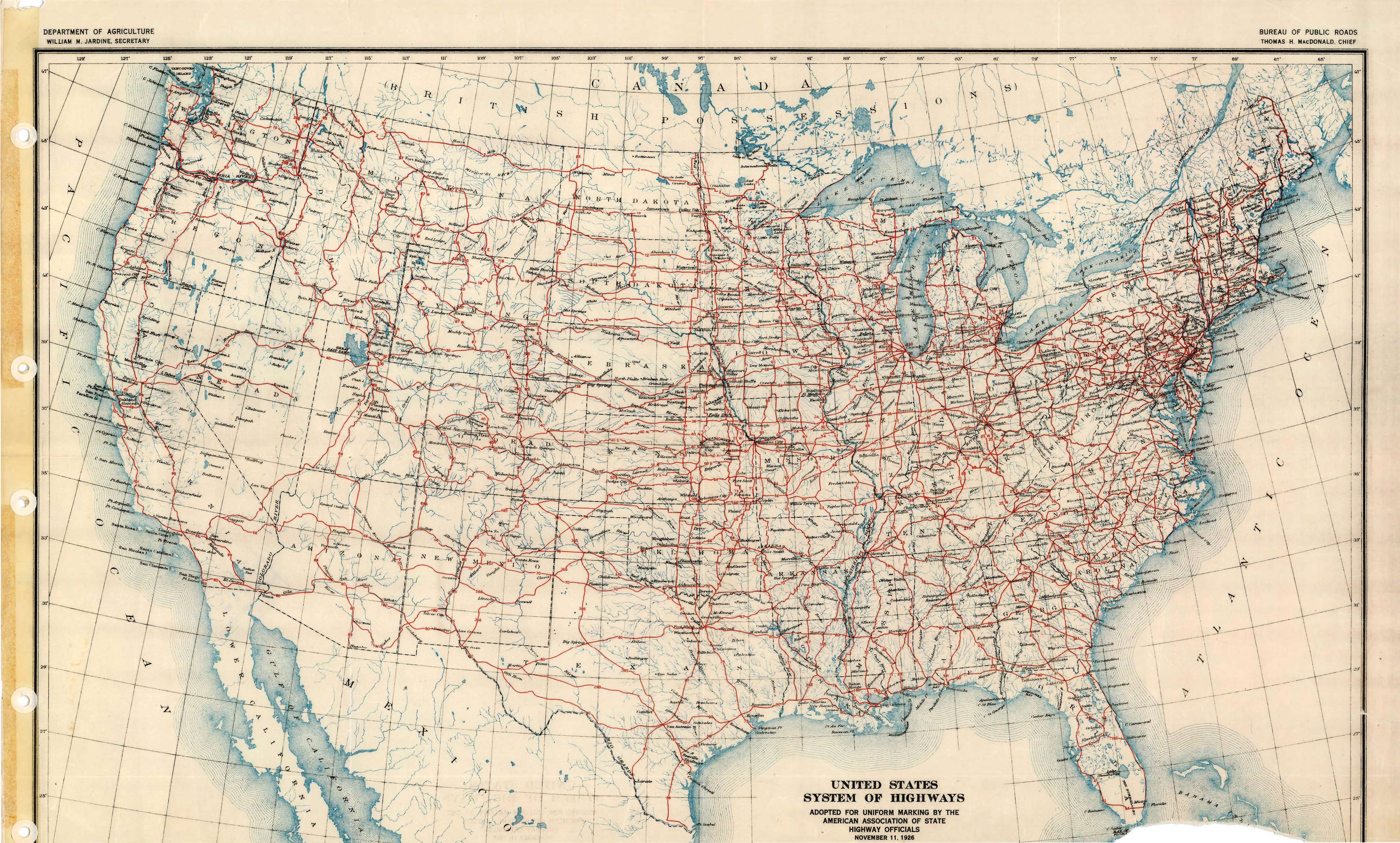
The_original_1926_plan_for_the_U.S. highway system. All former U.S. highways in Washington are on the map..jpg|The_)
George Washington Memorial Bridge , commonly called the Aurora Bridge, carried US 99 over theLake Washington Ship Canal from1926 to1968 . The bridge now carries SR 99, a large portion of US 99's former route.Notes
References
;General
#cite map |publisher=Rand McNally |title=The Road Atlas |year=2008 |isbn=0528939610
#cite map |publisher=Rand McNally |title=The Thomas Guide Pacific Northwest Road Atlas |year=2006 |edition=7th |isbn=0528858696;Specific
Wikimedia Foundation. 2010.