- Morgan County, Alabama
-
Morgan County, Alabama 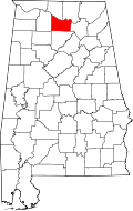
Location in the state of Alabama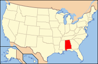
Alabama's location in the U.S.Founded February 6[1], 1818[1] Named for Daniel Morgan Seat Decatur Largest city Decatur Area
- Total
- Land
- Water
599.06 sq mi (1,552 km²)
582.21 sq mi (1,508 km²)
16.84 sq mi (44 km²), 2.81%Population
- (2010)
- Density
119,490
205/sq mi (79/km²)Congressional districts 4th, 5th Time zone Central: UTC-6/-5 Website www.co.morgan.al.us Morgan County is the most populous county in the Decatur Metropolitan Area, and the second most populous county in the Huntsville-Decatur Combined Statistical Area in the U.S. State of Alabama. It was created by the Alabama Territorial legislature on February 6, 1818 from land acquired from the Cherokee Indians in the Treaty of Turkeytown, and was originally called Cotaco County.[1] In 1821 it was renamed in honor of American Revolutionary War General Daniel Morgan of Virginia.[2] As of 2010 the population was 119,490. The county seat is Decatur, and it is a prohibition or dry county, though the City of Decatur is wet. Morgan County is also a part of the North, Northwest, and North-Central regions of Alabama.
Contents
Geography
According to the 2000 census, the county has a total area of 599.06 square miles (1,551.6 km2), of which 582.21 square miles (1,507.9 km2) (or 97.19%) is land and 16.84 square miles (43.6 km2) (or 2.81%) is water.[3]
Major highways
 Interstate 65
 U.S. Route 31
 U.S. Highway 72 Alternate
 U.S. Highway 231
 State Route 20
 State Route 24
 State Route 36
 State Route 67
Rail
River
Adjacent counties
- Madison County (northeast)
- Marshall County (east)
- Cullman County (south)
- Lawrence County (west)
- Limestone County (northwest)
National protected area
Demographics
Historical populations Census Pop. %± 1820 5,263 — 1830 9,062 72.2% 1840 9,841 8.6% 1850 10,125 2.9% 1860 11,335 12.0% 1870 12,187 7.5% 1880 16,428 34.8% 1890 24,089 46.6% 1900 28,820 19.6% 1910 33,781 17.2% 1920 40,196 19.0% 1930 46,176 14.9% 1940 48,148 4.3% 1950 52,924 9.9% 1960 60,454 14.2% 1970 77,306 27.9% 1980 90,231 16.7% 1990 100,043 10.9% 2000 111,064 11.0% 2010 119,490 7.6% [4][5][6] As of the census[7] of 2000, there were 111,064 people, 43,602 households, and 31,437 families residing in the county. The population density was 191 people per square mile (74/km2). There were 47,388 housing units at an average density of 81 per square mile (31/km2). The racial makeup of the county was 85.07% White, 11.24% Black or African American, 0.67% Native American, 0.45% Asian, 0.07% Pacific Islander, 1.25% from other races, and 1.25% from two or more races. 3.28% of the population were Hispanic or Latino of any race.
There were 43,602 households out of which 33.50% had children under the age of 18 living with them, 57.40% were married couples living together, 11.20% had a female householder with no husband present, and 27.90% were non-families. 24.80% of all households were made up of individuals and 9.40% had someone living alone who was 65 years of age or older. The average household size was 2.51 and the average family size was 2.99.
In the county the population was spread out with 25.30% under the age of 18, 8.40% from 18 to 24, 30.10% from 25 to 44, 23.80% from 45 to 64, and 12.30% who were 65 years of age or older. The median age was 37 years. For every 100 females there were 96.20 males. For every 100 females age 18 and over, there were 93.50 males.
The median income for a household in the county was $37,803, and the median income for a family was $45,827. Males had a median income of $35,759 versus $21,885 for females. The per capita income for the county was $19,223. About 9.70% of families and 12.30% of the population were below the poverty line, including 15.90% of those under age 18 and 12.80% of those age 65 or over.
Cities and towns
- Decatur (part of Decatur is in Limestone County)
- Danville
- Eva
- Falkville
- Hartselle
- Lacey's Spring
- Morgan City
- Priceville
- Somerville
- Trinity
Rankings
Rank City/Town Population 2006 estimates 1 Decatur 55,778 2 Hartselle 13,479 3 Priceville 2,380 4 Trinity 1,887 5 Falkville 1,185 See also
- National Register of Historic Places listings in Morgan County, Alabama
- Properties on the Alabama Register of Landmarks and Heritage in Morgan County, Alabama
References
- ^ a b c Acts Passed at the First Session of the First General Assembly, of the Alabama Territory: In the Forty Second Year of American Independence (1818). St. Stephens, Alabama, printed by Thomas Eastin. Reprinted T.L. Cole, Washington, D.C., July 1912. Pages 8-12. "An Act to establish the counties of Cotaco, Lawrence and Franklin...Approved-6th February, 1818."
- ^ Acts Passed at the Called Session of the General Assemby of the State of Alabama Begun and Held in the Town of Cahawba, on the First Monday in June, One Thousand Eight Hundred and Twenty One (1821). Cahawba, Alabama: Printed by Allen & Brickell, State Printers. Reprint by Statute Law Book Co., Washington, D.C. Nov. 1913. Page 40. "An Act to change the name of Ococoposa, and for other purposes...Approved, June 14, 1821."
- ^ "Census 2000 U.S. Gazetteer Files: Counties". United States Census. http://www.census.gov/tiger/tms/gazetteer/county2k.txt. Retrieved 2011-02-13.
- ^ http://www.census.gov/population/www/censusdata/cencounts/files/al190090.txt
- ^ http://factfinder2.census.gov
- ^ http://mapserver.lib.virginia.edu/
- ^ "American FactFinder". United States Census Bureau. http://factfinder.census.gov. Retrieved 2008-01-31.
External links
- Decatur Morgan County Chamber of Commerce
- Learn more about Decatur-Morgan County
- Alabama Jubilee - Hot Air Balloon Classic

Limestone County Madison County Lawrence County 
Marshall County  Morgan County, Alabama

Cullman County Municipalities and communities of Morgan County, Alabama Cities 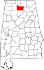
Towns Eva | Falkville | Priceville | Somerville | Trinity
Unincorporated
communitiesBasham | Burningtree Mountain | Danville | Hulaco | Lacey's Spring | Morgan City | Moulton Heights | Ryan Crossroads | Union Hill
Ghost town Footnotes ‡This populated place also has portions in an adjacent county or counties
Communities of the Huntsville-Decatur Area Population over 100,000 Population over 50,000 Population over 20,000 Population over 10,000 Population over 5,000 Population over 2,000 Population over 1,000 Population over 500 Population over 200 Population under 200 Unincorporated areas Belle Mina · Caddo · Danville · Hulaco · Lacey's Spring · Meridianville · Morgan City · Moulton Heights · New Market · Tanner · ToneyCounties  State of Alabama
Topics - Index
- History
- Geography
- People
- Delegations
- Government
- Governors
- Lieutenant Governors
- Metropolitan Areas
- Visitor Attractions
- National Historic Landmarks
Regions Metros - Greater Birmingham
- Montgomery Metro Area
- Mobile Metro Area
- Huntsville Metro Area
Larger cities Counties - Autauga
- Baldwin
- Barbour
- Bibb
- Blount
- Bullock
- Butler
- Calhoun
- Chambers
- Cherokee
- Chilton
- Choctaw
- Clarke
- Clay
- Cleburne
- Coffee
- Colbert
- Conecuh
- Coosa
- Covington
- Crenshaw
- Cullman
- Dale
- Dallas
- DeKalb
- Elmore
- Escambia
- Etowah
- Fayette
- Franklin
- Geneva
- Greene
- Hale
- Henry
- Houston
- Jackson
- Jefferson
- Lamar
- Lauderdale
- Lawrence
- Lee
- Limestone
- Lowndes
- Macon
- Madison
- Marengo
- Marion
- Marshall
- Mobile
- Monroe
- Montgomery
- Morgan
- Perry
- Pickens
- Pike
- Randolph
- Russell
- Shelby
- St. Clair
- Sumter
- Talladega
- Tallapoosa
- Tuscaloosa
- Walker
- Washington
- Wilcox
- Winston
Coordinates: 34°27′06″N 86°51′26″W / 34.45167°N 86.85722°W
Categories:- Alabama counties
- 1818 establishments in the United States
- Populated places established in 1818
- Huntsville–Decatur Combined Statistical Area
- Decatur Metropolitan Area
- Morgan County, Alabama


Wikimedia Foundation. 2010.