- History of Cumbria
-
The history of Cumbria as a county of England begins with the Local Government Act 1972. Its territory and constituent parts however have a long history under various other administrative and historic units of governance. Long existing as an upland, coastal and rural area, Cumbria's heritage is characterised by a broad number of invasions, migration and settlement, as well as battles and skirmishes between the English and Scottish.
Contents
Character
Cumbria was created in 1974 from territory from the historic counties of Cumberland, Westmorland, Lancashire North of the Sands and a small part of Yorkshire, but the human history of the area is ancient. The region is a country of contrasts, with its mountainous central region and famous lakes, its fertile coastal plains in the north and its gently undulating hills in the south. It is a place of rock and water, and it seems to be this unique identity that has been the key to the area's popularity for millennia.
In the 21st century Cumbria relies upon tourism and farming as an economic base, but almost since humans first arrived here, industry has also played a vital role in the area's fortunes. The region might have enjoyed far greater prosperity were it not for its politico-geographical position: its proximity to Scotland has meant that for much of its history Cumbria has been disputed land between the Scots and the English, and has acted as a buffer-zone to protect the wealthier south from harassment. Raids from Scotland were a frequent part of Cumbrian life until the Acts of Union 1707 and the large area of coastline also meant vulnerability from Irish and Norse raids.
The character of Cumbria is therefore undoubtedly one of isolation. Until the coming of the railway, much of the region would have been difficult to reach and even today there are routes which make most motorists a little nervous. (In the harsher winter months, many of the central valleys are cut off from the outside world.) This made the area something of a refuge for dispossessed peoples, which may well account for the popular conception of Cumbria as a provincial backwater; quaint and archaic. The Brythonic Celts managed to cling on in enclaves until around the 10th century, long after much of England was essentially 'English', and the Norse retained a distinct identity well into the Middle Ages. After that Cumbria remained somewhat a 'no mans' land' between Scotland and England, which meant that the traditional Cumbrian identity was neither English nor Scottish.
Since the act of union, the border areas have become more firmly English or Scottish. Whilst Cumbrians are generally hospitable to guests, it is also well known that they have an uncertain attitude to offcomers.
Prehistory
Earliest Inhabitants
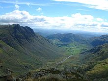 Great Langdale, site of the Langdale Axe Factory
Until around 13,000 years ago, Cumbria would have been uninhabitable because it would have been completely covered with thick ice sheets, which were largely responsible for carving out the mountains and valleys of the Lake District.
Although evidence has been put forward for Upper Paleolithic habitation in the south of the county, it is generally accepted by archeologists that the earliest inhabitants of Cumbria would have arrived during the Mesolithic era, after 10,000 years ago. It is thought that settlers would have made their way across Morecambe Bay and along the fertile coast where resources could have been exploited with ease. At this time the upland central region of the county would probably have been heavily forested and very dangerous. Large Mesolithic flint-chipping sites, where flints washed up from the Irish Sea would have been worked into tools, have been found at Eskmeals, near Ravenglass on the west coast and at Walney in the south.
Neolithic period
There is much more visible evidence of Neolithic activity than any time before. This was a time of technological advancement and national population expansion. At some point, the mesolithic coastal communities must have moved further inland, probably following rivers along valley corridors into the heart of Lakeland.
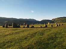 Castlerigg Stone Circle
The most famous and important Neolithic activity in Cumbria is the so-called 'Langdale Axe Factory', which created many thousands of axe heads from the green volcanic tuff found on the Pike O'Stickle from around 6000 BC. The axe heads were not merely for local practical use; they have been found all over the United Kingdom from Norfolk to Northern Ireland, and seem to have often been used for ceremonial or ritual purposes. Clearly the green rock created a sense of mystery and magic in the Neolithic mind.
Also at this time, possibly because of the economic power created by the Axe Factory, stone circles and henges began to be constructed across the county. Neolithic examples include the impressive henge at Mayburgh, near Penrith, and a partly destroyed one at nearby King Arthur's Round Table as well as the famous Castlerigg Stone Circle above Keswick. It's also possible that the megalith Long Meg was erected at this time.
Bronze Age
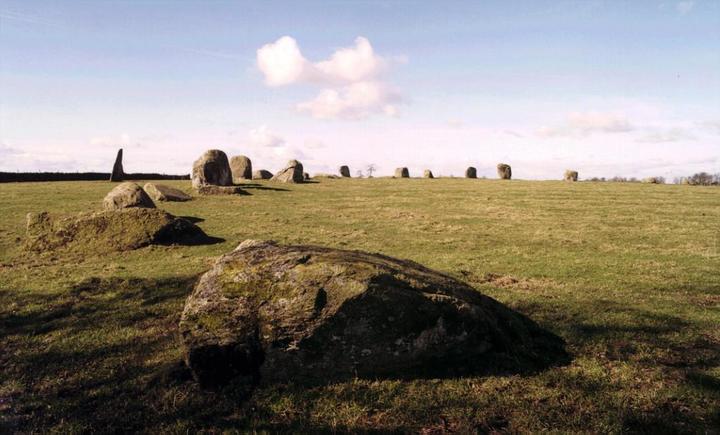
 Long Meg and Her Daughters
By the Bronze Age, settlements in Cumbria are likely to have taken a much more permanent form. Bronze Age artefacts have been uncovered throughout the county, including several bronze axe heads around Kendal and Levens, an axe and a sword at Gleaston, an intriguing carved granite ball discovered near Carlisle and part of a gold necklace believed to be from France or Ireland found at Greysouthen. A timber palisade has also been discovered at High Crosby near Carlisle.
Ritual or 'religious' sites can be seen across the county and are often clearly visible. Cairns and round barrows can be found throughout the area and a cemetery has been discovered near Allithwaite. More impressive remains include stone circles, such as Birkrigg stone circle, Long Meg and Her Daughters, Swinside, Little Meg and several others.
Iron Age
The Iron Age in Britain is generally characterised by the arrival of Celtic culture - including certain art forms and languages - as well as the obvious increase in the production of iron. During this time the people of Great Britain and Ireland were divided into various tribes. In Cumbria the Carvetii dominated most of the county for a time whilst the Setantii were present in the south, until both were incorporated into the vast Brigantes which ruled most of northern England. They would have spoken the ancient British language of Brythonic, the predecessor of modern Welsh, and were probably responsible for naming some of the county's most notable topographical features such as its rivers (e.g. Kent, Eden, Cocker, Levens) and mountains (e.g. Blencathra).
There are many remains of Iron Age settlement in Cumbria, including hill forts such as those at Maiden Castle and Dunmallard Hill and many hundreds of smaller settlements and field systems. In the 18th century a beautiful iron sword with a bronze scabbard, dating to around 50 BC, was found at Embleton near Cockermouth and is now in the British Museum.
Romans
After the Romans' initial conquest of Britain in AD 43 the territory of the Brigantes remained independent of Roman rule for some time. At that time the leader of the Brigantes was the queen Cartimandua, of illustrious birth,[1] whose husband Venutius is believed to have been a Carvetian and may therefore be responsible for the incorporation of Cumbria into the Brigantian federation.
Despite retaining their independence, Cartimandua and Venutius were loyal to the Romans and in return were offered protection by their Imperial neighbours. But the royal couple were divorced and Venutius led two rebellions against his ex-wife. The first, in the 50's AD, was successfully quashed by the Romans but the second, in 69 AD, came at a time of political instability in the Empire and resulted in the Romans evacutating Cartimandua and leaving Venutius to reign over the Brigantes.
 Hardknott Roman Fort
Two years later the Roman conquest of the Brigantes began, but appears to have lasted for several decades. In 78 AD Agricola managed to push north from Deva (Chester) to Carlisle and placed garrisons between the Solway Firth and the River Tyne, consolidating his gains over the following two years. Despite the Romans managing to occupy the region and make allegiances with the Brigantes, the troubles seem to have continued until at least the 140's AD when they were said to have been defeated in an unprovoked war by Emperor Antonius Pius.
Although not attested by any literary source, evidence from inscriptions suggests that under Roman rule most of the area of what is now Cumbria formed a civitas of the Carvetii separate from that of the Brigantes. Its administrative capital is presumed to have been Luguvalium (Carlisle), the only walled town known in the region.
The impression left upon Cumbria by the Roman occupation can hardly be understated. From around the 120's AD a system of roads was built across the county, including the aptly named High Street which runs across the eastern fells from the Roman fort Brocavum at Brougham to Galava near Ambleside. The roads were a vital means of communication across the mountains and moors of the county, connecting the many forts, such as the one at Hardknott with the sea ports at Ravenglass and Maryport, the important settlement of Luguvalium at Carlisle and, of course, Hadrian's Wall.
Building of Hadrian's Wall along the line of Agricola's earlier garrisons was begun in 122 AD and was completed in less than ten years, such was the efficiency of the Roman military. For Hadrian's Wall in the west of England, originally "turf and timber were preferred on the Solway plain, where stone is scarce".[2] It ran from Bowness on Solway on the Solway Firth across the north of the county and through Northumberland to Wallsend on the Tyne estuary and was created on the orders of emperor Hadrian as an attempt to create a solid northern frontier to the Roman Empire and keep the Brigantes and neighbouring Scotti under control.
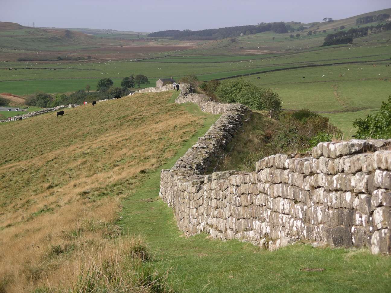
 Hadrian's Wall
Only twenty years after Hadrian's Wall was started, Antonius Pius almost abandoned it, turning his attentions to his own frontier fortification the Antonine Wall in Scotland. But Antonius' attempts to exert control in the far north failed and he returned to Hadrian's Wall in 164 AD, after which garrisons were retained until the onset of the 5th century.
There are several forts and milecastles along Cumbrian half of the wall, the largest or which is Birdoswald.
It is difficult to assess the long-term effects that the Roman occupation had on the native inhabitants of Cumbria. Everyone would certainly have been aware of their arrival in the area, and their final departure, but the locals were left much more up to their own devices than those in the south of England. No doubt there would have been some Romanisation of the local culture, specifically among the governing élites who worked closely with the Roman military. The local dialect word eglus, meaning a church, has survived from Roman times, having been incorporated into the Brythonic language from the Latin ecclesia, showing not only an acceptance of Roman culture among the locals, but also the original introduction of Christianity to the region.
Sub-Roman times
By the time of the official Roman break with Britannia in 410, most of Britain was already acting independently of its occupiers. In Cumbria, because the Roman presence had been almost entirely military rather than civil, the withdrawal is unlikely to have caused much change. Many of the Roman forts may have continued in use as places of local government and habitation; there is evidence suggesting that Birdoswald was inhabited until at least the 6th century.
Even before the Romans left Britain, it appears that Coel Hen was an important figure in the Roman province of Northern Britain, which covered everything between the River Humber and the River Tweed. It is thought by some that he may have been the last of the Duces Brittanniarum and as such would have commanded the army in this region. After the withdrawal, Coel Hen became the High King of Northern Britain (in the same vein as the Irish Ard Rí) and ruled from Eburacum (now York).
Following Coel Hen's death, his kingdom was continually divided among his descendants until, in the 6th century Urien is recorded as the king of a land called Rheged, which is thought to have been centred on modern Cumbria but also included large parts of Dumfriesshire, Lancashire and Yorkshire. The Kingdom was based at Llwyfenydd, believed to be what is now the Lyvennet Beck, a tributary of the River Eden in east Cumbria. The little that is known about Rheged and its kings comes from the poems of Taliesin, who was bard to Urien. It is known that under Urien's leadership, the kings of the north fought against the encroaching Angles and that he was betrayed by one of his own allies, Morcant Bulc, who arranged his assassination after the battle of Ynys Metcaut (Lindisfarne) around 585 AD.
Unfortunately the lack of documentary or even archaeological evidence from this period of Cumbria's history has meant that history and legend have become hopelessly intertwined and the fragments of certainty have become the basis of local myth. One of Cumbria's greatest heroes is Urien Rheged's son, Owain (usually Ewain in Cumbria), who is supposed to have lived at Castle Hewen, believed to be a Romano-British hillfort south of Carlisle.
As with many other areas with Celtic connections, there are a number of Arthurian legends associated with Cumbria. Arthur's father, Uther Pendragon is supposed to have live at Pendragon Castle, high in the upper Eden Valley, although the castle itself is probably 12th century and was originally called Mallerstang Castle. It is also believed that Arthur's famous last Battle of Camlann in which he was fatally wounded was fought in the vicinity of Birdoswald, whose Roman named was Camboglanna. More popular in local legend are associations with Arthur's knight Lancelot, who is believed to have been from Tarn Wadling, now a dried up lake near High Hesket (and overlooked by Owain map Urien's Castle Hewen). Even King Arthur's Round Table, a massive earthwork near Penrith, has no actual associations with Arthur but is said to have been a duelling ground for Lancelot. Finally, the Roman Bath-house at Ravenglass, known locally as Walls Castle, is thought to be the Arthurian Lyons Garde.
 Walls Castle, Ravenglass: the possible site of the Arthurian Lyons Garde or St Patrick's birthplace
One aspect of the sub-Roman period in Cumbria that can be assumed with a little more certainty is the early establishment of Christianity. A number of early saints are associated with the region, including Saint Patrick, Saint Ninian and Saint Kentigern.
Patrick was born to a family of local dignitaries at Banna venta Berniae, assumed to be Ravenglass (whose Roman name was Glannaventa) or somewhere in the Solway region of Carlisle. Several places are traditionally associated with Patrick, such as Aspatria and Patterdale, largely because both derive their names from historical Patricks, but there is no evidence to suggest that there is any association with these places.
Saint Ninian, born about 360 AD, was almost certainly of Cumbrian origin and has strong associations with Ninekirks near Penrith. Not only did Ninian give his name to the place, he is believed to have had a hermitage in the caves of Isis Parlis overlooking the present church, which was originally dedicated to him. Earthworks in the area also give tantalising clues to an early monastery here. Ninian is often credited with the conversion of the Cymry to Christianity, despite its original introduction to the area by Romans.
By the 6th century, however, it seems that the Cymry had fallen back into old pagan ways and that it was the responsibility of Saint Kentigern to re-Christianise the area. Kentigern, or Mungo as he was affectionately known, was a contemporary of Urien Rheged (although one source claims that he was the illegitimate son of Owain mab Urien) who is known to have been a Christian, but his subjects might have been less devout. Around 553 AD Kentigern was expelled from Strathclyde where he was based, because of a strong anti-Christian movement. The fact that he fled as far as Wales, and could not find refuge in Cumbria, suggests that similar feeling might have been popular here. However, in 573 AD a battle took place at Ardderydd (Arthuret) on the border with Scotland, between the Christian King Rhydderch Hael of Strathclyde and the pagan King Gwenddolau and was a victory for the Christians, after which Kentigern returned to Strathclyde. What involvement Rheged had in this battle is not clear, but it seems they benefitted by gaining the land formerly called Caer-Wenddolau (modern Carwinley) by the Border Esk separating Cumbria from Dumfries and Galloway, and they may have even amalgamated with Strathclyde to form a sort of dual-kingdom.
Angles
Around the year 638 AD Oswiu, who would become the King of Northumbria, married Riemmelth (Rhiainfellt), a direct descendant of Urien Rheged and a Princess of the kingdom. This peaceable alliance between the British and English nations signalled the beginning of the end of Cumbrian independence, as Angles from the north east began to filter into the Eden Valley and along the north and south coasts of the county.
It is possible that at the time of the Synod of Whitby in 664 AD, when the Celtic Church of the North was abandoned in favour of the Roman Church, which was dominant in the south of England, much if not all of Cumbria was subject to the will of the Northumbrian Kings. The area certainly seems to have undergone a full scale conversion to the Roman faith. In 670 AD, Oswiu's son—but not by Riemmelth—Ecgfrith ascended the throne of Northumbria and it was probably in that year that the Bewcastle Cross was erected, bearing English runes, which shows that they were certainly present in the area. But it seems that Cumbria was little more than a province at this time and, although Anglian influences were clearly seeping in, the region remained essentially British and retained its own client-kings. In 685 AD, when Saint Cuthbert was granted lands in Cumbria by Aldfrith, the new King of Northumbria, it is said he was given Cartmel and all the Britons therein, showing that even areas where Anglian settlement was greatest, the British were still predominant.
Vikings
 The northeastern Irish Sea, showing new settlements with Norse place names.
The arrival of the first Norse settlers is thought to have been around 925 AD. Unlike much of the country to the east, the Vikings of Cumbria were Norwegians who came via Ireland, Scotland and the Isle of Man. Fifty years earlier the Danes led by Halfdan had entered Cumbria through the Stainmore Pass and ransacked the area, reducing Carlisle to such a state that it remained in ruins for the next two hundred years, and annexed Cumbria to the Danelaw.
For a time, it is likely that the Vikings would have simply raided the coastal areas of the county by sea before returning to Ireland and the Isle of Man. But they soon came to settle, and seem to have preferred the uplands of the central region, no doubt because the Angles had not penetrated so far and land was easier to come by. Their influence is still evident in the vast number of place names, particularly in the central lakes, which include Norse elements such as dale, fell, howe and thwaite.
During this period much of Cumberland and Westmorland - traditionally to the Rere Cross on Stainmore formed part of the Kingdom of Strathclyde also known as Cumbria. One theory is that Viking colonisation was encouraged by the Cumbric speaking kings as a bulwark against the English to the South
In 945 AD the Anglo-Saxon Chronicle records a defeat of the Cumbrians and the harrying of Cumberland (referring not just to the English county of Cumberland but also all the Cumbrian lands up to Glasgow). Edmund I of England defeated the last Cumbrian king, Dunmail - possibly Dyfnwal III of Strathclyde. Following the defeat, the area was ceded to Malcolm I of Scotland, although it is probable that the southernmost areas around Furness, Cartmel and Kendal remained in under English control.
 Fibulae from the Penrith hoard
The influence of the Vikings remained strong until the Middle Ages, particularly in the central region. A Norse-English creole was spoken until at least the 12th century and evidence of the imposition of the Viking political system is shown in the existence of several possible Thing mounds throughout the county, the most significant of which is at Fell Foot in Langdale. As an example of Viking relics, a hoard of Viking coins and silver objects was discovered at Penrith.[3]
Middle Ages
Domesday
 Approximate extent of Domesday coverage
When the Normans conquered England in 1066 much of Cumbria was a no-man's-land between England and Scotland which meant that the land was not of great value. As a consequence, when the Domesday Book was compiled on behalf of William I only the southern part of the county was included and even that was only as annexes to Yorkshire.
For the most part the Cumbrian Domesday entries are little more than a list of place names and the amount of taxable land therein, with the names of the pre- and post-conquest landowners - a much sparser account than much of the rest of England. This in itself shows the isolated and remote nature of the area at this time, but the entries also provide evidence that Cumbria's prosperity had decreased significantly since the middle of the previous millennium - no doubt in part caused by the Conqueror's Harrying of the North.
Hougun
The western-most entries for Cumbria, covering the Duddon and Furness Peninsulas are largely recorded as part of the Manor of Hougun. The entry in Domesday Book covering Hougun refers to the time when it was held by Earl Tostig about 1060. The exact location of Hougun has been long disputed and Millom is often suggested, although High Haume near Dalton-in-Furness has also been suggested given that it was recorded in 1336 as Howehom. The name itself is thought to derive from the Old Norse haugr meaning 'among the hills,'[citation needed] which could refer to almost anywhere in the area. Houganai or island of Hougun was also the name given to nearby Walney Island.[4]
The Hougun entry is as follows (land is measured in carucates in the north, which is roughly the amount of land assume to provide for one household for one year):
- In Hougun Manor Earl Tosti had four carucates rateable to the geld.
- In Chiluestreuic iii c., Sourebi iii c., Hietun iiii c., Daltune ii c., Warte ii c., Neutun vi c.,
- Walletun vi c., Suntun ii c., Fordebodele ii c., Rosse vi c., Hert ii c., Lies vi c., Alia Lies ii c.,
- Glassertun ii c., Steintun ii c., Clivertun iiii c., Ouregrave iii c., Meretun iiii c., Penni-
- getun ii c., Gerleuuorde ii c., Borch vi c., Beretsiege iiii c., Witingham iiii c., Bodele iiii c.,
- Santacherche i c., Hougenai vi c.. All these vills belong to Hougun.[5]
Hougun (?High Haume/Millom), 4 c., Tosti
- Chiluestreuic (Killerwick, lost), 3c.
- Sourebi (Sowerby), 3c.
- Hietun (Hawcoat), 4c.
- Daltune (Dalton-in-Furness), 2c.
- Warte (Thwaite Flat), 2c.
- Neutun (Newton), 6c.
- Walletun (Waltoncote, lost), 6c.
- Suntun (?Sunbrick/Stank), 2c.
- Fordbodele (Fordbootle, lost), 2c.
- Rosse (Roose), 6c.
- Hert (Hart, lost), 2c.
- Lies (Leece), 6c.
- Alia Lies (another Leece, lost), 2c.
- Glassertun (Gleaston), 2c.
- Steintun (Stainton), 2c.
- Clivertun (Crivelton, lost) 4c.
- Ourgrave (Orgrave), 3c.
- Meretun (Marton), 4c.
- Pennigetun (Pennington), 2c.
- Gerleuuorde (Ireleth), 2c.
- Borch (?Broughton-in-Furness/Birkrigg), 6c.
- Beretseige (Bardsea), 4c.
- Witingham (Whicham), 4c.
- Bodele (Bootle), 4c.
- Santacherche (Kirksanton) 1c.
- Hougenai (Walney), 6c.
Ulvreston (Ulverston), 6c., Turulf
- Dene (Dendron), 1c.
- Bodeltun (Bolton-with-Adgarley), 6c.
Aldingham (Aldingham), 6c., Ernulf
Cherchebi (?Cartmel), Dwan from the King
Holecher (Holker), Orm from the King
Neutun (High and Low Newton), King's land
Bretebi (Birkby), Orm from the King
Further east, in what was later to become Westmorland, several other places are mentioned but with similar brevity. Most of the places are within the low lying areas around the Kent and Lune valleys. Most of the entries are in two groups: the first is land around Kendal belonging to the King which had belonged to a Gillemichael before the Conquest; and the second is land belonging to Roger de Poitou and held by one Ernwin the Priest under him:
- In Stercaland, Mimet, Cherchebi, Helsingetune, Steintun, Bodelforde, Hoton, Bortun,
- Daltun, Patun. Gillemichael had them. There are xx c. of land taxable in them.
- In Biedun Earl Tosti had vi c. taxable. Now Roger de Poitou has them, and Ernwin the
- Priest under him. In Yeland iiii c., Fareltun iiii c., Prestun iii c., Borwick ii c.,
- Hennecastre ii c., Eureshaim ii c., Lefuenes ii c.
King's land
- Stercaland (Strickland Roger)
- Mimet (Mint)
- Cherchebi (Kendal) [previously known as Kirkby Kendal]
- Helsingetune (Helsington)
- Steintun (Stainton)
- Bodelforde lost
- Hoton (Old Hutton)
- Bortun (Burton-in-Kendal)
- Daltun (Dalton)
- Patun (Patton)
Biedun (Beetham), 6c., Ernwin the Priest from Roger de Poitou
- Yeland (Yealand Conyers/Yealand Redmayne), 4c.
- Fareltun (Farleton) 4c.
- Preston (Preston Patrick/Preston Richard) 3c.
- Borwick (Borwick) 2c.
- Hennecastre (Hincaster), 2c.
- Eureshaim (Heversham), 2c.
- Lefuenes (Levens) 2c.
Brebrune (Barbon), King's land
Castretune (Casterton), King's land
Holme (Holme), King's land
Hotun (Hutton Roof), King's land
Cherchebi (Kirkby Lonsdale), King's land
Lupetun (Lupton), King's land
Manzserge (Mansergh), King's land
Middeltun (Middleton), King's land
Scottish wars
It did not take long for the Normans to assert their control over the whole of Cumbria. In 1092, William II conquered Carlisle for England, beginning a period of centuries of border conflict and instability. Lands in the county were granted to Norman allies to secure the taking and almost immediately they began constructing strongholds at places such as Carlisle, Brough and Liddel to protect the new border.
In 1136 King David I of Scotland invaded Carlisle and captured it forcing King Stephen to cede much of Cumberland and Westmorland to him, and in 1139 David's son Prince Henry was created Earl of Northumberland, giving him control of the administrative area of Northumberland, Cumberland, Westmorland and Lancashire north of the River Ribble. In return for acknowledging their new King's overlordship the Norman lords of Cumbria were mostly allowed to keep their lands and their positions and there appears to have been a short period of relative peace as there are no known instances of castle building at this time.
But in 1157, Malcolm IV of Scotland surrendered the lands granted in 1136 back to England. In the period which followed, many of the great castles of Cumbria were built or strengthened, including Carlisle, Brougham, Brough and Appleby, strongly suggesting that there was a sense of insecurity at this time.
It was around this time that the ancient counties which made up modern Cumbria came into existence. Westmorland was recorded as early as 966 when it was mentioned in the Anglo-Saxon Chronicle, but at this time it was not an administrative district. It was mentioned again in 1131 by which time it had become a more definite political district, although it wasn't until 1177 that it was formally created from the baronies of Appleby and Kendal. After the area's recovery from Scotland in 1092, Cumberland was granted to Ranulph le Meschin as the 'Honour of Carlisle' but reverted to the Crown in 1121 when he became Earl of Chester. After being recovered from Scotland again in 1157 the barony of Copeland was added to the area to form the county as it remained until 1974; it was renamed Cumberland in 1177. Lancashire was one of the last counties to be formed in England in 1182 although its boundaries may have been fixed around 1100. Why the Furness and Cartmel peninsulas were included in the county of Lancashire when they are entirely cut off from the main body by Morecambe Bay is not immediately obvious. If the borders were settled as early as 1100 the decision may have been due to the influence of Roger de Poitou who held lands on both sides of the Bay, but it is more likely that it was a result of the cross-sands communications between Furness and Lancaster being stronger than those with Cumberland and Westmorland to the north due to the diffuculties of travelling out of the area.
The 13th century was a relatively peaceful one as relations between England and Scotland remained amiable for a while following the Treaty of York in which Alexander II resigned his hereditary claim to Cumberland and Westmorland in return for several manors in both counties. It also appears to have been a period of relative prosperity, with many of the monasteries which had been established in the 12th century beginning to flourish; most notably Furness Abbey in the south of the county which went on to become the second richest religious house in the north of England with lands across Cumbria and in Yorkshire. Wool was probably the greatest commercial asset of Cumbria at this time, with sheep being bred on the fells then wool carried along a network of packhorse trails to centres like Kendal, which became wealthy on the wool trade and gave its name to the vibrant Kendal Green colour. Iron was also commercially exploited at this time and the wide expanses of Forest became prime hunting ground for the wealthy.
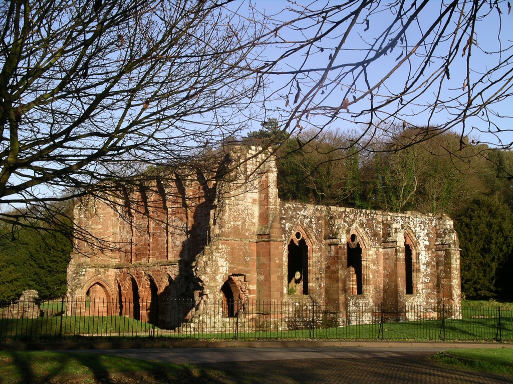
 Furness Abbey, attacked by the Scots in 1322
Towards the end of the 13th century the peace between England and Scotland was shattered at the hand of Edward I. In 1286 he confiscated the manors granted in 1237 and in 1292 installed John Balliol on the Scottish throne and when Balliol invaded Cumbria four years later Edward defeated him and took upon the government of Scotland himself. Resistance came from Scotland in the form of William Wallace and Robert the Bruce and a three hundred year period of regular raids and counter-raids followed which effectively undid the years of economic progress since the Harrying of the North two centuries earlier.
Two early raids of 1316 and 1322, under the leadership of Bruce were particularly damaging and were as far reaching as Yorkshire. On the second occasion, the Abbot of Furness Abbey went to meet Bruce in an attempt to bribe him into sparing his Abbey and its lands from destruction. The Scottish King accepted the bribe but continued to ransack the entire area anyway, so much so that in a tax inquisition of 1341 the land at nearby Aldingham was said to have decreased in value from £53 6s 8d to just £10 and at Ulverston from £35 6s 8d to only £5.
Early Modern period
Border Reivers
In the three hundred years leading up to the Union of the English and Scottish crowns in 1603, as well as actual military clashes between the two countries, unrest remained constant thanks to the inhabitants of the Borderlands themselves, often called the Border Reivers. The Reivers were characterised by strong kinship bonds, forming clan-like groups under a given surname - Hetherington and Carleton were two of the most prominent in the Cumbria area. These groups became semi-autonomous from local government, owing far more loyalty to their name than to the king or local lords.
The Reivers take their name from the fact that they lived by raiding (from the Old English rēafian 'to rob'), rustling cattle and sheep from across the border and even looting the armies of their own King, such was their antipathy towards their nations. The reiving became so common and so violent by the 16th century that wealthier border families took to building bastle houses or pele towers - fortified dwellings, often with room for livestock and supplies beneath the accommodation - which are still a common site in the north of Cumbria.
 Kentmere Hall, an example of a Cumbrian Pele tower
In an attempt to deal with the growing problem, the English and Scottish monarchs installed local magnates, with extensive local connections and considerable power, as wardens. In Cumbria the powerful northern families such as the Dacres and the Cliffords, who owned Brough and Brougham castles amongst many others, were often in control of the wardenship.
The problem of the reivers worsened in the last few decades of the 16th century, first because an increase in taxes forced an increase in rents which caused a breakdown of the ties between landlords and tenants, and second because many of the border families remained staunch Catholics following the Protestant Reformation. Only when the border effectively disintegrated with the Union of the Crowns in 1603 did reiving cease to dominate the lives of the border inhabitants.
Civil War
Early Industry
Georgian and Victorian periods
Heavy Industry
Main article: Seaton Iron WorksSeaton Iron Works was an iron works which operated between 1762 and 1857 in Seaton, Cumberland. As well as making iron it also manufactured iron goods, and before 1800 was a manufacturer of steam engines.
Lakeland Poets
20th century
- 1910 Ais Gill rail accident
- 1913 Ais Gill rail accident
- World War II
- Windscale fire
- 1995 Ais Gill rail accident
21st century
2000 - 2010
Leading Cumbria into the 21st century was the 2001 UK Census which showed the county as having a population of 487,607 (237,915 males and 249,692 females). The population density proved fairly low due to Cumbria being the third largest county in England. At the start of the century, Cumbria was one of the least ethnically diverse regions in the country with 99.3% of individuals classing themselves as being of any 'White' background. The next national census is due in 2011 and is expected to show significant change in certain aspects of the county's demography (especially ethnicity, with the 'White' population in Cumbria being estimated at just over 97.9% in 2007 - see also Demographics of Cumbria).[6]
Also in 2001, Cumbria saw one of the most devastating agricultural incidents of recent times. An outbreak of foot-and-mouth resulted in the killing of 10 million cattle and sheep across the UK, out of 2,000 cases nationwide 843 were in Cumbria (or 42% of all cases).[7] Cumbria was the worst affected county in the outbreak which dominated much of the 2001 UK media coverage prior to the September 11 attacks. Cumbria's agriculture and tourism industries were severely scarred, many tourists were put off visiting the Lake District, whilst the local economy is estimated to have lost billions. After huge efforts to prevent the disease from spreading further (by killing infected animals as well as disinfecting every vehicle to enter certain parts of the county) the outbreak was officially halted in October, 2001 (after begin in February the same year).[7]
In 2001, the South Cumbrian town of Barrow-in-Furness hit global headlines after an outbreak of Legionnaires' disease, the source of the bactera was later found to be from steam coming out of a badly maintained air conditioning unit in the forum 28 media and arts centre, ultimately seven people died from contracting the disease and in total the number of cases stood at 172 it was and still remains one of the worst outbreak of its kind in recorded history (the most deadly in the UK's history).[8] Because of the 2001 outbreak, in 2006, Barrow Borough Council became the first public body in the country to have faced corporate manslaughter charges, the charges were cleared however chief architect Gillian Beckingham and Barrow Borough Council were fined £15,000 and £125,000 respectively after both admitted breaching the Health and Safety at Work Act.[9]
On the evening of February 5, 2004, dozens of illegal Chinese workers were collecting cockles off the Cumbrian coast when rising tides led to 23 of them eventually drowning in Morecambe Bay. The workers were all illegal immigrants, mainly from the Fujian province of China, and have been described as being untrained and inexperienced. They were being exploited by gang leader Lin Liangren who paid them £5 per 25 kg of cockles.[10] local authorities were alerted by one of the gang members who contacted them with a mobile phone, but only one of the workers was rescued from the waters. This was partly due to the fact that the phone call was unclear both to the extent and severity of the danger, and to their location, presumably through a lack of English language ability.[11] A total of 21 bodies, of men and women between the ages of 18 and 45, were recovered from the bay after the incident. Two of the victims were women, the vast majority were young men in their 20's and 30's and it is presumed that two more bodies were lost at sea. The disaster led to the Gangmaster Licensing Act 2004 and the formation of the Gangmasters Licensing Authority (also the perpetrator, Lin Liangren was sentenced to 14 years' imprisonment, numerous others linked with the disaster were also imprisoned on immigration offences and of perverting the course of justice).
One of several incidents to have occurred on the West Coast Main Line in the 21st century was the Tebay rail accident, on the 15th February 2004 four railway workers were hit and killed by a trolley carrying lengths of rail which had not been properly secured and had run away from a maintenance yard several miles away. The boss of the rail maintenance company and a crane operator were tried on charges of manslaughter caused by gross negligence, both men were eventually jailed.
 A Tesco store underwater in Carlisle during the January 2005 floods
On January 8, 2005 flooding caused massive disruption and damage across the north of the county, this was considered the worst flooding in living memory until the November 2009 Great Britain and Ireland floods, Carlisle was the worst affected location. More than 3,000 properties were affected, 60,000 homes were left without power and some areas of the city were under 7 ft (2.1 m) of water. Significant rainfall burst the banks of the rivers Eden, Kent, Derwent, Greta and Cocker. Ultimately £250 million of damage was caused.[12]
The 2006 Morecambe Bay helicopter crash had Cumbrian authorities on standby, especially the RNLI station in Barrow, the fatal air incident occurred on December 27, 2006 at approximately 18:40 GMT, whilst transporting replacement crew between the Millom and Morecambe gas platforms. It was eventually discovered that the Eurocopter AS365N descened into sea due to pilot error and this led to the death of six men.[13]
On February 23, 2007 train 1S83, the 17:15 Virgin West Coast Pendolino West Coast Main Line express service from London Euston to Glasgow Central was derailed by a defective set of points, the incident occurred at 20:15 GMT when 109 people were on board. 30 serious and 58 minor injuries were reported and ultimately 1 person was killed. Sir Richard Branson, owner of the Virgin empire visited the site and although was devestaded by the incident claimed that "If the train had been old stock then the number of injuries and the mortalities would have been horrendous".[14] The 2009 Cumbria earthquake refers to an event on April 28, 2009 at 11:22 am local time when an earthquake of the magnitude 3.7 struck Cumbria, England. It was recorded by the British Meteorological Society as having an epicentre approximately 8 km (5.0 mi) underneath Ulverston. The earthquake was felt by residents in Lancashire and the tremor lasted for 5–10 seconds. Phone calls were recorded from a number of people who felt the tremor in the Barrow, Carnforth and Kendal areas but there were no reports of any casualties, injuries or damages.[15]
 The site of the 2007 Grayrigg train derailment
During the night of November 19, 2009, some parts of Cumbria saw more rainfall than what is expected over the period of a whole winter month. The most intense period of rainfall broke nationwide records, and resulted in almost everywhere in the country being affected. However the worst damage occurred in the north and around Cockermouth and Workington where water rose to almost 3 meters in places, many Lakes of the Lake District overflowed and resulted in the collapse of several bridges. The flooding has so far claimed the life of one person in the county, Bill Barker a police officer who was performing his duties directing traffic away from the Northside Bridge at Workington when the bridge collapsed into the river.
On June 2, 2010 one of the worst mass shootings in British history occurred in West Cumbria. Taxi driver Derrik Bird went on a three hour shooting spree in the towns of Whitehaven, Egremont and Seascale which ultimately claimed the lives of twelve people (which included his twin brother and a former work colleague, the other fatalities are thought to have been targeted at random). Dozens more were injured before Bird turned the gun on himself and committed suicide in a field near the village of Boot. The event also saw the complete lockdown of the Sellafield nuclear processing site, an action unseen in the plants 50 year history.[16]
Also worth of note are several overseas events which have affected the county. The War in Afghanistan has so far claimed the lives of three Cumbrians (two men and one woman - the UK's first female loss), whilst the War in Iraq has seen the deaths of two Cumbrian servicemen.[17]
Timeline
BC c.11,000 Ice sheets melt c.8,000 Mesolithic hunter-gatherers settle coastal c.6,000 Langdale Axe Factory begins c.3,200 Castlerigg Stone Circle begun AD c.50–59 First rebellion by Venutius against Cartamandua, failed 69 Second rebellion by Venutius, he gains possession of Brigantian kingdom 71 Roman conquest of Brigantes begins 78 Agricola advances in Cumbria and places garrisons between the Solway and Tyne 79–80 Further military campaigns by Agricola 122 Hadrian's Wall begun 142 Antonius Pius abandons Hadrian's Wall 164 Hadrian's Wall reoccupied c.400 Romans begin withdrawing troops to Europe 410 Official end of Roman Britain, Coel Hen takes over as High King of Northern Britain c.420 Coel Hen dies, Ceneu takes over Northern Britain c.450 Ceneu dies; Rheged created by Gwrast Lledlwm c.490 Gwrast Lledlwm dies; Rheged given to Merchion Gul 535 Merchion Gul dies; Rheged divided into North, given to Cynfarch Oer, and South 559 Catraeth added to Rheged lands c.570 Cynfarch Oer dies; Urien Rheged becomes King 573 Caer-Guenddolau added to Rheged lands c.585 Battle of Ynys Metcaut; Urien killed by Morcant Bulc; Owain map Urien becomes King c.597 Owain map Urien killed by Morcant Bulc c.616 Angles of Bernacia enter Rheged c.638 Riemmelth, Princess of Rheged marries Oswiu, Prince of Northumbria 685 St Cuthbert granted land around Carlisle, where he founds a priory, and Cartmel 875 Danes sack Carlisle c.925 Norse arrive 945 Edmund I defeats Dunmail and cedes Cumbria to Malcolm I of Scotland 1092 William II restores Cumbria to England 1136 King Stephen forced to cede Cumbria to Scotland 1157 Henry II regains Cumbria 1182 Lancashire created, including part of South Cumbria 1316 Scottish raids along the west coast as far as Furness and Cartmel 1322 Scottish raids; the Abbot of Furness attempts to bribe Robert the Bruce 1745 Battle of Clifton, last military battle fought on English soil 1951 Lake District National Park established 1974 Modern county of Cumbria established References
- ^ Tacitus, Histories, 3.45, Rome
- ^ The Megalithic Portal and Megalith Map. "C.Michael Hogan (2007) ''Hadrian's Wall'', ed. A. Burnham, The Megalithic Portal". Megalithic.co.uk. http://www.megalithic.co.uk/article.php?sid=18177. Retrieved 2010-06-05.
- ^ Viking Archaeology: Treasure found in Cumbria, 13 September 2007
- ^ by A. M. Armstrong [and others .... "''The Place-Names of Cumberland'' (Cambridge: Cambridge University Press. 1952)". Openlibrary.org. http://openlibrary.org/b/OL198097M/place-names_of_Cumberland. Retrieved 2010-06-05.
- ^ "''Cumbria: Hougun'' (The Domesday Book On-Line)". Domesdaybook.co.uk. 2007-04-16. http://www.domesdaybook.co.uk/book.html. Retrieved 2010-06-05.
- ^ "Census 2001 - Profiles - Cumbria". Statistics.gov.uk. 2003-02-13. http://www.statistics.gov.uk/census2001/profiles/16.asp. Retrieved 2010-06-05.
- ^ a b "In Depth | Foot and mouth". BBC News. 2003-01-23. http://news.bbc.co.uk/1/hi/in_depth/uk/2001/foot_and_mouth/default.stm. Retrieved 2010-06-05.
- ^ "UK | England | Legionnaires' source officially traced". BBC News. 2002-08-20. http://news.bbc.co.uk/1/hi/england/2205186.stm. Retrieved 2010-06-05.
- ^ "UK | England | Cumbria | Bug death council worker cleared". BBC News. 2006-07-31. http://news.bbc.co.uk/1/hi/england/cumbria/5232086.stm. Retrieved 2010-06-05.
- ^ "Cockle pickers were swimming the wrong direction". The Westmorland Gazette. http://www.thewestmorlandgazette.co.uk/news/640835.cockles_pickers_were_swimming_the_wrong_direction/. Retrieved 2010-06-05.
- ^ "UK | England | Lancashire | Cockle jury played distress call". BBC News. 2005-10-21. http://news.bbc.co.uk/1/hi/england/lancashire/4364586.stm. Retrieved 2010-06-05.
- ^ "BBC Weather | Carlisle". Bbc.co.uk. 2010-01-29. http://www.bbc.co.uk/cumbria/weather/floods_january_2005/floods_gallery2_index.shtml. Retrieved 2010-06-05.
- ^ "UK | Six dead in rig helicopter crash". BBC News. 2006-12-28. http://news.bbc.co.uk/1/hi/uk/6213141.stm. Retrieved 2010-06-05.
- ^ "UK | Rail crash report blames points". BBC News. 2007-02-26. http://news.bbc.co.uk/1/hi/england/6398057.stm. Retrieved 2010-06-05.
- ^ "Sky News". News.sky.com. http://news.sky.com/skynews/Home/UK-News/Earthquake-In-Ulverston-Cumbria-According-To-British-Geological-Survey/Article/200904415270843?f=rss. Retrieved 2010-06-05.
- ^ "Cumbria shooting rampage death toll reaches 12". BBC News. 2010-06-02. http://news.bbc.co.uk/1/hi/england/10219655.stm. Retrieved 2010-06-05.
- ^ "UK | British military fatalities in Iraq". BBC News. http://news.bbc.co.uk/1/hi/uk/8040620.stm. Retrieved 2010-06-05.
Categories:- History of Cumbria
- Invasions of England
- History of England by county


Wikimedia Foundation. 2010.