- Tatebayashi, Gunma
Japanese city
Name = Tatebayashi
JapaneseName = 館林市
Region = Kantō
Prefecture =Gunma Prefecture
District =
Area_km2 = 60.98
Population = 79,753
PopDate = 2003
Density_km2 = 1307.86
Coords= coord|36|15|N|139|33|E|region:JP_type:city
Latitude = 36°23' N
Elevation =
Tree =
Flower =
Bird =
Symbol
Map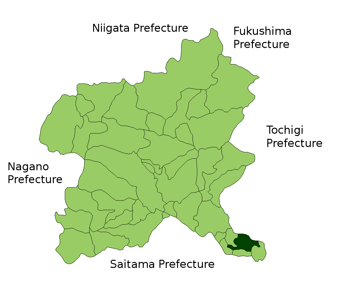
Mayor =
CityHallPostalCode =
CityHallAddress =
CityHallPhone =
CityHallLink = http://www.city.tatebayashi.gunma.jp/
City
ExtraNotes =
nihongo|Tatebayashi|館林市|Tatebayashi-shi is a city located in Gunma,Japan .As of
2007 , the city has an estimatedpopulation of 80,629 and the density of 1,322.22 persons per km². The total area is 60.98 km².Tatebayashi is famous for Azalea Hill Park(つつじヶ岡公園,Tsutsuji-ga-oka koen) and
Bunbuku Chagama ofMorinji Temple (茂林寺).The city was founded on
April 1 ,1954 and its current mayor is Kazuo Yasuraoka.Transportation
Rail
Tatebayashi Station is one ofTobu Railway 's hub stations. TheIsesaki Line ,Sano Line , andKoizumi Line all meet here. Tatebayashi Station is also Express Ryomo stop. Following are approximate times by train from Tatebayashi:
*Takasaki, Gunma: 1 hr 25 min
*Maebashi, Gunma: 1 hr 15min
*Isesaki, Gunma: 55 min
*Kiryu, Gunma: 45 min
*Ashikaga, Tochigi: 15 min
*Sano, Tochigi: 15 min
*Tokyo : 1 hr (by Express Ryomo)Roads
*Tatebayashi IC -
Tōhoku Expressway
*National Route 122- connects toTokyo , Saitama City, Ota, Kiryu, and Nikkō.
*National Route 354- connects to Takasaki and Hokota, Ibarakiister cities
*flagicon|Australia
Maroochy Shire Council ,Australia
*flagicon|ChinaKunshan ,China ightseeing
*
Tatebayashi Castle (館林城)
*Gunma Museum of Art,Tatebayashi (群馬県立館林美術館)
*Tsutsuji-ga-oka kōen(Azalea Hill Park、つつじが岡公園)
*Jō-numa(swamp)(城沼)
*Tatara-numa(swamp)(多々良沼)
*Morinji Temple(茂林寺)Famous people
*
Teiichiro Shoda - the founder ofNisshin Flour
*Katai Tayama - novelist written Rural Teacher (田舎教師) and Futon (蒲団).
*Kenjiro Shoda - mathematician
*Hidesaburo Shoda - businessman,father ofEmpress Michiko
*Chiaki Mukai -astronaut ,doctorExternal links
* [http://www.city.tatebayashi.gunma.jp/ Tatebayashi official website] in Japanese
*Wikitravel
Wikimedia Foundation. 2010.