- Chandauli district
-
This article is about the district. For its eponymous headquarters, see Chandauli.
Chandauli district
चंदौली ज़िला
چندولی ضلع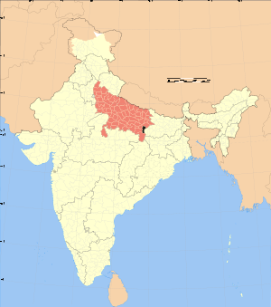
Location of Chandauli district in Uttar PradeshState Uttar Pradesh,  India
IndiaAdministrative division Varanasi Headquarters Chandauli Area 2,484.70 km2 (959.35 sq mi) Population 1,148,732 (1991) Lok Sabha Constituencies Chandauli Official website Chandauli District (Hindi: चंदौली ज़िला, Urdu: چندولی ضلع) is a district of Uttar Pradesh state of India, and Chandauli town is the district headquarters. Chandauli district is a part of Varanasi Division.
Chanduali became a district in the period of Mayawati (a chief minister of Uttar Pradesh). It borders Bihar in the East and hence there are lot of cultural effects and festivals similar to Bihar. Mughal sarai, a city in the district has the busiest rail station in the North East of India. It has great natural beauty in the form of Chandraprabha Sanctuary and many waterfalls which include Devdari and Rajdari. The District contributes to Indian GDP by providing the various cereals from the district including paddy and wheat. Popularly known as the "Dhaan Ka Katora of Uttar Pradesh" bacause of extreme fertile lands of the Gangetic Plain. Chanduali district made big contributions at the time of freedom movements. Chanduali District is not much developed and there were lot of problems of infrastructure and education. But slowly, situation is improving as people are now awakened and want development of the area as critical for their future. In Chanduali there is a very famous village named Khakhara which is famous for the protest against Britishers for the freedom of the India.
The district is currently a part of the Red Corridor.[1]
Contents
Economy
In 2006 the Ministry of Panchayati Raj named Chandauli one of the country's 250 most backward districts (out of a total of 640).[2] It is one of the 34 districts in Uttar Pradesh currently receiving funds from the Backward Regions Grant Fund Programme (BRGF).[2]
Demographics
According to the 2011 census Chandauli district has a population of 1,952,713,[3] roughly equal to the nation of Lesotho[4] or the US state of New Mexico.[5] This gives it a ranking of 238th in India (out of a total of 640).[3] The district has a population density of 768 inhabitants per square kilometre (1,990 /sq mi) .[3] Its population growth rate over the decade 2001-2011 was 18.83 %.[3] Chandauli has a sex ratio of 913 females for every 1000 males,[3] and a literacy rate of 73.86 %.[3]
References
- ^ "83 districts under the Security Related Expenditure Scheme". IntelliBriefs. 2009-12-11. http://intellibriefs.blogspot.com/2009/12/naxal-menace-83-districts-under.html. Retrieved 2011-09-17.
- ^ a b Ministry of Panchayati Raj (September 8, 2009). "A Note on the Backward Regions Grant Fund Programme". National Institute of Rural Development. http://www.nird.org.in/brgf/doc/brgf_BackgroundNote.pdf. Retrieved September 27, 2011.
- ^ a b c d e f "District Census 2011". Census2011.co.in. 2011. http://www.census2011.co.in/district.php. Retrieved 2011-09-30.
- ^ US Directorate of Intelligence. "Country Comparison:Population". https://www.cia.gov/library/publications/the-world-factbook/rankorder/2119rank.html. Retrieved 2011-10-01. "Lesotho 1,924,886"
- ^ "2010 Resident Population Data". U. S. Census Bureau. http://2010.census.gov/2010census/data/apportionment-pop-text.php. Retrieved 2011-09-30. "New Mexico - 2,059,179"
External links

Varanasi district Ghazipur district Mirzapur district 
Kaimur district, Bihar  Chandauli district

Sonbhadra district Divisions and Districts of Uttar Pradesh, India Agra division Aligarh division Aligarh · Etah · Mahamaya Nagar · Kanshi Ram Nagar
Allahabad division Azamgarh division Bareilly division Badaun · Bareilly · Pilibhit · Shahjahanpur
Basti division Chitrakoot division Banda · Chitrakoot · Hamirpur · Mahoba
Devipatan division Faizabad division Gorakhpur division Deoria · Gorakhpur · Kushinagar · Maharajganj
Jhansi division Kanpur division Auraiya · Etawah · Farrukhabad · Kannauj · Kanpur Nagar · Ramabai Nagar
Lucknow division Meerut division Bagpat · Bulandshahr · Gautam Buddha Nagar · Ghaziabad · Meerut · Panchsheel Nagar
Mirzapur division Moradabad division Bhimnagar · Bijnor · Jyotiba Phule Nagar · Moradabad · Rampur
Saharanpur division Prabuddhanagar · Muzaffarnagar · Saharanpur
Varanasi division Varanasi division topics General Mythology, history Districts Rivers, dams, lakes Ganges • KarmanasaLanguages, people Transport NH 2 • Grand Trunk Road • NH 29 • NH 68 • Howrah-Delhi main line • Varanasi Junction • Varanasi Airport • Malviya Bridge • Shahi Bridge, JaunpurLok Sabha constituencies See also Cities and towns in Chandauli district • Cities and towns in Ghazipur district • Cities and towns in Jaunpur district • Cities and towns in Varanasi district • Villages in Chandauli district • Villages in Ghazipur district • Villages in Jaunpur district • Villages in Varanasi district • People from Chandauli • People from Ghazipur • People from Jaunpur • People from VaranasiOther Divisions Agra • Aligarh • Allahabad • Azamgarh • Bareilly • Basti • Chitrakoot • Devipatan • Faizabad • Gorakhpur • Jhansi • Kanpur • Lucknow • Meerut • Mirzapur • Moradabad • SaharanpurCategories:- Districts of Uttar Pradesh
- Chandauli district
- Uttar Pradesh geography stubs

Wikimedia Foundation. 2010.