- Ontario Highway 69
-
Highway 69

Trans-Canada Highway Route information Maintained by The Ministry of Transportation of Ontario Length: 169.8 km[1] (105.5 mi)
excluding a 26.5 km (16.5 mi) gap from Rankin Lake Road to Highway 559Existed: 1936[citation needed] – present Major junctions South end:  Highway 400 near MacTier (exit 189)
North end:  Highway 17 in Sudbury
Highway system Ontario provincial highways
400-series • Former←  Highway 67
Highway 71  →
→King's Highway 69, commonly referred to as Highway 69, is a major north–south highway in the central area of the Canadian province of Ontario, linking Highway 400 north of Parry Sound with Sudbury. A second, shorter portion of Highway 69, bypassed by the construction of Highway 400, exists between Mactier and Horseshoe Lake.
Contents
Route description
The current highway begins at the Highway 400 interchange south of MacTier (exit 189), and ends at an interchange with Highway 17 in Sudbury. After the interchange, the roadway continues northward into the urban core of Sudbury as Regent Street/Municipal Road 46.
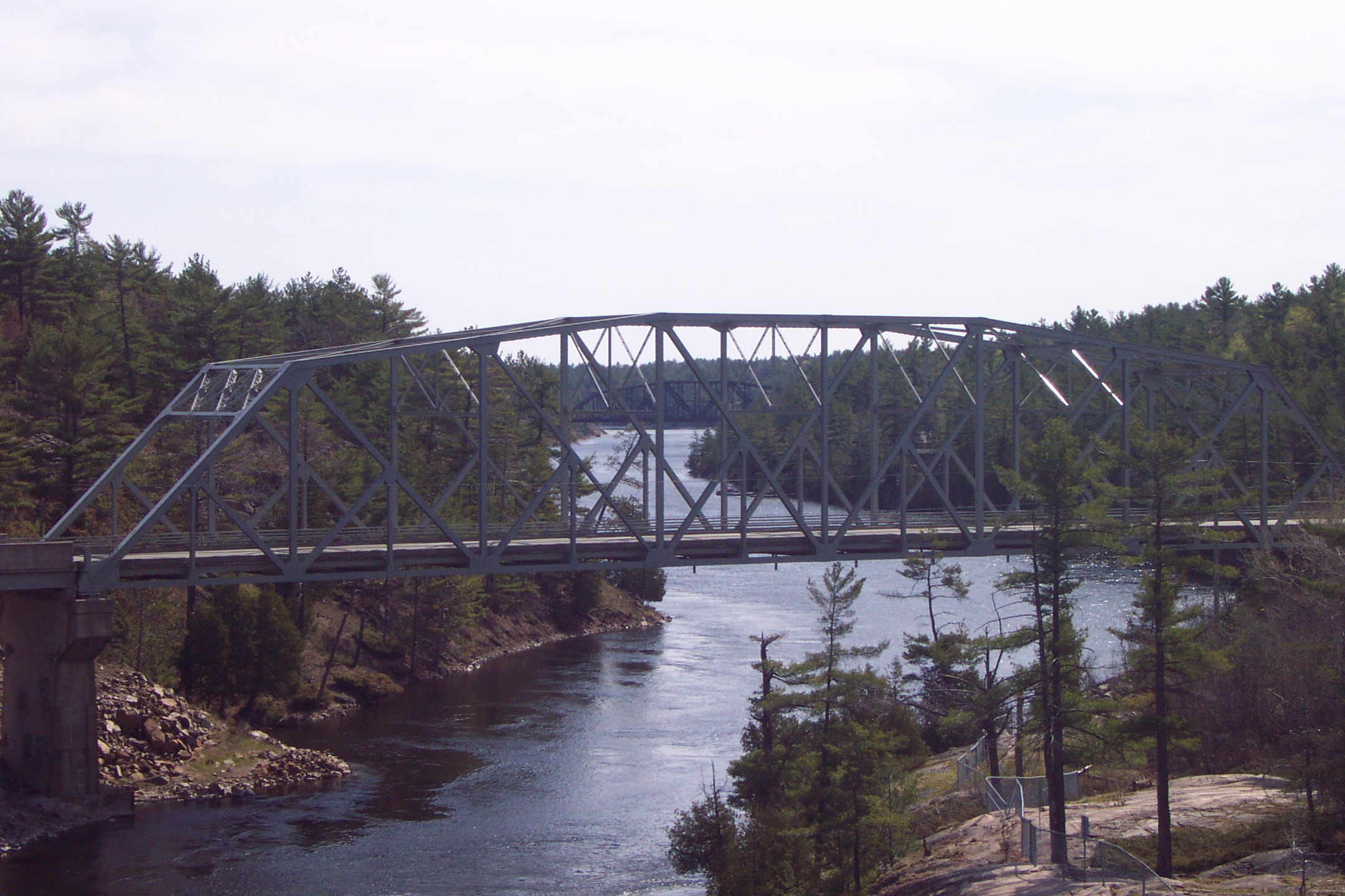
 Highway 69 bridge over the French River
The highway is currently 170 kilometres (110 mi) long. The length of the highway has gradually been decreasing over recent years with northward extensions of Highway 400, which eventually could completely take over Highway 69, likely around 2017.
The segment between Exit 213 on Highway 400 and the end of the four-lane freeway in Nobel is concurrent with 400. Until the summer of 2008 when the freeway in that area was completed, the southernmost segment between the Musquash River and its current southern terminus was also concurrent with Highway 400.
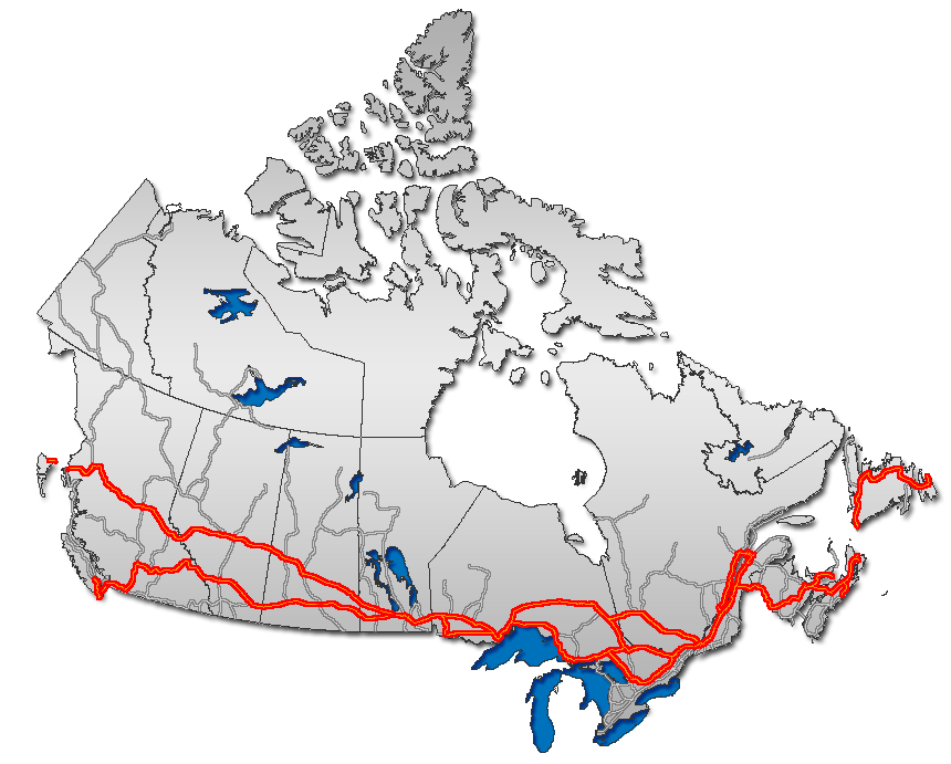
The highway is part of the Trans-Canada Highway for most of its length, except for the section between Exits 189 and 213 bypassed by Highway 400.
Between Parry Sound and Sudbury, there are no large communities, although there are numerous small communities including (from south to north) Nobel, Shawanaga, Pointe au Baril, Byng Inlet, Britt, Bigwood, Delamere and Estaire. The posted speed limit is 90 km/h (55 mph) for most of its length.
History
Highway 69 has the most colourful and turbulent history of any provincially controlled roadway. Through the past 70 years, the road has been transformed from a minor northern two-lane gravel highway, into a multi-lane all-season freeway in some parts. It started out in 1936 as the gravel "Rama Road" along the eastern shore of Lake Couchiching, from Rama, through Orillia and Gravenhurst, with its final northern terminus at Bala. This original alignment is a full 80 km from its current alignment. This road is now Simcoe County Road 44 and Muskoka District Road 169, and aside from a brief former concurrency with Highway 11, the road is no longer provincially maintained.
The roadway was extended to MacTier shortly after being upgraded to a provincial highway, and work began on creating a direct link to Sudbury from the south. Work began on both northern (Sudbury) and southern (MacTier) ends, and was expected that the roadway would be linked together from both ends near a middle point in the future.
When World War II broke out in late 1939, the province declared that all major road construction projects would have to cease if they were not absolutely necessary, or for the war effort. The stretch of Highway 69 under construction between Parry Sound and Nobel was deemed to be critically important because of the large munitions factory located in Nobel, and with an all-weather roadway to Nobel from the south, it made movement of troops and munitions much easier.
Once the war ended, construction resumed on Highway 69. Paving and extending the road continued, with the first gap (between Britt and Burwash) being closed in 1951. French River would be linked to the provincial roadway network in 1952. This allowed motorists to take a far more direct route between Severn River and Sudbury, by taking advantage of a detour (via Highway 535 and Highway 64, through the small communities of Hagar and Noëlville).
The biggest gap that remained on Highway 69 was between Alban and Burwash, but this was eventually eliminated from 1952 to 1955, when the road was finally completed and provided a third link from Southern Ontario to Northern Ontario (the other two being Highways 11 and 17).
Until Highway 69 between Parry Sound and Sudbury was completed, drivers from Southern Ontario that wanted to reach Sudbury or Sault Ste. Marie had to travel along a rather out-of-the-way routing on Highway 11 to North Bay, and then take Highway 17 westbound into Sudbury and Sault Ste. Marie.
The year 1976 saw big changes for Highway 69. The portion of highway south of MacTier was shifted onto the routing of former Highway 103, completely absorbing that roadway into its length. The former routing was renamed Highway 169. It was at this time that Highway 69 was at its longest, from Highways 12 and 400 near Port Severn to Sudbury.
At one time, Highway 69 continued through Sudbury and into the suburban towns of Valley East and Capreol. Although this route is no longer part of the provincial highway, and is officially designated as a series of Sudbury Municipal Roads, it continues to be referred to locally as "Highway 69 North".
Since 1989, Highway 400 has been extended gradually northward towards Sudbury, and now reaches Nobel. However, as of 2009 the Highway 69 designation has been truncated at MacTier, rather than Nobel, in the south — the two highways share a routing for 32 kilometres between Nobel and Rankin Lake Road, and then follow separate routes between Rankin Lake Road and Highway 69's southern terminus near MacTier. Between Rankin Lake Road and Lake Joseph, this southerly route falls within the Parry Sound District, which has no upper tier of municipal government to maintain it as a county road, and is too important of a road to be downloaded to the townships involved — as a result, the provincial government cannot decommission that portion of the route as a provincial highway, although it may eventually be renumbered as a secondary highway.
Four-laning
Although planning for a four-lane highway started in 1969, the commitment to expand Highway 69 to a full freeway was originally made in 1991 by the New Democrat government of Bob Rae.[2] Although construction did commence northward from Waubaushene at the highway's southern end, the project was curtailed by the Progressive Conservative government of Mike Harris shortly after the 1995 provincial election, with construction ending at kilometre 225 in Parry Sound.[2]
The city of Sudbury continued to lobby for the highway's expansion, calling attention especially to an ongoing series of fatal car accidents at the intersection of Highway 637, where a sharp S-curve in Highway 69's route rendered the approaching intersection effectively invisible to northbound traffic.[2] Assisted by Rick Bartolucci, the Liberal MPP for Sudbury, the Crash 69 committee of Sudbury residents campaigned throughout the late 1990s and early 2000s to have the project reinstated.[2] The revived construction to Sudbury was announced in 2002 by Harris' successor (and former MPP for Parry Sound—Muskoka), Ernie Eves.[2]
In 2004, construction began on the segment from Sudbury southwards to Estaire, and route planning studies were completed for the Estaire to Parry Sound branch. Although the timetable may be subject to change, the four-laned route is scheduled to be completed in its entirety by 2017. Portions of the route will be opened to traffic as construction is completed — the 20 kilometre section south of Sudbury from Crown Ridge to Estaire was opened for traffic on November 13, 2009,[3] and the segment from Highway 559 to Parry Sound opened to traffic on October 26, 2010.[4] The former alignment in Sudbury now has the street name Estaire Road, while the former route through Nobel now has the street name Nobel Drive.
Work has also commenced on a realignment of the controversial S-curve at Highway 637. A new four-lane route at this location is currently under construction, but only two lanes will be opened until adjacent portions of the highway are four-laned. The realigned two-lane route opened to traffic on July 27, 2010,[5] with the second set of freeway lanes through the area scheduled for completion in 2012. The former S-curve alignment now has the name Murdock River Road, and is temporarily accessible only from its southern terminus, with the S-curve itself blocked off at the north; when the four-laning is completed through this segment, Murdock River Road will be reconnected to Highway 637 as a local road at its north end and the southerly intersection will be closed off.
Once the four-lane expansion project is complete, the highway will be fully renumbered as Highway 400. Northern sections will retain the 69 designation until the freeway is fully connected.
Concurrently with the final stages of construction on Highway 69, the Highway 17 freeway in Sudbury will be extended eastward to the Coniston neighbourhood along the city's Southwest and Southeast Bypasses. In preparation for this latter project, an interchange opened in 2008 at the intersection of Highway 17 and Sudbury's Long Lake Road.
As of July 3, 2011, the federal government has delayed further work from being done on this highway while it completes a screening under the Canadian Environmental Assessment Act. As of November 1, 2011, Transport Canada addressed a letter to the Greater Sudbury Chamber of Commerce advising that the reassessment was nearly complete.[6]
Status of construction activity
- Currently under construction:
-
- Estaire to Highway 637 (8 km)[7]
- Planning, engineering and property acquisition:
-
- Highway 559 to Shebeshekong Road (16 km)
- Shebeshekong Road to Highway 529 (11 km)
- Highway 529 to Harris Lake Road (14 km)
- Harris Lake Road to Highway 522 (27 km)
- Highway 522 to Highway 64 (25 km)
- Highway 64 to Highway 637 (10 km)
Interchanges
MacTier to Nobel
Distances in this segment are based on the exit numbering of Highway 400.
Municipality Distance Destinations Notes Georgian Bay 189 Highway 400Terminus of Highway 69 Seguin 213 Highway 400Route duplexes with Highway 400 northward to Parry Sound. 214 Seguin Trail Road, Horseshoe Lake Road 217 Oastler Park Drive, Badger Road 220  Highway 518 (Hunter Drive) – Orrville
Parry Sound 224 Bowes Street, McDougall Road 229 Parry Sound Drive McDougall 231  Highway 124 (Parry Sound Drive)
236 Avro Arrow Rd. - Access to Nobel 247  Highway 559
249 Highway 400 terminates; Highway 69 continues. Killarney to Sudbury
Interchanges on the segment immediately south of Sudbury are not yet numbered, because of the route's discontinuity with the Parry Sound freeway segment. Accordingly, note that distances currently listed in this table are approximated southward from the Sudbury terminus of Highway 69, and are not posted exit numbers.
When the freeway construction between Sudbury and Parry Sound is complete, the posted exit numbers are expected to be in the 350-400 range, as they will be numbered northward from Toronto.
Municipality Distance Destinations Notes Sudbury, Unorganized 32  Highway 637
Under construction. 20 Nelson Road Access to town of Estaire. Opened in 2009. Greater Sudbury 13  Highway 537
Opened in 2009. 6 Estaire Road Opened in 2009. 0 Highway 17Terminus of Highway 69; roadway continues northerly as Regent Street/Municipal Road 46. References
- ^ Ministry of Transportation of Ontario (2007). "Annual Average Daily Traffic (AADT) counts". http://www.raqsb.mto.gov.on.ca/techpubs/TrafficVolumes.nsf/tvweb?OpenForm&Seq=5. Retrieved July 17, 2011.
- ^ a b c d e "Highway 69 and 11 expansion rolling north: Northerners say safety, efficiency, new development will open up the region". Northern Ontario Business, May 1, 2008.
- ^ "New section of 69 opens to public". Northern Life, November 13, 2009.
- ^ "$177-million section of highway now open". CottageCountryNow.ca, October 27, 2010.
- ^ "Bad section of Highway 69 now fixed: MPP". Sudbury Star, July 28, 2010.
- ^ "EA almost done: official". Sudbury Star, November 1, 2011.
- ^ "Next phase of Hwy 69 improvements begin". Northern Life, November 6, 2009.
External links
Preceded by
 Highway 17
Trans-Canada Highway
 Highway 69
Succeeded by
 Highway 400
 Portions of the Trans-Canada Highway
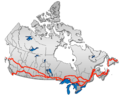 British Columbia: Highway 1 • Highway 5 • Highway 16 | Alberta: Highway 1 • Highway 16
Saskatchewan: Highway 1 • Highway 16 | Manitoba: Highway 1 • Highway 16 • Highway 100
Ontario: Highway 17 • Highway 69 • Highway 400 • Highway 12 • Highway 7 • Highway 71 • Highway 11 • Highway 66 • Highway 417
Quebec: Autoroute 40 • Autoroute 25 • Autoroute 20 • Autoroute 85 • Route 185 • Route 117 • Autoroute 15
New Brunswick: Route 2 • Route 16 | Confederation Bridge | Prince Edward Island: Route 1 | Nova Scotia: Highway 104 • Highway 105 • Highway 106
Newfoundland: Route 1The King's Highways of Ontario Current highwaysFormer highways- 2A
- 2B
- 2S
- 3B
- 4A
- 5A
- 7B
- 8A
- 12B
- 14
- 15A
- 18
- 18A
- 22
- 24A
- 25
- 27
- 29
- 30
- 31
- 32
- 35A
- 35B
- 36
- 38
- 39
- 40B
- 42
- 43
- 44
- 45
- 46
- 47
- 48B
- 50
- 51
- 52
- 53
- 54
- 55
- 56
- 57
- 59
- 68
- 70
- 73
- 74
- 75
- 76
- 78
- 79
- 80
- 81
- 82
- 83
- 84
- 86
- 87
- 88
- 90
- 91
- 92
- 95
- 96
- 97
- 98
- 99
- 100
- 103
- 104
- 106
- 107
- 109
- 110
- 111
- 114
- 116
- 117
- 119
- 120
- 121
- 122
- 123
- 126
- 128
- 131
- 133
- 134
- 135
- 136
- 169
- 400A
- 401A
County roads in Ontario · Ontario numbered highways · Expressways and 400-series highways · King's Highways · Secondary highways · Tertiary and 7000-series highways · List of Ontario provincial highways · List of former provincial highways in Ontario · Highways in Ontario · List of Ontario expressways · Trans-Canada Highway · Connecting Link · Emergency Detour RouteCategories:- Ontario provincial highways
- Trans-Canada Highway


Wikimedia Foundation. 2010.