- Nikhom Kham Soi District
-
Nikhom Kham Soi
นิคมคำสร้อย— Amphoe — Amphoe location in Mukdahan Province
Coordinates: 16°22′18″N 104°33′2″E / 16.37167°N 104.55056°ECoordinates: 16°22′18″N 104°33′2″E / 16.37167°N 104.55056°E Country  Thailand
Province Mukdahan Seat Nikhom Kham Soi Tambon Muban Amphoe established Area – Total 377.2 km2 (145.6 sq mi) Population (2005) – Total 42,225 – Density 111.9/km2 (289.8/sq mi) Time zone THA (UTC+7) Postal code 49130 Geocode 4902 Nikhom Kham Soi (Thai: นิคมคำสร้อย) is a district (Amphoe) of Mukdahan Province, northeastern Thailand.
Contents
Geography
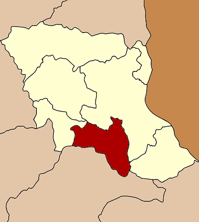
Neighboring districts are (from the west clockwise) Nong Sung, Mueang Mukdahan and Don Tan of Mukdahan Province, and Loeng Nok Tha of Yasothon Province.
History
The minor district (King Amphoe) was established on June 2 1975, when the five tambon Nikhom Kham Soi, Na Kok, Na Udom, Nong Waeng and Kok Daeng were split off from Mukdahan district.[1] It was upgraded to a full district on March 25 1979.[2] When Mukdahan Province was created in 1982, Nikhom Kham Soi was one of districts forming the new new province.
Administration
The district is subdivided into 7 subdistricts (tambon), which are further subdivided into 79 villages (muban). Nikhom Kham Soi is a township (thesaban tambon) which covers parts of the tambon Nikhom Kham Soi, Na Kok and Chok Chai. There are further 7 Tambon administrative organization (TAO).
No. Name Thai name Villages Inh. 1. Nikhom Kham Soi นิคมคำสร้อย 14 8,541 2. Na Kok นากอก 13 5,278 3. Nong Waeng หนองแวง 11 7,574 4. Kok Daeng กกแดง 13 5,119 5. Na Udom นาอุดม 12 8,273 6. Chok Chai โชคชัย 9 4,367 7. Rom Klao ร่มเกล้า 7 3,073 References
- ^ "ประกาศกระทรวงมหาดไทย เรื่อง แบ่งท้องที่อำเภอมุกดาหาร จังหวัดนครพนม ตั้งเป็นกิ่งอำเภอนิคมคำสร้อย" (in Thai). Royal Gazette 92 (104 ง): 1338. June 3 1975. http://www.ratchakitcha.soc.go.th/DATA/PDF/2518/D/104/1338.PDF.
- ^ "พระราชกฤษฎีกาตั้งอำเภอหนองกุงศรี อำเภอไทรงาม อำเภอบ้านฝาง อำเภออุบลรัตน์ อำเภอเวียงชัย อำเภอดอยเต่า อำเภอนิคมคำสร้อย อำเภอนาหว้า อำเภอเสิงสาง อำเภอศรีสาคร อำเภอบึงสามพัน อำเภอนาดูน อำเภอค้อวัง อำเภอโพธิ์ชัย อำเภอเมืองสรวง อำเภอปลวกแดง อำเภอยางชุมน้อย อำเภอกาบเชิง อำเภอสุวรรณคูหา และอำเภอกุดข้าวปุ้น พ.ศ. ๒๕๒๒" (in Thai). Royal Gazette 96 (42 ก Special): 19–24. March 25 1979. http://www.ratchakitcha.soc.go.th/DATA/PDF/2522/A/042/19.PDF.
External links
Categories:- Amphoe of Mukdahan
- Isan geography stubs
Wikimedia Foundation. 2010.