- National Register of Historic Places listings in northern Cincinnati, Ohio
-
This is a list of the National Register of Historic Places listings in northern Cincinnati, Ohio.
This is intended to be a complete list of the properties and districts on the National Register of Historic Places in northern Cincinnati, Ohio, United States. Northern Cincinnati is defined as being all of the city north of a line running along Interstate 74 from the city's western edge to Interstate 75, south to Martin Luther King Dr., east to Interstate 71, and north to the city's eastern edge. The locations of National Register properties and districts may be seen in a Google map.[1]
There are 242 properties and districts listed on the National Register in Cincinnati, including 12 National Historic Landmarks. Northern Cincinnati includes 55 of these properties and districts, including 2 National Historic Landmarks; the city's remaining properties and districts are listed elsewhere.
-
- This National Park Service list is complete through NPS recent listings posted November 10, 2011.[2]
Current listings
[3] Landmark name[4] Image Date listed Location Summary 1 American Can Company Building 
October 17, 2007 4101 Spring Grove Ave.
39°9′37″N 84°32′14″W / 39.16028°N 84.53722°W2 Balch House 
March 3, 1980 267 Greendale Ave.
39°9′4″N 84°31′4″W / 39.15111°N 84.51778°W3 Cedric G. and Patricia Neils Boulter House 
May 14, 1999 1 Rawson Woods Circle
39°9′6″N 84°31′24″W / 39.15167°N 84.52333°W4 Frederick E. and Catherine Bullerdick House 
December 20, 2007 4321 Hamilton Ave.
39°9′58″N 84°32′29″W / 39.16611°N 84.54139°W5 A. E. Burckhardt House 
March 3, 1980 400 Forest Ave.
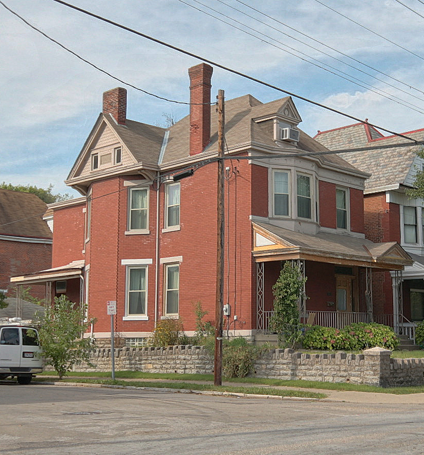
39°8′47″N 84°29′58″W / 39.14639°N 84.49944°W6 Calvary Episcopal Church Sunday School 
March 3, 1980 3770 Clifton Ave.
39°9′8″N 84°31′3″W / 39.15222°N 84.5175°W7 Freeman Grant Cary Pleasant Hill Academy April 29, 1999 5651 Hamilton Ave.
39°11′37″N 84°33′8″W / 39.19361°N 84.55222°W8 Cincinnati Street Gas Lamps 
December 22, 1978 1109 Street lamps at various locations throughout Cincinnati 9 Cincinnati Zoo Historic Structures 
February 27, 1987 3400 Vine St.
39°8′39″N 84°30′31″W / 39.14417°N 84.50861°W10 Clifton Avenue Historic District 
December 8, 1978 Irregular pattern along Clifton Ave.
39°9′18″N 84°31′1″W / 39.155°N 84.51694°W11 Clifton Methodist Episcopal Church 
April 12, 2007 3418 Clifton Ave.
39°8′39″N 84°31′7″W / 39.14417°N 84.51861°W12 Coca-Cola Bottling Corporation Building 
July 2, 1987 1507 Dana Ave.
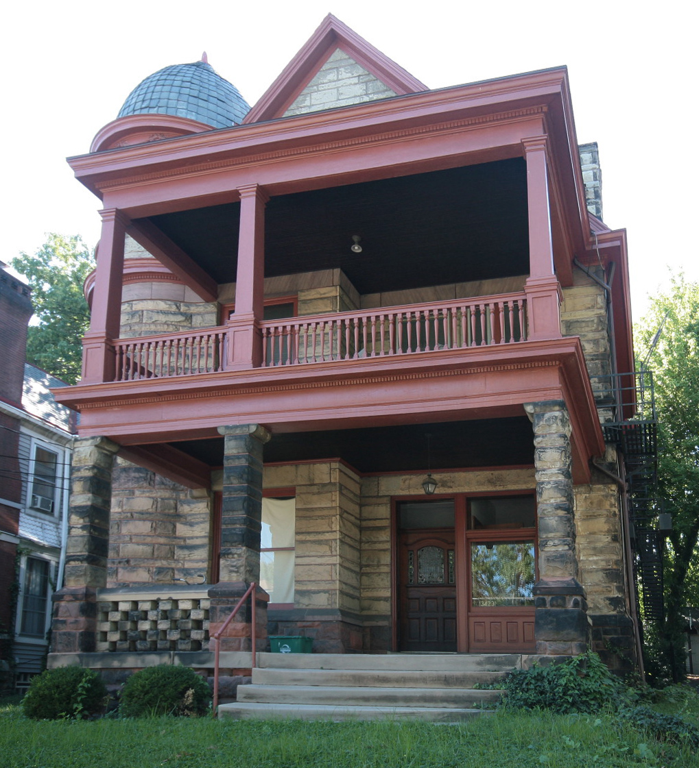
39°8′47″N 84°28′26″W / 39.14639°N 84.47389°W13 College Hill Town Hall 
March 17, 1978 Belmont Ave. and Larch St.
39°11′37″N 84°32′59″W / 39.19361°N 84.54972°W14 Cote Bonneville November 29, 1984 4850 Colerain Ave.
39°10′13″N 84°33′21″W / 39.17028°N 84.55583°W15 George B. Cox House 
November 6, 1973 Brookline and Jefferson Aves.
39°8′33″N 84°30′54″W / 39.1425°N 84.515°W16 Domhoff Buildings 
March 11, 1980 4201-4203 Hamilton Ave. and 1604-1614 Chase Ave.
39°9′45″N 84°32′22″W / 39.1625°N 84.53944°W17 Walter Field House 
March 3, 1980 3725 Reading Rd.
39°9′4″N 84°29′12″W / 39.15111°N 84.48667°W18 Freund-Heintz House 
August 21, 2003 3332 Whitfield Ave.
39°8′35″N 84°31′26″W / 39.14306°N 84.52389°W19 General Hospital Nurses' Home 
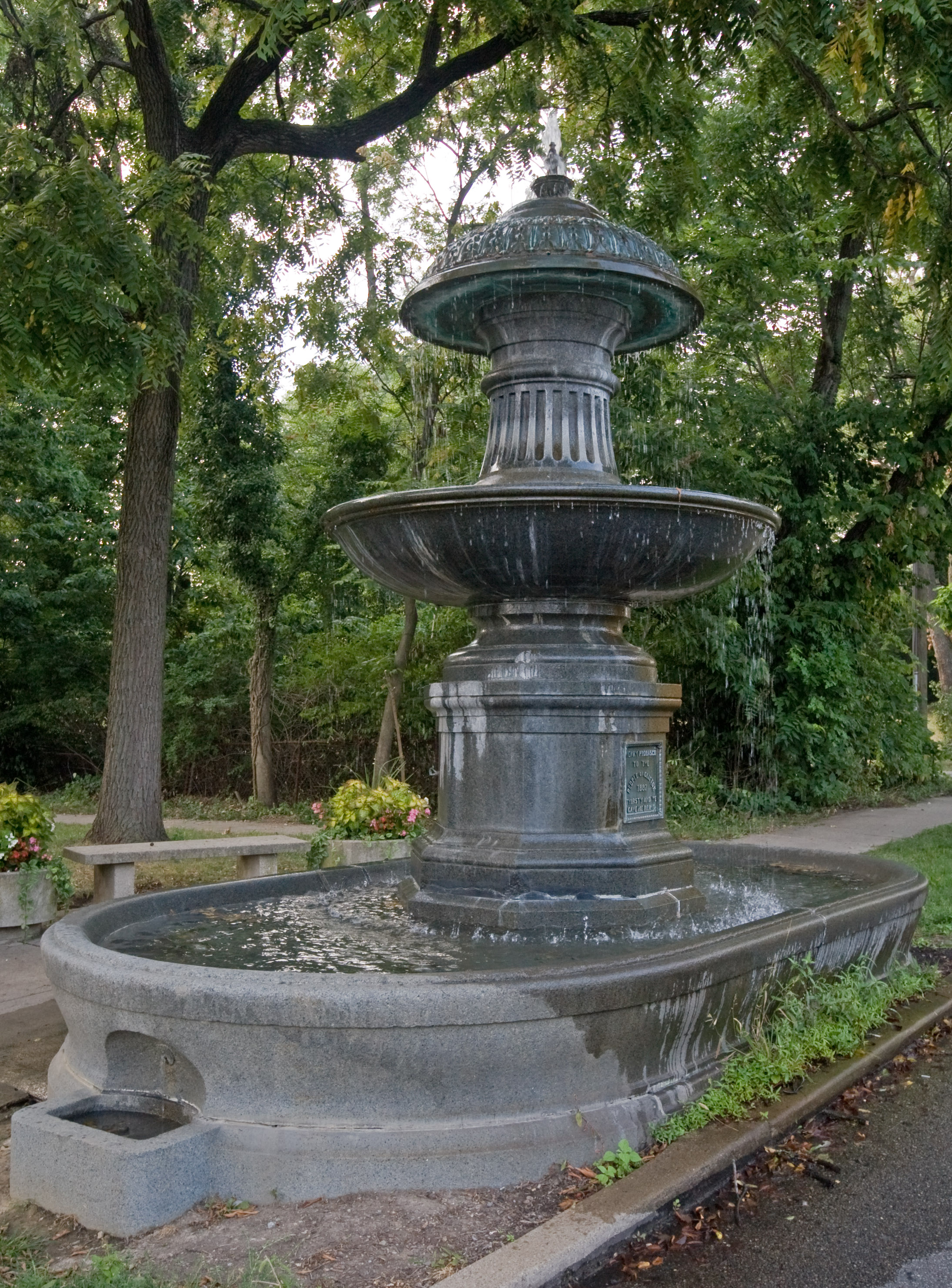
June 10, 2005 311 Albert Sabin Way
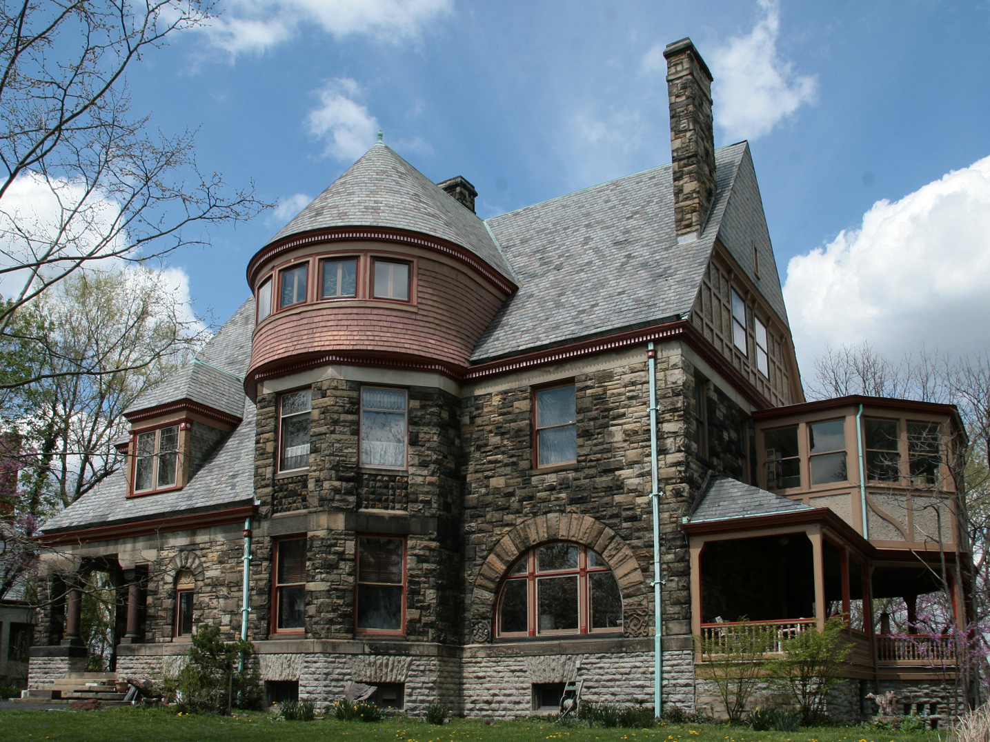
39°8′20″N 84°30′9″W / 39.13889°N 84.5025°W20 German Evangelical Protestant Cemetery Chapel 
February 28, 2008 3701 Vine St.
39°9′21″N 84°30′32″W / 39.15583°N 84.50889°W21 Stephen A. Gerrard Mansion 
November 5, 1987 748 Betula Ave.
39°9′39″N 84°29′9″W / 39.16083°N 84.48583°W22 Moses Goldsmith Building 
June 10, 1982 356 Bryant
39°8′45″N 84°31′18″W / 39.14583°N 84.52167°W23 Sir Alfred T. Goshorn House 
April 3, 1973 3540 Clifton Ave.
39°8′50″N 84°31′6″W / 39.14722°N 84.51833°W24 Grace Church 
September 16, 1982 3626 Reading Rd.
39°8′53″N 84°29′14″W / 39.14806°N 84.48722°WNow known as St. Michael and All Angels Episcopal Church 25 Haddon Hall 
July 22, 1982 3418 Reading Rd.
39°8′30″N 84°29′32″W / 39.14167°N 84.49222°W26 Samuel Hannaford House 
March 3, 1980 768 Derby Ave.
39°10′17″N 84°31′9″W / 39.17139°N 84.51917°W27 Hewson-Gutting House 
December 21, 1979 515 Lafayette Ave.
39°9′17″N 84°31′30″W / 39.15472°N 84.525°W28 Hoffner Historic District 
October 3, 1978 Bounded by Bluerock, Moline Court, Langland, and Hamilton Aves.
39°9′38″N 84°32′22″W / 39.16056°N 84.53944°W29 Hulbert House and McAlpin Bridal Cottage 
April 29, 1982 333 and 341 Lafayette Ave.
39°9′22″N 84°31′12″W / 39.15611°N 84.52°W30 George Hummel House 
March 3, 1980 3423 Whitfield Ave.
39°8′43″N 84°31′20″W / 39.14528°N 84.52222°W31 John Uri Lloyd House 
March 7, 1973 3901 Clifton Ave.
39°9′26″N 84°31′3″W / 39.15722°N 84.5175°W32 David and Mary May House 
August 22, 1996 3723 Washington Ave.
39°9′7″N 84°29′40″W / 39.15194°N 84.49444°W33 Charles A. Miller House 
March 3, 1980 1817 Chase St.
39°9′52″N 84°32′53″W / 39.16444°N 84.54806°W34 Richard H. Mitchell House 
March 3, 1980 3 Burton Woods Lane
39°9′24″N 84°29′14″W / 39.15667°N 84.48722°W35 Morrison House April 3, 1973 750 Ludlow Ave.
39°8′54″N 84°31′43″W / 39.14833°N 84.52861°W36 Mount Airy Forest April 13, 2010 5083 Colerain Ave.
39°10′47.02″N 84°33′57.18″W / 39.1797278°N 84.5658833°W37 Northside United Methodist Church 
March 3, 1980 1674 Chase
39°9′50″N 84°32′37″W / 39.16389°N 84.54361°W38 Old College Hill Post Office June 16, 1976 1624 Pasadena Ave.
39°11′32″N 84°32′49″W / 39.19222°N 84.54694°W39 Parkside Apartments 
February 28, 2008 3315-3317 Jefferson Ave.
39°8′27″N 84°30′50″W / 39.14083°N 84.51389°W40 Pfleger Family Houses 
March 11, 1980 216 and 218 Erkenbrecker Ave.
39°8′32″N 84°30′20″W / 39.14222°N 84.50556°W41 Pinecroft December 17, 2008 2336 Kipling Ave.
39°12′9.5″N 84°34′13″W / 39.202639°N 84.57028°W42 Probasco Fountain 
March 3, 1980 Clifton Ave.
39°9′2″N 84°31′7″W / 39.15056°N 84.51861°W43 Henry Probasco House 
November 9, 1972 430 W. Cliff Lane
39°9′29″N 84°31′26″W / 39.15806°N 84.52389°W44 Rawson House 
July 24, 1973 3767 Clifton Ave.
39°9′8″N 84°31′10″W / 39.15222°N 84.51944°W45 William Resor House 
March 7, 1973 254 Greendale Ave.
39°9′6″N 84°31′1″W / 39.15167°N 84.51694°W46 Charles B. Russell House 
March 3, 1980 3416 Brookline Ave.
39°8′35″N 84°30′54″W / 39.14306°N 84.515°W47 Sacred Heart Academy 
April 11, 1973 525 Lafayette St.
39°9′11″N 84°31′38″W / 39.15306°N 84.52722°W48 St. Patrick's Catholic Church 
December 4, 1978 1662 Blue Rock
39°9′38″N 84°32′30″W / 39.16056°N 84.54167°W49 Scarlet Oaks 
March 7, 1973 440 Lafayette Ave.
39°9′25″N 84°31′32″W / 39.15694°N 84.52556°W50 Spring Grove Cemetery 
May 13, 1976 4521 Spring Grove Ave.
39°10′11″N 84°31′32″W / 39.16972°N 84.52556°W51 Spring Grove Cemetery Chapel 
March 3, 1980 4521 Spring Grove Ave.
39°9′52″N 84°31′25″W / 39.16444°N 84.52361°W52 Peter G. Thomson House 
November 29, 1979 5870 Belmont Ave.
39°11′56″N 84°33′16″W / 39.19889°N 84.55444°W53 Samuel and Sally Wilson House November 15, 2000 1502 Aster Place
39°11′31″N 84°32′40″W / 39.19194°N 84.54444°W54 Winton Place Methodist Episcopal Church 
March 3, 1980 700 E. Epworth Ave.
39°10′24″N 84°30′59″W / 39.17333°N 84.51639°W55 Mary A. Wolfe House 
March 3, 1980 965 Burton Ave.
39°8′59″N 84°29′1″W / 39.14972°N 84.48361°W
See also
- List of National Historic Landmarks in Ohio
- National Register of Historic Places listings in Cincinnati, Ohio
References
- ^ The latitude and longitude information provided in this table was derived originally from the National Register Information System, which has been found to be fairly accurate for about 99% of listings. For about 1% of NRIS original coordinates, experience has shown that one or both coordinates are typos or otherwise extremely far off; some corrections may have been made. A more subtle problem causes many locations to be off by up to 150 yards, depending on location in the country: most NRIS coordinates were derived from tracing out latitude and longitudes off of USGS topographical quadrant maps created under the North American Datum of 1927, which differs from the current, highly accurate WGS84 GPS system used by Google maps. Chicago is about right, but NRIS longitudes in Washington are higher by about 4.5 seconds, and are lower by about 2.0 seconds in Maine. Latitudes differ by about 1.0 second in Florida. Some locations in this table may have been corrected to current GPS standards.
- ^ "National Register of Historic Places: Weekly List Actions". National Park Service, United States Department of the Interior. Retrieved on November 10, 2011.
- ^ Numbers represent an ordering by significant words. Various colorings, defined here, differentiate National Historic Landmark sites and National Register of Historic Places Districts from other NRHP buildings, structures, sites or objects.
- ^ "National Register Information System". National Register of Historic Places. National Park Service. 2008-04-24. http://nrhp.focus.nps.gov/natreg/docs/All_Data.html.
National Register of Historic Places in Ohio Lists by county Adams • Allen • Ashland • Ashtabula • Athens • Auglaize • Belmont • Brown • Butler • Carroll • Champaign • Clark • Clermont • Clinton • Columbiana • Coshocton • Crawford • Cuyahoga • Darke • Defiance • Delaware • Erie • Fairfield • Fayette • Franklin • Fulton • Gallia • Geauga • Greene • Guernsey • Hamilton • Hancock • Hardin • Harrison • Henry • Highland • Hocking • Holmes • Huron • Jackson • Jefferson • Knox • Lake • Lawrence • Licking • Logan • Lorain • Lucas • Madison • Mahoning • Marion • Medina • Meigs • Mercer • Miami • Monroe • Montgomery • Morgan • Morrow • Muskingum • Noble • Ottawa • Paulding • Perry • Pickaway • Pike • Portage • Preble • Putnam • Richland • Ross • Sandusky • Scioto • Seneca • Shelby • Stark • Summit • Trumbull • Tuscarawas • Union • Van Wert • Vinton • Warren • Washington • Wayne • Williams • Wood • Wyandot

Lists by city Other lists Categories:- National Register of Historic Places in Cincinnati, Ohio
-


Wikimedia Foundation. 2010.