- National Register of Historic Places listings in Vernon County, Wisconsin
-
Buildings, sites, districts, and objects in Vernon County listed on the National Register of Historic Places
-
- This National Park Service list is complete through NPS recent listings posted November 10, 2011.[1]
This document is intended to provide a comprehensive listing of entries in the National Register of Historic Places that are located in Vernon County, Wisconsin. The locations of National Register properties, the latitude and longitude coordinates of which are included below, may be seen in a Google map.[2]
[3] Landmark name [4] Image Date listed Location City or town Summary 1 George Apfel Round Barn December 20, 2006 11314 Cty Hwy P
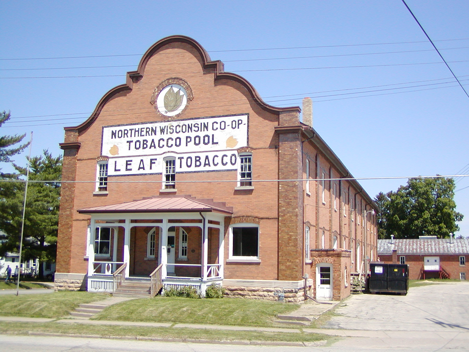
43°39′15″N 90°41′24″W / 43.654167°N 90.69°WClinton 2 Archeological Site No. 47 VE-881 September 30, 1993 Address Restricted Sterling 3 B. Lawrence Site I June 30, 1975 Address Restricted Rockton 4 Bekkedal Leaf Tobacco Warehouse 
November 14, 2003 504 E. Decker
43°33′34″N 90°53′01″W / 43.559444°N 90.883611°WViroqua 5 Cade Archeological District November 3, 1988 Address Restricted Newton 6 Goose Island Archeological Site Ve-502 July 17, 1980 Address Restricted Stoddard 7 Hanson Petroglyphs December 31, 1974 Address Restricted Viola 8 Hay Valley Archeological District December 31, 1974 Address Restricted Ontario 9 Larson Cave January 6, 1988 Address Restricted Westby 10 Charles Lord House January 26, 1998 113 South St.
43°43′15″N 90°35′11″W / 43.720833°N 90.586389°WOntario 11 Markee Site August 22, 1975 Address Restricted Rockton 12 Masonic Temple Building December 1, 2000 116 S. Main St.
43°33′21″N 90°53′21″W / 43.555833°N 90.889167°WViroqua 13 Norwegian Evangelic Lutheran Church and Cemetery July 14, 1986 Coon Prairie and E. Coon Prairie Rds.
43°37′49″N 90°51′12″W / 43.630278°N 90.853333°WWestby 14 Rockton Archeological District December 31, 1974 Address Restricted Ontario 15 Nils Skumsrud House July 11, 1990 southeast of the junction of SR 162 and U.S. 14/61
43°41′48″N 91°02′13″W / 43.696667°N 91.036944°WCoon Valley See also Norskedalen 16 Tollackson Mound Group December 15, 1997 Address Restricted Harmony 17 Upper Kickapoo Valley Prehistoric Archeological District September 24, 1999 Address Restricted La Farge 18 Vernon County Courthouse January 8, 1980 N. Dunlap Ave.
43°33′24″N 90°53′35″W / 43.556667°N 90.893056°WViroqua 19 Vernon County Normal School July 26, 2011 410 S. Center Ave.
43°33′11″N 90°53′17″W / 43.553056°N 90.888056°WViroqua Now the Vernon County Museum[5] 20 Viola Rockshelter (47 Ve 640) December 10, 1987 Address Restricted Kickapoo Center 21 Viroqua Downtown Historic District 
July 17, 2003 Main St., roughly bounded by W. Court, E. Jefferson and the odd numbered 200 blk of S. Main St.
43°33′19″N 90°53′22″W / 43.555278°N 90.889342°WViroqua References
- ^ "National Register of Historic Places: Weekly List Actions". National Park Service, United States Department of the Interior. Retrieved on November 10, 2011.
- ^ The latitude and longitude information provided is primarily from the National Register Information System, and has been found to be fairly accurate for about 99% of listings. For 1%, the location info may be way off. We seek to correct the coordinate information wherever it is found to be erroneous. Please leave a note in the Discussion page for this article if you believe any specific location is incorrect.
- ^ Numbers represent an ordering by significant words. Various colorings, defined here, differentiate National Historic Landmark sites and National Register of Historic Places Districts from other NRHP buildings, structures, sites or objects.
- ^ "National Register Information System". National Register of Historic Places. National Park Service. . http://nrhp.focus.nps.gov/natreg/docs/All_Data.html.
- ^ Vernon County Museum, Viroqua, Wisconsin
Municipalities and communities of Vernon County, Wisconsin Cities 
Villages Towns Unincorporated
communitiesBloomingdale | Bud | Dilly | Esofea | Fargo | Kickapoo Center | Liberty Pole | Newry | Newton | Pleasant Valley | Purdy | Red Mound | Retreat | Rockton | Romance | Ross | Tunnelville‡ | Valley | Victory | West Prairie
Footnotes ‡This populated place also has portions in an adjacent county or counties
U.S. National Register of Historic Places Topics Lists by states Alabama • Alaska • Arizona • Arkansas • California • Colorado • Connecticut • Delaware • Florida • Georgia • Hawaii • Idaho • Illinois • Indiana • Iowa • Kansas • Kentucky • Louisiana • Maine • Maryland • Massachusetts • Michigan • Minnesota • Mississippi • Missouri • Montana • Nebraska • Nevada • New Hampshire • New Jersey • New Mexico • New York • North Carolina • North Dakota • Ohio • Oklahoma • Oregon • Pennsylvania • Rhode Island • South Carolina • South Dakota • Tennessee • Texas • Utah • Vermont • Virginia • Washington • West Virginia • Wisconsin • WyomingLists by territories Lists by associated states Other Categories:- Vernon County, Wisconsin
- Lists of historic places in Wisconsin
-


Wikimedia Foundation. 2010.