- Chaseburg, Wisconsin
-
Chaseburg, Wisconsin — Village — Location of Chaseburg, Wisconsin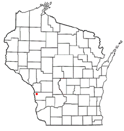
Coordinates: 43°39′21″N 91°5′50″W / 43.65583°N 91.09722°WCoordinates: 43°39′21″N 91°5′50″W / 43.65583°N 91.09722°W Country United States State Wisconsin County Vernon Area – Total 0.6 sq mi (1.6 km2) – Land 0.6 sq mi (1.6 km2) – Water 0.0 sq mi (0.0 km2) Elevation[1] 709 ft (216 m) Population (2000) – Total 306 – Density 492.4/sq mi (190.1/km2) Time zone Central (CST) (UTC-6) – Summer (DST) CDT (UTC-5) FIPS code 55-14150[2] GNIS feature ID 1562965[1] Chaseburg is a village in Vernon County, Wisconsin, United States. The population was 306 at the 2000 census.
Geography
Chaseburg is located at 43°39′21″N 91°5′50″W / 43.65583°N 91.09722°W (43.655890, -91.097095)[3].
According to the United States Census Bureau, the village has a total area of 0.6 square miles (1.6 km²), all of it land.
Consistent with most small towns in Wisconsin, Chaseburg sports a high 'tavern' to 'population' ratio. As of the 2000 census, all of the population could fit comfortably in the five taverns that did business in the village.
Demographics
As of the census[2] of 2000, there were 306 people, 133 households, and 80 families residing in the village. The population density was 492.4 people per square mile (190.6/km²). There were 146 housing units at an average density of 234.9 per square mile (90.9/km²). The racial makeup of the village was 100.00% White.
There were 133 households out of which 30.1% had children under the age of 18 living with them, 52.6% were married couples living together, 3.8% had a female householder with no husband present, and 39.8% were non-families. 33.8% of all households were made up of individuals and 17.3% had someone living alone who was 65 years of age or older. The average household size was 2.30 and the average family size was 2.99.
In the village the population was spread out with 25.2% under the age of 18, 6.2% from 18 to 24, 30.1% from 25 to 44, 22.2% from 45 to 64, and 16.3% who were 65 years of age or older. The median age was 37 years. For every 100 females there were 114.0 males. For every 100 females age 18 and over, there were 108.2 males.
The median income for a household in the village was $38,438, and the median income for a family was $45,417. Males had a median income of $28,125 versus $25,469 for females. The per capita income for the village was $18,851. About 3.8% of families and 7.9% of the population were below the poverty line, including 2.5% of those under the age of eighteen and 20.0% of those sixty five or over.
References
- ^ a b "US Board on Geographic Names". United States Geological Survey. 2007-10-25. http://geonames.usgs.gov. Retrieved 2008-01-31.
- ^ a b "American FactFinder". United States Census Bureau. http://factfinder.census.gov. Retrieved 2008-01-31.
- ^ "US Gazetteer files: 2010, 2000, and 1990". United States Census Bureau. 2011-02-12. http://www.census.gov/geo/www/gazetteer/gazette.html. Retrieved 2011-04-23.
Municipalities and communities of Vernon County, Wisconsin Cities 
Villages Towns Unincorporated
communitiesBloomingdale | Bud | Dilly | Esofea | Fargo | Kickapoo Center | Liberty Pole | Newry | Newton | Pleasant Valley | Purdy | Red Mound | Retreat | Rockton | Romance | Ross | Tunnelville‡ | Valley | Victory | West Prairie
Footnotes ‡This populated place also has portions in an adjacent county or counties
Categories:- Populated places in Vernon County, Wisconsin
- Villages in Wisconsin


Wikimedia Foundation. 2010.