- National Register of Historic Places listings in Transylvania County, North Carolina
-

This list includes properties and districts listed on the National Register of Historic Places in Transylvania County, North Carolina. Click the "Map of all coordinates" link to the right to view a Google map of all properties and districts with latitude and longitude coordinates in the table below.[1]
-
- This National Park Service list is complete through NPS recent listings posted November 10, 2011.[2]
Landmark name Image Date listed Location City or Town Summary 1 E. M. Backus Lodge June 9, 1988 Cold Mountain Gap Rd.
35°9′38″N 82°59′51″W / 35.16056°N 82.9975°WVicinity of Lake Toxaway 2 Biltmore Forest School 
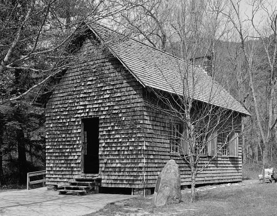
November 19, 1974 NW of Brevard off U.S. 276 in Pisgah National Forest
35°21′4″N 82°46′52″W / 35.35111°N 82.78111°WBrevard 3 William Breese, Jr., House June 23, 1983 401 E. Main St.
35°13′53.34″N 82°43′45.46″W / 35.2314833°N 82.7292944°WBrevard 4 Brevard College Stone Fence and Gate December 21, 1993 Jct. of N. Broad St. and French Broad Ave., NW corner
35°14′11.57″N 82°43′54.72″W / 35.2365472°N 82.7318667°WBrevard 5 Max and Claire Brombacher House October 15, 2001 571 E. Main St.
35°13′30″N 82°43′43″W / 35.225°N 82.72861°WBrevard 6 William Deaver House August 13, 1979 N of Pisgah Forest on NC 280
35°16′34″N 82°42′7″W / 35.27611°N 82.70194°WPisgah Forest 7 East Main Street Historic District August 20, 2009 249-683 and 768 East Main St.; 6-7 Rice St.; St. Phillip's Ln.; 1-60 Woodside Dr.; and 33 Deacon Ln.
35°14′4.59″N 82°44′12.53″W / 35.2346083°N 82.7368139°WBrevard 8 Flem Galloway House February 24, 1995 NC 1388 W side, 2 miles S of jct. with NC 1129
35°9′17″N 82°48′41″W / 35.15472°N 82.81139°WCalvert 9 Godfrey-Barnette House December 30, 1993 411 S. Broad St.
35°13′37″N 82°44′15″W / 35.22694°N 82.7375°WBrevard 10 William H. Grogan House September 10, 2008 24 Warren La.
35°13′38.06″N 82°43′15.42″W / 35.2272389°N 82.72095°WBrevard 11 Hanckel-Barclay House December 9, 1999 0.8 miles W of Jct. NC 1114 and US 276
35°11′41″N 82°43′53″W / 35.19472°N 82.73139°WBrevard Boundary increased on July 20, 2000 12 Hillmont October 16, 1986 W side of Lake Toxaway 3 miles N of US 64
35°8′27″N 82°57′10″W / 35.14083°N 82.95278°WLake Toxaway 13 Lake Toxaway Methodist Church February 18, 1994 Cold Mountain Rd. N side, 0.1 miles NW of jct. with NC 281
35°8′22″N 82°55′59″W / 35.13944°N 82.93306°WLake Toxaway 14 Main Street Historic District September 6, 2002 Roughly bounded by Gaston St., England St., Probart St., and Jordan St.
35°13′59″N 82°44′4″W / 35.23306°N 82.73444°WBrevard 15 McMinn Building February 18, 1994 2-6 W. Main St.
35°14′2″N 82°44′4″W / 35.23389°N 82.73444°WBrevard 16 Morgan's Mill August 16, 1979 SW of Brevard on SR 1331
35°10′17″N 82°48′41″W / 35.17139°N 82.81139°WBrevard 17 Royal and Louise Morrow House December 6, 2006 630 E. Main St.
35°13′36″N 82°43′40″W / 35.22667°N 82.72778°WBrevard 18 Charles E. Orr House December 6, 2006 269 E. Main St.
35°13′54″N 82°43′46″W / 35.23167°N 82.72944°WBrevard 19 Silvermont July 9, 1981 E. Main St.
35°13′44″N 82°43′47″W / 35.22889°N 82.72972°WBrevard 20 St. Philip's Episcopal Church December 30, 1997 317 E. Main St.
35°13′54″N 82°43′51″W / 35.23167°N 82.73083°WBrevard 21 Transylvania County Courthouse May 10, 1979 N. Broad and E. Main St.
35°14′1″N 82°44′1″W / 35.23361°N 82.73361°WBrevard See also
- National Register of Historic Places listings in North Carolina
- List of National Historic Landmarks in North Carolina
References
- ^ The latitude and longitude information provided in this table was derived originally from the National Register Information System, which has been found to be fairly accurate for about 99% of listings. For about 1% of NRIS original coordinates, experience has shown that one or both coordinates are typos or otherwise extremely far off; some corrections may have been made. A more subtle problem causes many locations to be off by up to 150 yards, depending on location in the country: most NRIS coordinates were derived from tracing out latitude and longitudes off of USGS topographical quadrant maps created under the North American Datum of 1927, which differs from the current, highly accurate WGS84 GPS system used by Google maps. Chicago is about right, but NRIS longitudes in Washington are higher by about 4.5 seconds, and are lower by about 2.0 seconds in Maine. Latitudes differ by about 1.0 second in Florida. Some locations in this table may have been corrected to current GPS standards.
- ^ "National Register of Historic Places: Weekly List Actions". National Park Service, United States Department of the Interior. Retrieved on November 10, 2011.
National Register of Historic Places listings in North Carolina by county. Counties - Alamance
- Alexander
- Alleghany
- Anson
- Ashe
- Avery
- Beaufort
- Bertie
- Bladen
- Brunswick
- Buncombe
- Burke
- Cabarrus
- Caldwell
- Camden
- Carteret
- Caswell
- Catawba
- Chatham
- Cherokee
- Chowan
- Clay
- Cleveland
- Columbus
- Craven
- Cumberland
- Currituck
- Dare
- Davidson
- Davie
- Duplin
- Durham
- Edgecombe
- Forsyth
- Franklin
- Gaston
- Gates
- Graham
- Granville
- Greene
- Guilford
- Halifax
- Harnett
- Haywood
- Henderson
- Hertford
- Hoke
- Hyde
- Iredell
- Jackson
- Johnston
- Jones
- Lee
- Lenoir
- Lincoln
- Macon
- Madison
- Martin
- McDowell
- Mecklenburg
- Mitchell
- Montgomery
- Moore
- Nash
- New Hanover
- Northampton
- Onslow
- Orange
- Pamlico
- Pasquotank
- Pender
- Perquimans
- Person
- Pitt
- Polk
- Randolph
- Richmond
- Robeson
- Rockingham
- Rowan
- Rutherford
- Sampson
- Scotland
- Stanly
- Stokes
- Surry
- Swain
- Transylvania
- Tyrrell
- Union
- Vance
- Wake
- Warren
- Washington
- Watauga
- Wayne
- Wilkes
- Wilson
- Yadkin
- Yancey
 Category:National Register of Historic Places in North Carolina •
  Portal:National Register of Historic Places
U.S. National Register of Historic Places Topics Lists by states Alabama • Alaska • Arizona • Arkansas • California • Colorado • Connecticut • Delaware • Florida • Georgia • Hawaii • Idaho • Illinois • Indiana • Iowa • Kansas • Kentucky • Louisiana • Maine • Maryland • Massachusetts • Michigan • Minnesota • Mississippi • Missouri • Montana • Nebraska • Nevada • New Hampshire • New Jersey • New Mexico • New York • North Carolina • North Dakota • Ohio • Oklahoma • Oregon • Pennsylvania • Rhode Island • South Carolina • South Dakota • Tennessee • Texas • Utah • Vermont • Virginia • Washington • West Virginia • Wisconsin • WyomingLists by territories Lists by associated states Other Municipalities and communities of Transylvania County, North Carolina City 
Town Unincorporated
communitiesCategories:- Transylvania County, North Carolina
- National Register of Historic Places in North Carolina
- Buildings and structures in Transylvania County, North Carolina
-

Wikimedia Foundation. 2010.