There are 400 properties and districts listed on the National Register in the county, including 15 National Historic Landmarks. The cities of Pawtucket and Providence include 50 and 158 of these properties and districts — including 1 and 12 National Historic Landmarks — respectively; they are listed separately. Properties and districts located in the county's other municipalities, including 2 National Historic Landmarks, are listed here. One property is located partially in Providence and partially in another municipality, and is thus included on both lists.
| [3] |
Landmark name [4] |
Image |
Date listed |
Location |
City or town |
Summary |
| 1 |
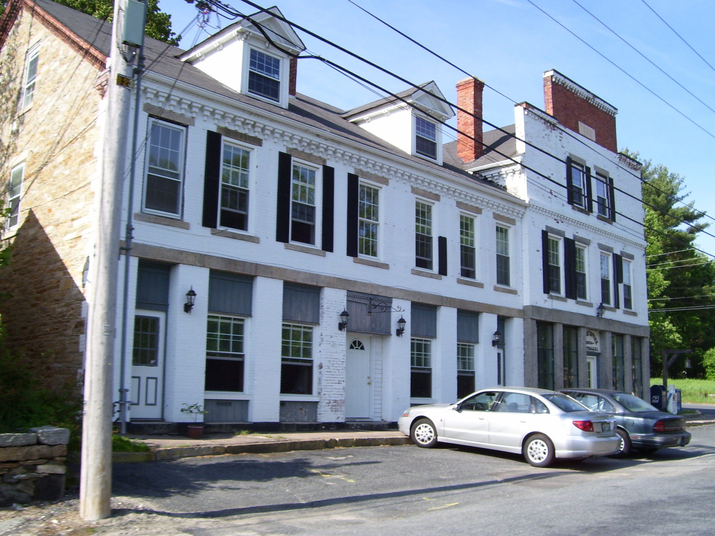
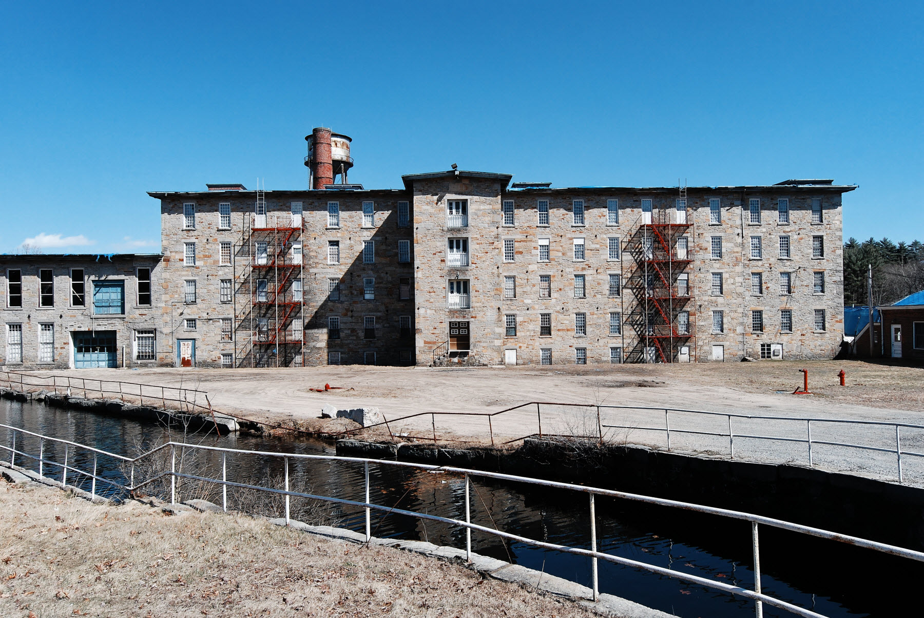
1761 Milestone |
|
01982-11-24November 24, 1982 |
640 S. Main St.
41°59′22″N 71°31′54″W / 41.989444°N 71.531667°W / 41.989444; -71.531667 (1761 Milestone) |
Woonsocket |
|
| 2 |
Albion Historic District |
|
01984-07-19July 19, 1984 |
Roughly bounded by Berkshire Dr., Willow Lane, Ledge Way, Kennedy Boulevard, and School and Main Sts.
41°57′06″N 71°27′26″W / 41.951667°N 71.457222°W / 41.951667; -71.457222 (Albion Historic District) |
Lincoln |
|
| 3 |
Allen Street Historic District |
|
01990-09-13September 13, 1990 |
Allen St.
42°00′06″N 71°30′50″W / 42.001667°N 71.513889°W / 42.001667; -71.513889 (Allen Street Historic District) |
Woonsocket |
|
| 4 |
Allendale Mill |
|
01973-05-07May 7, 1973 |
494 Woonasquatucket Ave.
41°51′00″N 71°28′51″W / 41.85°N 71.480833°W / 41.85; -71.480833 (Allendale Mill) |
North Providence |
|
| 5 |
Allenville Mill |
|
01972-01-20January 20, 1972 |
5 Esmond St.
41°52′41″N 71°30′09″W / 41.878056°N 71.5025°W / 41.878056; -71.5025 (Allenville Mill) |
Smithfield |
|
| 6 |
Andrews-Luther Farm |
|
01985-06-19June 19, 1985 |
Elmdale Rd.
41°51′08″N 71°36′04″W / 41.852222°N 71.601111°W / 41.852222; -71.601111 (Andrews-Luther Farm) |
Scituate |
|
| 7 |
Daniel Angell House |
|
01975-04-21April 21, 1975 |
15 Dean Ave.
41°52′46″N 71°30′01″W / 41.879444°N 71.500278°W / 41.879444; -71.500278 (Daniel Angell House) |
Johnston |
|
| 8 |
Angell-Ballou House |
|
02004-03-18March 18, 2004 |
49 Ridge Rd.
41°53′42″N 71°30′05″W / 41.895°N 71.501389°W / 41.895; -71.501389 (Angell-Ballou House) |
Smithfield |
|
| 9 |
Arkwright Bridge |
|
01978-12-12December 12, 1978 |
Crosses the Pawtuxet River at Hill St.
41°43′49″N 71°32′49″W / 41.730278°N 71.546944°W / 41.730278; -71.546944 (Arkwright Bridge) |
Cranston |
Extends into Kent County |
| 10 |
Arnold Mills Historic District |
|
01978-12-28December 28, 1978 |
East of Cumberland Hill at Sneech Pond, Attleboro, and Abbott Run Valley Rds.
41°58′46″N 71°23′30″W / 41.979444°N 71.391667°W / 41.979444; -71.391667 (Arnold Mills Historic District) |
Cumberland |
|
| 11 |
Dexter Arnold Farmstead |
|
01977-11-25November 25, 1977 |
Chopmist Hill Rd.
41°48′59″N 71°39′54″W / 41.816389°N 71.665°W / 41.816389; -71.665 (Dexter Arnold Farmstead) |
Scituate |
|
| 12 |
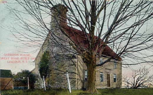
Eleazer Arnold House |
|
01968-11-24November 24, 1968 |
Great Rd. (RI 123) near its junction with RI 126
41°54′10″N 71°25′14″W / 41.902778°N 71.420556°W / 41.902778; -71.420556 (Eleazer Arnold House) |
Lincoln |
|
| 13 |
Israel Arnold House |
|
01970-12-18December 18, 1970 |
Great Rd.
41°54′17″N 71°25′35″W / 41.904722°N 71.426389°W / 41.904722; -71.426389 (Israel Arnold House) |
Lincoln |
|
| 14 |
John Arnold House |
|
01982-11-24November 24, 1982 |
99 Providence St.
41°59′41″N 71°31′22″W / 41.994722°N 71.522778°W / 41.994722; -71.522778 (John Arnold House) |
Woonsocket |
|
| 15 |
Peleg Arnold Tavern |
|
01974-07-30July 30, 1974 |
Woonsocket Hill Rd.
41°59′21″N 71°32′02″W / 41.989167°N 71.533889°W / 41.989167; -71.533889 (Peleg Arnold Tavern) |
North Smithfield |
|
| 16 |
Ashton Historic District |
|
01984-11-01November 1, 1984 |
Roughly Mendon, Scott, and Old Angell Rds., Store Hill Rd., Front and Middle Sts.
41°56′20″N 71°25′54″W / 41.938889°N 71.431667°W / 41.938889; -71.431667 (Ashton Historic District) |
Cumberland |
|
| 17 |
Ballou House |
|
01984-08-30August 30, 1984 |
Albion Rd.
41°56′48″N 71°28′21″W / 41.946667°N 71.4725°W / 41.946667; -71.4725 (Ballou House) |
Lincoln |
|
| 18 |
Ballou-Weatherhead House |
|
01993-06-25June 25, 1993 |
Tower Hill Rd. (Pole 68)
41°59′47″N 71°26′38″W / 41.996389°N 71.443889°W / 41.996389; -71.443889 (Ballou-Weatherhead House) |
Cumberland |
|
| 19 |
Battey-Barden House |
|
01980-08-29August 29, 1980 |
Plainfield Pike
41°47′30″N 71°37′08″W / 41.791667°N 71.618889°W / 41.791667; -71.618889 (Battey-Barden House) |
Scituate |
|
| 20 |
Belknap School |
|
02010-12-07December 7, 2010 |
509 Greenville Ave.
41°50′48″N 71°30′05″W / 41.846667°N 71.501389°W / 41.846667; -71.501389 (Belknap School) |
Johnston |
|
| 21 |
Berkeley Mill Village |
|
01972-02-23February 23, 1972 |
Bounded roughly by Martin St., Mendon Rd., railroad, and cemetery
41°55′39″N 71°25′25″W / 41.9275°N 71.423611°W / 41.9275; -71.423611 (Berkeley Mill Village) |
Cumberland |
|
| 22 |
Bernon Worsted Mill |
|
02005-06-10June 10, 2005 |
828 Park Ave.
41°59′38″N 71°30′50″W / 41.993889°N 71.513889°W / 41.993889; -71.513889 (Bernon Worsted Mill) |
Woonsocket |
|
| 23 |
Bicknell-Armington Lightning Splitter House |
|
01980-11-28November 28, 1980 |
3591 Pawtucket Ave.
41°46′36″N 71°21′47″W / 41.776667°N 71.363056°W / 41.776667; -71.363056 (Bicknell-Armington Lightning Splitter House) |
East Providence |
|
| 24 |
Blackstone Canal |
|
01971-05-06May 6, 1971 |
From Steeple and Promenade Sts. to the Ashton Dam
41°55′16″N 71°25′21″W / 41.921111°N 71.4225°W / 41.921111; -71.4225 (Blackstone Canal) |
Lincoln |
Extends into Providence |
| 25 |
Borders Farm |
|
02009-07-29July 29, 2009 |
31-38 N. Rd.
41°47′17″N 71°44′38″W / 41.787989°N 71.743828°W / 41.787989; -71.743828 (Borders Farm) |
Foster |
|
| 26 |
Boston and Providence Railroad Bridge |
|
01980-11-28November 28, 1980 |
Spans the Ten Mile River
41°50′05″N 71°21′45″W / 41.834722°N 71.3625°W / 41.834722; -71.3625 (Boston and Providence Railroad Bridge) |
East Providence |
|
| 27 |
Breezy Hill Site (RI-957) |
|
01985-09-28September 28, 1985 |
Address Restricted
|
Foster |
|
| 28 |
Bridgeton School |
|
02006-12-27December 27, 2006 |
16 Laurel Hill Ave.
41°57′52″N 71°42′47″W / 41.964444°N 71.713056°W / 41.964444; -71.713056 (Bridgeton School) |
Burrillville |
|
| 29 |
Bridgham Farm |
|
01980-11-28November 28, 1980 |
120, 148, 150, and 160 Pleasant St.
41°50′13″N 71°20′38″W / 41.836944°N 71.343889°W / 41.836944; -71.343889 (Bridgham Farm) |
East Providence |
|
| 30 |
Brown Avenue Historic District |
|
01973-04-24April 24, 1973 |
Brown Ave.
41°50′44″N 71°32′37″W / 41.845556°N 71.543611°W / 41.845556; -71.543611 (Brown Avenue Historic District) |
Johnston |
|
| 31 |
Burlingame-Noon House |
|
01974-02-15February 15, 1974 |
3261 Mendon Rd.
41°58′32″N 71°27′25″W / 41.975556°N 71.456944°W / 41.975556; -71.456944 (Burlingame-Noon House) |
Cumberland |
|
| 32 |
Carpenter, Lakeside, and Springvale Cemeteries |
|
01980-11-28November 28, 1980 |
Newman and Pawtucket Aves.
41°50′33″N 71°21′09″W / 41.8425°N 71.3525°W / 41.8425; -71.3525 (Carpenter, Lakeside, and Springvale Cemeteries) |
East Providence |
|
| 33 |
Cato Hill Historic District |
|
01976-08-10August 10, 1976 |
RI 44
42°00′18″N 71°30′54″W / 42.005°N 71.515°W / 42.005; -71.515 (Cato Hill Historic District) |
Woonsocket |
|
| 34 |
Central Falls Congregational Church |
|
01976-07-12July 12, 1976 |
376 High St.
41°53′05″N 71°23′04″W / 41.884722°N 71.384444°W / 41.884722; -71.384444 (Central Falls Congregational Church) |
Central Falls |
|
| 35 |
Central Falls Mill Historic District |
|
01976-07-02July 2, 1976 |
Between Roosevelt Avenue and the Blackstone River
41°53′11″N 71°22′55″W / 41.886389°N 71.381944°W / 41.886389; -71.381944 (Central Falls Mill Historic District) |
Central Falls |
|
| 36 |
Central Street School |
|
01979-04-06April 6, 1979 |
379 Central St.
41°53′04″N 71°23′38″W / 41.884444°N 71.393889°W / 41.884444; -71.393889 (Central Street School) |
Central Falls |
|
| 37 |
Chepachet Village Historic District |
|
01971-03-31March 31, 1971 |
Both sides of U.S. Route 44 (roughly from the intersection of U.S. Route 44 and RI 102 north to the intersection of RI 100 and RI 102) and radiating
41°54′46″N 71°40′00″W / 41.912778°N 71.666667°W / 41.912778; -71.666667 (Chepachet Village Historic District) |
Glocester |
|
| 38 |
Cherry Valley Archeological Site, RI-279 |
|
01984-11-01November 1, 1984 |
Address Restricted
|
Glocester |
|
| 39 |
Clayville Historic District |
|
01988-12-29December 29, 1988 |
Roughly bounded by Cole Ave., Plainfield Pike, Field Hill Rd., and Victory Highway
41°46′37″N 71°40′35″W / 41.776944°N 71.676389°W / 41.776944; -71.676389 (Clayville Historic District) |
Foster and Scituate |
|
| 40 |
Clemence-Irons House |
|
01973-07-02July 2, 1973 |
38 George Waterman Rd.
41°50′21″N 71°29′04″W / 41.839167°N 71.484444°W / 41.839167; -71.484444 (Clemence-Irons House) |
Johnston |
|
| 41 |
John Cole Farm |
|
01977-08-16August 16, 1977 |
East of Manville on Reservoir Rd.
41°59′26″N 71°24′24″W / 41.990556°N 71.406667°W / 41.990556; -71.406667 (John Cole Farm) |
Cumberland |
|
| 42 |
Samuel B. Conant House |
|
01979-04-06April 6, 1979 |
104 Clay St.
41°52′59″N 71°23′25″W / 41.883056°N 71.390278°W / 41.883056; -71.390278 (Samuel B. Conant House) |
Central Falls |
|
| 43 |
Amos Cooke House |
|
01979-10-30October 30, 1979 |
Chopmist Hill Rd.
41°48′31″N 71°39′41″W / 41.808611°N 71.661389°W / 41.808611; -71.661389 (Amos Cooke House) |
Scituate |
|
| 44 |
Cornell-Randall-Bailey Roadhouse |
|
01984-05-10May 10, 1984 |
2737 Hartford Ave.
41°49′57″N 71°33′29″W / 41.8325°N 71.558056°W / 41.8325; -71.558056 (Cornell-Randall-Bailey Roadhouse) |
Johnston |
|
| 45 |
Crescent Park Looff Carousel |
|
01976-04-21April 21, 1976 |
Riverside Park
41°45′24″N 71°21′34″W / 41.756594°N 71.359431°W / 41.756594; -71.359431 (Crescent Park Looff Carousel) |
East Providence |
Restored 1895 carousel features some of Charles I.D. Looff's finest workmanship |
| 46 |
Nathaniel Daggett House |
|
01980-11-28November 28, 1980 |
74 Roger Williams Ave.
41°50′16″N 71°21′46″W / 41.837778°N 71.362778°W / 41.837778; -71.362778 (Nathaniel Daggett House) |
East Providence |
|
| 47 |
Henry Darling House |
|
01982-11-26November 26, 1982 |
786 Harris Ave.
42°00′50″N 71°31′40″W / 42.013889°N 71.527778°W / 42.013889; -71.527778 (Henry Darling House) |
Woonsocket |
|
| 48 |
James Dennis House |
|
01980-11-28November 28, 1980 |
3120 Pawtucket Ave.
41°47′21″N 71°21′53″W / 41.789167°N 71.364722°W / 41.789167; -71.364722 (James Dennis House) |
East Providence |
|
| 49 |
District 6 Schoolhouse |
|
01980-11-28November 28, 1980 |
347 Willett Ave
41°46′23″N 71°21′19″W / 41.773056°N 71.355278°W / 41.773056; -71.355278 (District 6 Schoolhouse) |
East Providence |
|
| 50 |
Capt. George Dorrance House |
|
01972-03-16March 16, 1972 |
Jencks Rd.
41°44′22″N 71°47′12″W / 41.739444°N 71.786667°W / 41.739444; -71.786667 (Capt. George Dorrance House) |
Foster |
|
| 51 |
Double L Site, RI-958 |
|
01985-09-12September 12, 1985 |
Address Restricted
|
Scituate |
|
| 52 |
Eddy Homestead |
|
01986-08-13August 13, 1986 |
2543 Hartford Ave.
41°49′57″N 71°32′56″W / 41.8325°N 71.548889°W / 41.8325; -71.548889 (Eddy Homestead) |
Johnston |
|
| 53 |
Edgewood Historic District-Arnold Farm Plat |
|
02010-09-10September 10, 2010 |
Arnold, Albert, Columbia Aves.; parts of Broad St., Pawtuxet Ave., Narragansett Blvd.
41°46′38″N 71°23′44″W / 41.777222°N 71.395556°W / 41.777222; -71.395556 (Edgewood Historic District-Arnold Farm Plat) |
Cranston |
|
| 54 |
Edgewood Historic District-Taft Estate Plat |
|
02003-10-24October 24, 2003 |
Roughly bounded by Windsor Rd, Narragansett Bay, Circuit Dr., and Broad St.
41°46′14″N 71°23′27″W / 41.770556°N 71.390833°W / 41.770556; -71.390833 (Edgewood Historic District-Taft Estate Plat) |
Cranston |
|
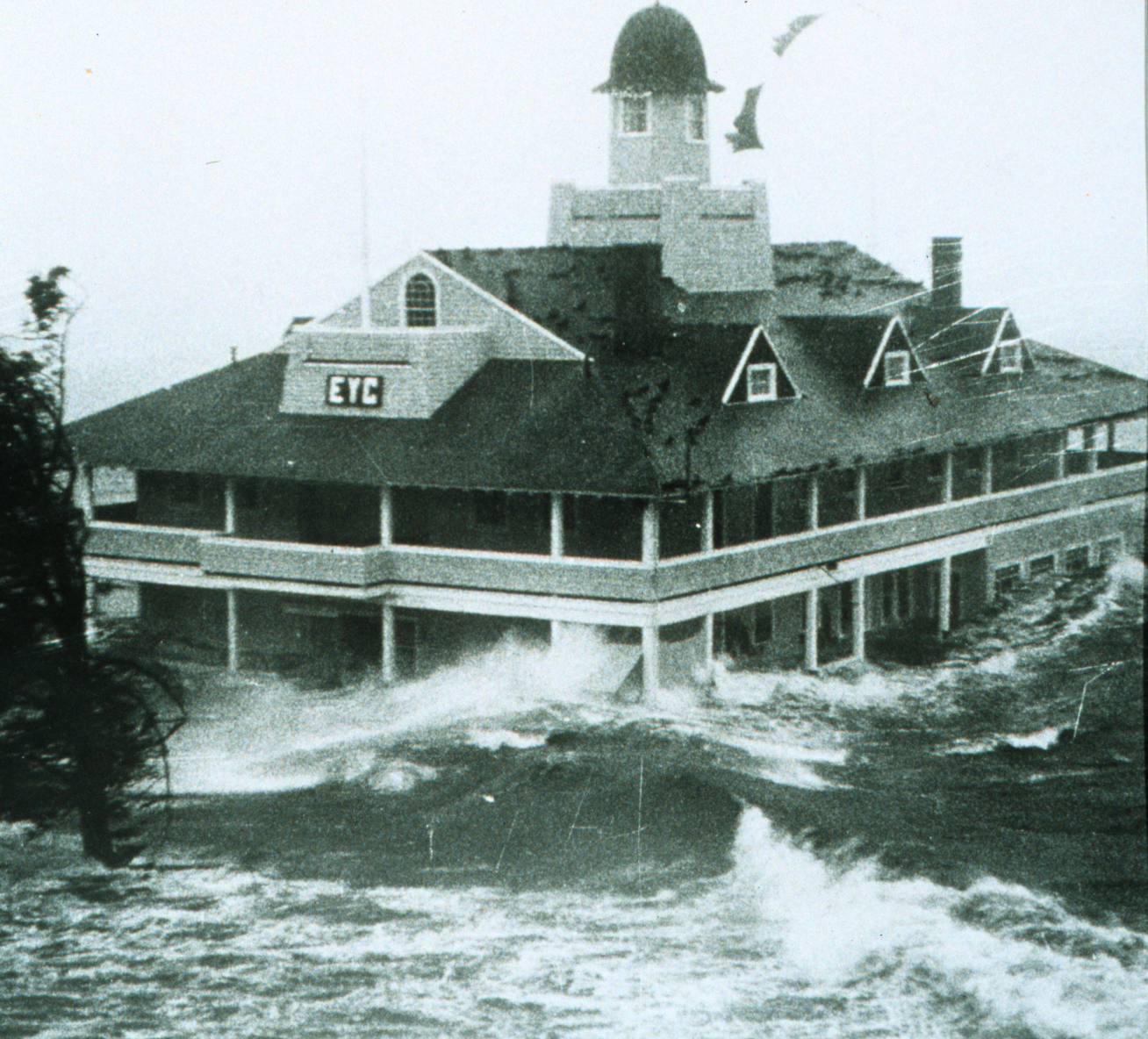
| 55 |
Edgewood Yacht Club |
|
01989-02-23February 23, 1989 |
3 Shaw Ave.
41°46′34″N 71°23′26″W / 41.776111°N 71.390556°W / 41.776111; -71.390556 (Edgewood Yacht Club) |
Cranston |
|
| 56 |
Elliot-Harris-Miner House |
|
01984-08-30August 30, 1984 |
1406 Old Louisquisset Pike
41°52′43″N 71°26′11″W / 41.878611°N 71.436389°W / 41.878611; -71.436389 (Elliot-Harris-Miner House) |
Lincoln |
|
| 57 |
David G. Fales House |
|
01979-04-06April 6, 1979 |
476 High St.
41°53′10″N 71°23′05″W / 41.886111°N 71.384722°W / 41.886111; -71.384722 (David G. Fales House) |
Central Falls |
|
| 58 |
Edwin H. Farnum House |
|
01974-05-17May 17, 1974 |
U.S. Route 44 at its junction with Collins St.
41°51′46″N 71°29′39″W / 41.862778°N 71.494167°W / 41.862778; -71.494167 (Edwin H. Farnum House) |
Johnston |
|
| 59 |
Thomas Fenner House |
|
01990-03-02March 2, 1990 |
43 Stony Acre Dr.
41°47′27″N 71°29′19″W / 41.790833°N 71.488611°W / 41.790833; -71.488611 (Thomas Fenner House) |
Cranston |
|
| 60 |
Forestdale Mill Village Historic District |
|
01972-06-05June 5, 1972 |
East and west along Main St. and north on Maple Ave.
41°59′51″N 71°33′50″W / 41.9975°N 71.563889°W / 41.9975; -71.563889 (Forestdale Mill Village Historic District) |
North Smithfield |
|
| 61 |
Foster Center Historic District |
|
01974-05-11May 11, 1974 |
Foster
41°47′07″N 71°43′18″W / 41.785278°N 71.721667°W / 41.785278; -71.721667 (Foster Center Historic District) |
Foster |
|
| 62 |
French Worsted Company Mill Historic District |
|
02008-05-21May 21, 2008 |
153 Hamlet Ave.
42°00′10″N 71°30′00″W / 42.002764°N 71.499919°W / 42.002764; -71.499919 (French Worsted Company Mill Historic District) |
Woonsocket |
|
| 63 |
Furnace Carolina Site |
|
01993-05-10May 10, 1993 |
Address Restricted
|
Cumberland |
|
| 64 |
Furnace Hill Brook Historic and Archeological District |
|
01980-08-06August 6, 1980 |
Address Restricted
|
Cranston |
|
| 65 |
Alphonse Gaulin Jr. House |
|
01982-11-24November 24, 1982 |
311 Elm St.
42°00′25″N 71°29′55″W / 42.006944°N 71.498611°W / 42.006944; -71.498611 (Alphonse Gaulin Jr. House) |
Woonsocket |
|
| 66 |
Georgiaville Historic District |
|
01985-10-03October 3, 1985 |
Roughly bounded by Stillwater Rd., Cross St., Whipple Ave., and Farnum Pike
41°53′18″N 71°30′26″W / 41.888333°N 71.507222°W / 41.888333; -71.507222 (Georgiaville Historic District) |
Smithfield |
|
| 67 |
Glenark Mills |
|
01989-05-15May 15, 1989 |
64 East St.
41°59′54″N 71°31′09″W / 41.998333°N 71.519167°W / 41.998333; -71.519167 (Glenark Mills) |
Woonsocket |
|
| 68 |
Glocester Town Pound |
|
01970-09-22September 22, 1970 |
Pound Rd. and Chopmist Hill Rd.
41°53′44″N 71°40′09″W / 41.895556°N 71.669167°W / 41.895556; -71.669167 (Glocester Town Pound) |
Glocester |
|
| 69 |
Great Road Historic District |
|
01974-07-22July 22, 1974 |
Great Rd.
41°54′21″N 71°25′41″W / 41.905833°N 71.428056°W / 41.905833; -71.428056 (Great Road Historic District) |
Lincoln |
|
| 70 |
Benjamin F. Greene House |
|
01979-04-06April 6, 1979 |
85 Cross St.
41°53′08″N 71°23′11″W / 41.885556°N 71.386389°W / 41.885556; -71.386389 (Benjamin F. Greene House) |
Central Falls |
|
| 71 |
Greystone Historic District |
|
02008-01-02January 2, 2008 |
1-16 Beckside Rd., 1-29 Greystone Ave., 1-24 Oakleigh Ave., 1-40 Langsberries Ave., 2-20 Larchmount Ave N, 1-16 S...
41°52′02″N 71°29′24″W / 41.867222°N 71.49°W / 41.867222; -71.49 (Greystone Historic District) |
North Providence |
|
| 72 |
Greystone Mill Historic District |
|
02004-04-28April 28, 2004 |
Greystone Ave.
41°51′53″N 71°29′28″W / 41.864722°N 71.491111°W / 41.864722; -71.491111 (Greystone Mill Historic District) |
North Providence |
|
| 73 |
Grove Street Elementary School |
|
01982-11-24November 24, 1982 |
312 Grove St.
41°59′54″N 71°30′33″W / 41.998333°N 71.509167°W / 41.998333; -71.509167 (Grove Street Elementary School) |
Woonsocket |
|
| 74 |
Hanora Mills |
|
01982-11-24November 24, 1982 |
1 Main St.
42°00′02″N 71°30′58″W / 42.000556°N 71.516111°W / 42.000556; -71.516111 (Hanora Mills) |
Woonsocket |
|
| 75 |
Harmony Chapel and Cemetery |
|
01980-06-25June 25, 1980 |
Putnam Pike
41°53′20″N 71°36′03″W / 41.888889°N 71.600833°W / 41.888889; -71.600833 (Harmony Chapel and Cemetery) |
Glocester |
|
| 76 |
Harris Warehouse |
|
01976-07-01July 1, 1976 |
61 Railroad St.
42°00′14″N 71°30′54″W / 42.003889°N 71.515°W / 42.003889; -71.515 (Harris Warehouse) |
Woonsocket |
|
| 77 |
Harrisville Historic District |
|
01984-03-21March 21, 1984 |
Roughly bounded by Wood and Sherman Rds., East Ave, and Main, Chapel, School, and River Sts.
41°57′59″N 71°40′33″W / 41.966389°N 71.675833°W / 41.966389; -71.675833 (Harrisville Historic District) |
Burrillville |
|
| 78 |
Hearthside |
|
01973-04-24April 24, 1973 |
Great Rd.
41°54′23″N 71°25′50″W / 41.906389°N 71.430556°W / 41.906389; -71.430556 (Hearthside) |
Lincoln |
|
| 79 |
Holy Trinity Church Complex |
|
01978-01-03January 3, 1978 |
134 Fuller Ave.
41°53′19″N 71°23′47″W / 41.888611°N 71.396389°W / 41.888611; -71.396389 (Holy Trinity Church Complex) |
Central Falls |
|
| 80 |
Honan's Block and 112-114 Main Street |
|
01989-08-03August 3, 1989 |
110-114 Main St.
42°00′08″N 71°30′53″W / 42.002222°N 71.514722°W / 42.002222; -71.514722 (Honan's Block and 112-114 Main Street) |
Woonsocket |
|
| 81 |
Hope Street School |
|
02000-04-14April 14, 2000 |
40 Hope St.
41°59′57″N 71°31′13″W / 41.999167°N 71.520278°W / 41.999167; -71.520278 (Hope Street School) |
Woonsocket |
|
| 82 |
Hope Village Historic District |
|
01995-08-08August 8, 1995 |
Roughly bounded by the Pawtuxet River, Hope Furnace Rd., Hope Mill Pond, North Rd., White Ln., and Harrington and Potter Sts.
41°44′00″N 71°33′45″W / 41.733333°N 71.5625°W / 41.733333; -71.5625 (Hope Village Historic District) |
Scituate |
|
| 83 |
Thomas H. Hughes House |
|
01979-06-15June 15, 1979 |
423 Central Ave.
41°48′28″N 71°29′51″W / 41.807778°N 71.4975°W / 41.807778; -71.4975 (Thomas H. Hughes House) |
Johnston |
|
| 84 |
Island Place Historic District |
|
01990-09-13September 13, 1990 |
Island Place and S. Main St. at Market Sq.
41°59′57″N 71°30′59″W / 41.999167°N 71.516389°W / 41.999167; -71.516389 (Island Place Historic District) |
Woonsocket |
|
| 85 |
Jenckes House |
|
01984-08-30August 30, 1984 |
81 Jenckes Hill Rd.
41°54′16″N 71°27′32″W / 41.904444°N 71.458889°W / 41.904444; -71.458889 (Jenckes House) |
Lincoln |
|
| 86 |
Jenckes House |
|
01984-10-10October 10, 1984 |
1730 Old Louisquisset Pike
41°53′44″N 71°26′55″W / 41.895556°N 71.448611°W / 41.895556; -71.448611 (Jenckes House) |
Lincoln |
|
| 87 |
Jenckes Mansion |
|
01982-11-24November 24, 1982 |
837-839 Social St.
42°00′44″N 71°30′07″W / 42.012222°N 71.501944°W / 42.012222; -71.501944 (Jenckes Mansion) |
Woonsocket |
|
| 88 |
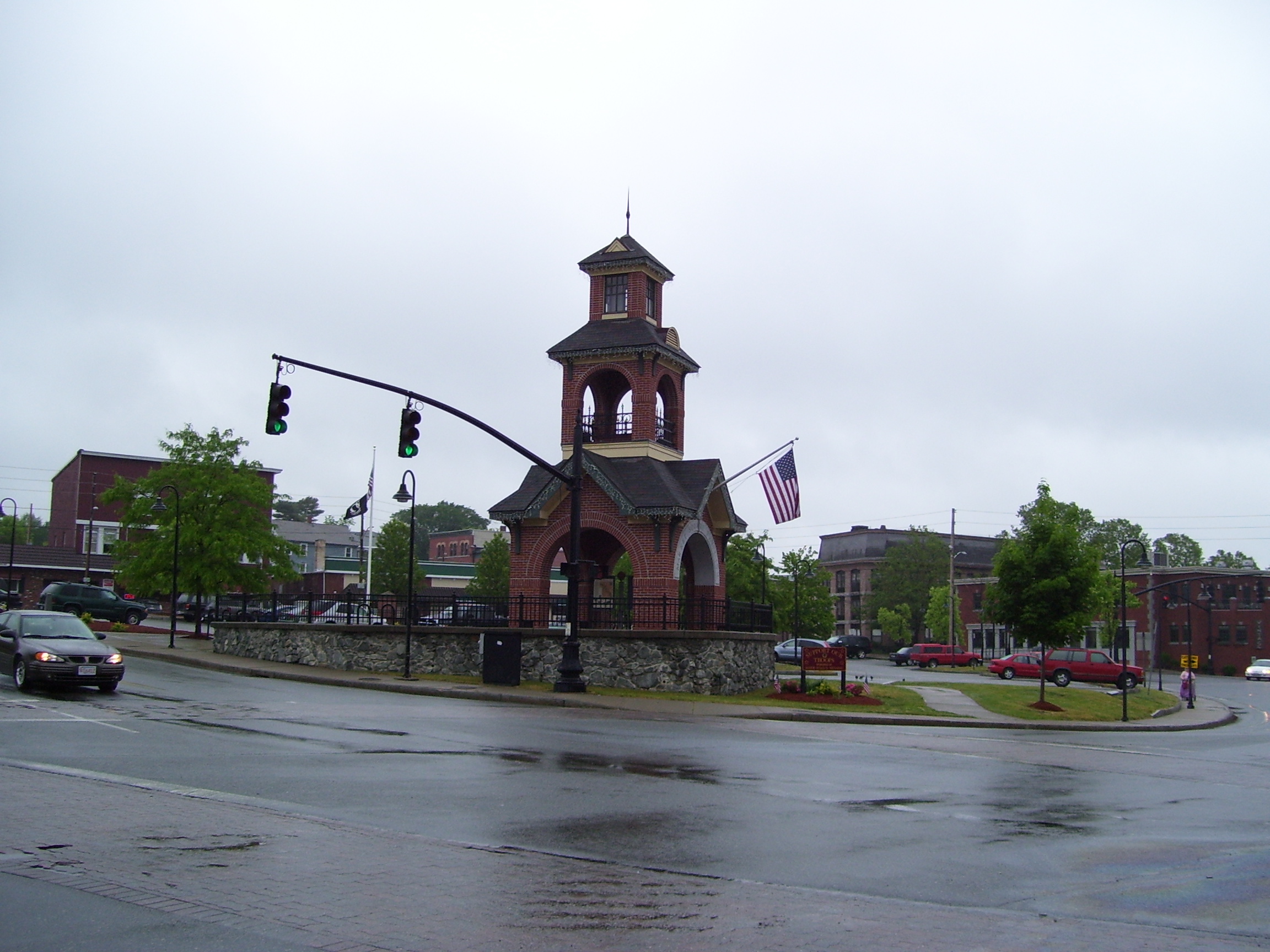
Jenks Park & Cogswell Tower |
|
01979-04-06April 6, 1979 |
Adjoining 580 Broad St.
41°53′15″N 71°23′21″W / 41.8875°N 71.389167°W / 41.8875; -71.389167 (Jenks Park & Cogswell Tower) |
Central Falls |
|
| 89 |
Luke Jillson House |
|
01982-08-12August 12, 1982 |
2510 Mendon Rd.
41°57′41″N 71°26′41″W / 41.961389°N 71.444722°W / 41.961389; -71.444722 (Luke Jillson House) |
Cumberland |
|
| 90 |
Joy Homestead |
|
01971-02-18February 18, 1971 |
156 Scituate Ave.
41°46′57″N 71°28′36″W / 41.7825°N 71.476667°W / 41.7825; -71.476667 (Joy Homestead) |
Cranston |
|
| 91 |
Jules Desurmont Worsted Company Mill |
|
02007-01-12January 12, 2007 |
84 Fairmount St.
42°00′09″N 71°31′21″W / 42.0025°N 71.5225°W / 42.0025; -71.5225 (Jules Desurmont Worsted Company Mill) |
Woonsocket |
|
| 92 |
Knightsville Meetinghouse |
|
01978-03-08March 8, 1978 |
67 Phenix Ave.
41°46′54″N 71°28′08″W / 41.781667°N 71.468889°W / 41.781667; -71.468889 (Knightsville Meetinghouse) |
Cranston |
|
| 93 |
L'Eglise du Precieux Sang |
|
01982-07-26July 26, 1982 |
94 Carrington Ave. and 61 Park Ave.
42°00′06″N 71°30′33″W / 42.001667°N 71.509167°W / 42.001667; -71.509167 (L'Eglise du Precieux Sang) |
Woonsocket |
|
| 94 |
Lime Kilns |
|
01984-08-30August 30, 1984 |
Off Louisquisset Pike, Sherman and Dexter Rock Rds.
41°55′51″N 71°26′53″W / 41.930833°N 71.448056°W / 41.930833; -71.448056 (Lime Kilns) |
Lincoln |
|
| 95 |
Limerock Village Historic District |
|
01974-05-23May 23, 1974 |
In an irregular pattern along Smith, Wilbur, and Great Rds., and Old Louisquisset Pike
41°55′40″N 71°27′22″W / 41.927778°N 71.456111°W / 41.927778; -71.456111 (Limerock Village Historic District) |
Lincoln |
|
| 96 |
Linton Block |
|
01982-11-24November 24, 1982 |
3-5 Monument Sq.
42°00′19″N 71°30′48″W / 42.005278°N 71.513333°W / 42.005278; -71.513333 (Linton Block) |
Woonsocket |
|
| 97 |
Lippitt Hill Historic District |
|
01989-03-02March 2, 1989 |
Hope Rd., Burlingame Rd., and Lippett Ave.
41°44′23″N 71°32′06″W / 41.739722°N 71.535°W / 41.739722; -71.535 (Lippitt Hill Historic District) |
Cranston |
|
| 98 |
Little Neck Cemetery |
|
01980-11-28November 28, 1980 |
Off Read St.
41°45′59″N 71°21′18″W / 41.766389°N 71.355°W / 41.766389; -71.355 (Little Neck Cemetery) |
East Providence |
|
| 99 |
Logee House |
|
01982-11-24November 24, 1982 |
225 Logee St.
41°59′41″N 71°30′43″W / 41.994722°N 71.511944°W / 41.994722; -71.511944 (Logee House) |
Woonsocket |
|
| 100 |
Lonsdale Historic District |
|
01984-05-25May 25, 1984 |
Lonsdale Ave., Blackstone Ct., and Front, Main, Cook, Broad, Mill, Cross and Blackstone Sts.
41°54′34″N 71°24′11″W / 41.909444°N 71.403056°W / 41.909444; -71.403056 (Lonsdale Historic District) |
Lonsdale |
|
| 101 |
Main Street Historic District |
|
01991-04-18April 18, 1991 |
Roughly Main St. east of Market Sq. to Depot Sq.
42°00′09″N 71°30′52″W / 42.0025°N 71.514444°W / 42.0025; -71.514444 (Main Street Historic District) |
Woonsocket |
|
| 102 |
Manton-Hunt-Farnum Farm |
|
01985-10-03October 3, 1985 |
Putnam Pike
41°53′54″N 71°37′15″W / 41.898333°N 71.620833°W / 41.898333; -71.620833 (Manton-Hunt-Farnum Farm) |
Glocester |
|
| 103 |
Manville Company Worker Housing Historic District |
|
02009-04-02April 2, 2009 |
Bounded by Chestnut Street, Angle Street, Railroad Street, Winter Street, Fall Street, Spring Street, Park Way, Almeida Drive, Main Street
41°58′13″N 71°28′18″W / 41.970278°N 71.471667°W / 41.970278; -71.471667 (Manville Company Worker Housing Historic District) |
Lincoln |
|
| 104 |
Mathewson Farm |
|
02001-01-26January 26, 2001 |
544 Greenville Ave.
41°50′44″N 71°30′16″W / 41.845556°N 71.504444°W / 41.845556; -71.504444 (Mathewson Farm) |
Johnston |
|
| 105 |
McGonagle Site, RI-1227 |
|
01985-09-12September 12, 1985 |
Address Restricted
|
Scituate |
|
| 106 |
Metcalf-Franklin Farm |
|
02007-06-07June 7, 2007 |
142 Abbott Run Valley Rd.
41°57′56″N 71°23′37″W / 41.965622°N 71.393511°W / 41.965622; -71.393511 (Metcalf-Franklin Farm) |
Cumberland |
|
| 107 |
Millrace Site, RI-1039 |
|
01985-09-12September 12, 1985 |
Address Restricted
|
Scituate |
|
| 108 |
Moosup Valley Historic District |
|
01988-05-11May 11, 1988 |
Roughly bounded by Harrington, Johnson, Moosup Valley and Barb Hill, and Cucumber Hill Rds.
41°44′25″N 71°45′23″W / 41.740278°N 71.756389°W / 41.740278; -71.756389 (Moosup Valley Historic District) |
Foster |
|
| 109 |
Moswansicut Pond Site, RI-960 |
|
01985-09-12September 12, 1985 |
Address Restricted
|
Scituate |
|
| 110 |
Mt. Hygeia |
|
01977-08-12August 12, 1977 |
Mt. Hygeia Rd.
41°50′48″N 71°45′17″W / 41.846667°N 71.754722°W / 41.846667; -71.754722 (Mt. Hygeia) |
Foster |
|
| 111 |
Mount Vernon Tavern |
|
01974-05-08May 8, 1974 |
Plainfield Pike (RI 14)
41°43′51″N 71°42′52″W / 41.730833°N 71.714444°W / 41.730833; -71.714444 (Mount Vernon Tavern) |
Foster |
|
| 112 |
Tyler Mowry House |
|
01996-08-16August 16, 1996 |
112 Sayles Hill Rd.
41°57′53″N 71°30′18″W / 41.964722°N 71.505°W / 41.964722; -71.505 (Tyler Mowry House) |
North Smithfield |
|
| 113 |
William Mowry House |
|
01983-02-10February 10, 1983 |
Farnum Pike
41°56′52″N 71°33′33″W / 41.947778°N 71.559167°W / 41.947778; -71.559167 (William Mowry House) |
North Smithfield |
|
| 114 |
Newman Cemetery |
|
01980-11-28November 28, 1980 |
Newman and Pawtucket Aves.
41°50′22″N 71°21′04″W / 41.839444°N 71.351111°W / 41.839444; -71.351111 (Newman Cemetery) |
East Providence |
|
| 115 |
Newman Congregational Church |
|
01980-11-28November 28, 1980 |
100 Newman Ave.
41°50′28″N 71°21′03″W / 41.841111°N 71.350833°W / 41.841111; -71.350833 (Newman Congregational Church) |
East Providence |
|
| 116 |
Nopkins Mill Historic District |
|
01984-05-10May 10, 1984 |
Old Danielson Pike, U.S. Route 6, Maple Rock and Rams Trail Rds.
41°49′21″N 71°42′25″W / 41.8225°N 71.706944°W / 41.8225; -71.706944 (Nopkins Mill Historic District) |
Foster |
|
| 117 |
North End Historic District |
|
01982-11-24November 24, 1982 |
Roughly bounded by Verry, Highland, Winter, and Summer Sts.
42°00′31″N 71°31′15″W / 42.008611°N 71.520833°W / 42.008611; -71.520833 (North End Historic District) |
Woonsocket |
|
| 118 |
Norwood Avenue Historic District |
|
02002-04-26April 26, 2002 |
Roughly along Norwood Ave. between Roger Williams to Broad St.
41°46′51″N 71°24′12″W / 41.780833°N 71.403333°W / 41.780833; -71.403333 (Norwood Avenue Historic District) |
Cranston |
|
| 119 |
Oak Lawn Village Historic District |
|
01977-11-25November 25, 1977 |
Wilbur Ave. from Natick Rd. to Oaklawn Ave., includes Searle, Exchange, and Wheelock Sts.
41°44′57″N 71°29′06″W / 41.749167°N 71.485°W / 41.749167; -71.485 (Oak Lawn Village Historic District) |
Cranston |
|
| 120 |
Oakland Historic District |
|
01987-09-09September 9, 1987 |
Victory Highway
41°57′32″N 71°38′47″W / 41.958889°N 71.646389°W / 41.958889; -71.646389 (Oakland Historic District) |
Burrillville |
|
| 121 |
Ochee Spring Quarry |
|
01978-05-05May 5, 1978 |
Address Restricted
|
Johnston |
|
| 122 |
Oddfellow's Hall |
|
01980-11-28November 28, 1980 |
63-67 Warren Ave.
41°49′01″N 71°22′56″W / 41.816944°N 71.382222°W / 41.816944; -71.382222 (Oddfellow's Hall) |
East Providence |
|
| 123 |
Old Ashton Historic District |
|
01984-08-30August 30, 1984 |
Lower River Rd. and Blackstone Canal Towpath
41°56′11″N 71°26′04″W / 41.936389°N 71.434444°W / 41.936389; -71.434444 (Old Ashton Historic District) |
Lincoln |
|
| 124 |
Old Congregational Church |
|
01974-01-11January 11, 1974 |
Off U.S. Route 6 on Greenville Rd. (RI 116)
41°50′03″N 71°35′14″W / 41.834167°N 71.587222°W / 41.834167; -71.587222 (Old Congregational Church) |
Scituate |
|
| 125 |
Capt. Stephen Olney House |
|
01974-05-01May 1, 1974 |
138 Smithfield Rd.
41°51′19″N 71°27′05″W / 41.855278°N 71.451389°W / 41.855278; -71.451389 (Capt. Stephen Olney House) |
North Providence |
|
| 126 |
Pascoag Grammar School |
|
02006-11-21November 21, 2006 |
265 Sayles Ave.
41°57′46″N 71°42′18″W / 41.962778°N 71.705°W / 41.962778; -71.705 (Pascoag Grammar School) |
Burrillville |
|
| 127 |
Patterson Brothers Commercial Building and House |
|
01993-06-10June 10, 1993 |
157, 159, and 161 Broad St.
41°54′10″N 71°23′32″W / 41.902778°N 71.392222°W / 41.902778; -71.392222 (Patterson Brothers Commercial Building and House) |
Cumberland |
|
| 128 |
Pawtuxet Village Historic District |
|
01973-04-24April 24, 1973 |
Bounded roughly by Bayside, S. Atlantic, and Ocean Aves., the Pawtuxet and Providence rivers, and Post Rd.
41°45′49″N 71°23′27″W / 41.763611°N 71.390833°W / 41.763611; -71.390833 (Pawtuxet Village Historic District) |
Cranston |
|
| 129 |
Phillipsdale Historic District |
|
02011-09-15September 15, 2011 |
Roughly bounded by Seekonk River, Roger Williams Ave. & Ruth Ave.
41°50′52″N 71°21′55″W / 41.847778°N 71.365278°W / 41.847778; -71.365278 (Phillipsdale Historic District) |
East Providence |
|
| 130 |
Philmont Worsted Company Mill |
|
02006-04-19April 19, 2006 |
685 Social St.
42°00′38″N 71°30′07″W / 42.010556°N 71.501944°W / 42.010556; -71.501944 (Philmont Worsted Company Mill) |
Woonsocket |
|
| 131 |
Pocasset Worsted Company Mill |
|
02010-07-19July 19, 2010 |
75 Pocasset St.
41°47′50″N 71°28′34″W / 41.797222°N 71.476111°W / 41.797222; -71.476111 (Pocasset Worsted Company Mill) |
Johnston |
|
| 132 |
Pomham Rocks Light Station |
|
01979-07-09July 9, 1979 |
Riverside Rd.
41°46′40″N 71°22′13″W / 41.777778°N 71.370278°W / 41.777778; -71.370278 (Pomham Rocks Light Station) |
East Providence |
|
| 133 |
Pothier House |
|
01982-11-24November 24, 1982 |
172 Pond St.
42°00′27″N 71°30′42″W / 42.0075°N 71.511667°W / 42.0075; -71.511667 (Pothier House) |
Woonsocket |
|
| 134 |
Potter-Remington House |
|
01978-12-28December 28, 1978 |
571 Natick Rd.
41°44′30″N 71°29′35″W / 41.741667°N 71.493056°W / 41.741667; -71.493056 (Potter-Remington House) |
Cranston |
|
| 135 |
Pullen Corner School |
|
01984-08-30August 30, 1984 |
Angell and Whipple
41°53′44″N 71°28′06″W / 41.895556°N 71.468333°W / 41.895556; -71.468333 (Pullen Corner School) |
Lincoln |
|
| 136 |
Rhodes-on-the Pawtuxet Ballroom and Gazebo |
|
01978-12-12December 12, 1978 |
Rhodes Pl.
41°46′04″N 71°23′32″W / 41.767778°N 71.392222°W / 41.767778; -71.392222 (Rhodes-on-the Pawtuxet Ballroom and Gazebo) |
Cranston |
|
| 137 |
Richmond Paper Company Mill Complex |
|
02006-11-01November 1, 2006 |
310 Bourne Ave.
41°50′31″N 71°22′14″W / 41.841944°N 71.370556°W / 41.841944; -71.370556 (Richmond Paper Company Mill Complex) |
East Providence |
|
| 138 |
Rosedale Apartments |
|
02007-04-10April 10, 2007 |
1180 Narragansett Boulevard
41°46′57″N 71°23′34″W / 41.7825°N 71.392778°W / 41.7825; -71.392778 (Rosedale Apartments) |
Cranston |
|
| 139 |
Rumford Chemical Works and Mill House Historic District |
|
01980-11-28November 28, 1980 |
N. Broadway, Newman, and Greenwood Aves.
41°50′22″N 71°21′16″W / 41.839444°N 71.354444°W / 41.839444; -71.354444 (Rumford Chemical Works and Mill House Historic District) |
East Providence |
|
| 140 |
Rumford Historic District |
|
01980-11-28November 28, 1980 |
Pleasant St. and Greenwood and Pawtucket Aves
41°49′50″N 71°20′55″W / 41.830556°N 71.348611°W / 41.830556; -71.348611 (Rumford Historic District) |
East Providence |
|
| 141 |
St. Andrews Episcopal Chapel |
|
01982-11-24November 24, 1982 |
576 Fairmont St.
42°00′03″N 71°31′54″W / 42.000833°N 71.531667°W / 42.000833; -71.531667 (St. Andrews Episcopal Chapel) |
Woonsocket |
|
| 142 |
St. Ann's Church Complex |
|
01982-11-24November 24, 1982 |
Cumberland and Elm Sts. and Gaulin Ave.
42°00′27″N 71°30′08″W / 42.0075°N 71.502222°W / 42.0075; -71.502222 (St. Ann's Church Complex) |
Woonsocket |
|
| 143 |
St. Charles Borromeo Church Complex |
|
01983-02-24February 24, 1983 |
N. Main, Daniels, and Earle Sts.
42°00′29″N 71°30′52″W / 42.008056°N 71.514444°W / 42.008056; -71.514444 (St. Charles Borromeo Church Complex) |
Woonsocket |
|
| 144 |
St. Joseph's Church Complex |
|
01982-08-12August 12, 1982 |
1303-1317 Mendon Rd.
41°56′03″N 71°25′40″W / 41.934167°N 71.427778°W / 41.934167; -71.427778 (St. Joseph's Church Complex) |
Cumberland |
|
| 145 |
St. Mary's Episcopal Church |
|
01980-11-28November 28, 1980 |
83 Warren Ave.
41°49′01″N 71°22′54″W / 41.816944°N 71.381667°W / 41.816944; -71.381667 (St. Mary's Episcopal Church) |
East Providence |
|
| 146 |
St. Matthew's Church |
|
01979-04-06April 6, 1979 |
Dexter and W. Hunt Sts.
41°53′21″N 71°24′07″W / 41.889167°N 71.401944°W / 41.889167; -71.401944 (St. Matthew's Church) |
Central Falls |
|
| 147 |
Saint Thomas Episcopal Church and Rectory |
|
01987-07-02July 2, 1987 |
Putnam Pike
41°52′16″N 71°33′12″W / 41.871111°N 71.553333°W / 41.871111; -71.553333 (Saint Thomas Episcopal Church and Rectory) |
Smithfield |
|
| 148 |
Sassafras Site, RI-55 |
|
01984-11-01November 1, 1984 |
Address Restricted
|
Lincoln |
|
| 149 |
Saylesville Historic District |
|
01984-08-30August 30, 1984 |
Roughly bounded by Memorial Ave., Scotts Road, Industrial Circle, Smithfield Ave., and Woodland Court
41°53′33″N 71°24′37″W / 41.8925°N 71.410278°W / 41.8925; -71.410278 (Saylesville Historic District) |
Lincoln |
|
| 150 |
Saylesville Meetinghouse |
|
01978-11-28November 28, 1978 |
Smithfield Ave.
41°54′02″N 71°25′06″W / 41.900556°N 71.418333°W / 41.900556; -71.418333 (Saylesville Meetinghouse) |
Lincoln |
|
| 151 |
Sheldon House |
|
01989-01-05January 5, 1989 |
458 Scituate Ave.
41°46′47″N 71°29′33″W / 41.779722°N 71.4925°W / 41.779722; -71.4925 (Sheldon House) |
Cranston |
|
| 152 |
Slatersville Historic District |
|
01973-04-24April 24, 1973 |
Main, Green, Church, and School Sts. and Ridge Rd.
41°59′53″N 71°34′57″W / 41.998056°N 71.5825°W / 41.998056; -71.5825 (Slatersville Historic District) |
North Smithfield |
|
| 153 |
Joseph Smith House |
|
01978-11-28November 28, 1978 |
109 Smithfield Rd.
41°51′22″N 71°27′00″W / 41.856111°N 71.45°W / 41.856111; -71.45 (Joseph Smith House) |
North Providence |
|
| 154 |
Smith-Appleby House |
|
01974-05-01May 1, 1974 |
Stillwater Rd. southeast of its junction with Capron Rd.
41°54′07″N 71°31′06″W / 41.901944°N 71.518333°W / 41.901944; -71.518333 (Smith-Appleby House) |
Smithfield |
|
| 155 |
Smith-Ballou House |
|
02003-06-06June 6, 2003 |
641 Harris Avenue
42°00′45″N 71°31′28″W / 42.0125°N 71.524444°W / 42.0125; -71.524444 (Smith-Ballou House) |
Woonsocket |
|
| 156 |
Smithfield Exchange Bank |
|
02006-04-19April 19, 2006 |
599 Putnam Pike
41°52′26″N 71°33′12″W / 41.873889°N 71.553333°W / 41.873889; -71.553333 (Smithfield Exchange Bank) |
Smithfield |
|
| 157 |
Smithfield Friends Meeting House, Parsonage & Cemetery |
|
01982-11-24November 24, 1982 |
126 Smithfield Rd.
41°59′21″N 71°31′49″W / 41.989167°N 71.530278°W / 41.989167; -71.530278 (Smithfield Friends Meeting House, Parsonage & Cemetery) |
Woonsocket |
|
| 158 |
Smithfield Road Historic District |
|
01987-02-18February 18, 1987 |
Smithfield Rd.
41°58′02″N 71°29′34″W / 41.967222°N 71.492778°W / 41.967222; -71.492778 (Smithfield Road Historic District) |
North Smithfield |
|
| 159 |
Smithville Seminary |
|
01978-03-29March 29, 1978 |
Institute Lane
41°50′02″N 71°35′00″W / 41.833889°N 71.583333°W / 41.833889; -71.583333 (Smithville Seminary) |
Scituate |
|
| 160 |
Smithville-North Scituate |
|
01979-08-29August 29, 1979 |
Danielson Pike and W. Greenville Road
41°50′00″N 71°35′07″W / 41.833333°N 71.585278°W / 41.833333; -71.585278 (Smithville-North Scituate) |
Scituate |
|
| 161 |
South Central Falls Historic District |
|
01991-01-31January 31, 1991 |
Roughly bounded by the Central Falls-Pawtucket boundary and Rand, Summit, Dexter and Broad Sts.
41°53′04″N 71°23′28″W / 41.884444°N 71.391111°W / 41.884444; -71.391111 (South Central Falls Historic District) |
Central Falls |
|
| 162 |
South Main Street Historic District |
|
01982-11-24November 24, 1982 |
Roughly bounded by Mason, Coe, Andrews St., and Bernice Ave.
41°59′37″N 71°31′35″W / 41.993611°N 71.526389°W / 41.993611; -71.526389 (South Main Street Historic District) |
Woonsocket |
|
| 163 |
Gov. William Sprague Mansion |
|
01971-02-18February 18, 1971 |
1351 Cranston St.
41°47′28″N 71°27′24″W / 41.791111°N 71.456667°W / 41.791111; -71.456667 (Gov. William Sprague Mansion) |
Cranston |
|
| 164 |
Squantum Association |
|
01980-11-28November 28, 1980 |
947 Veterans Memorial Parkway
41°47′24″N 71°22′25″W / 41.79°N 71.373611°W / 41.79; -71.373611 (Squantum Association) |
East Providence |
|
| 165 |
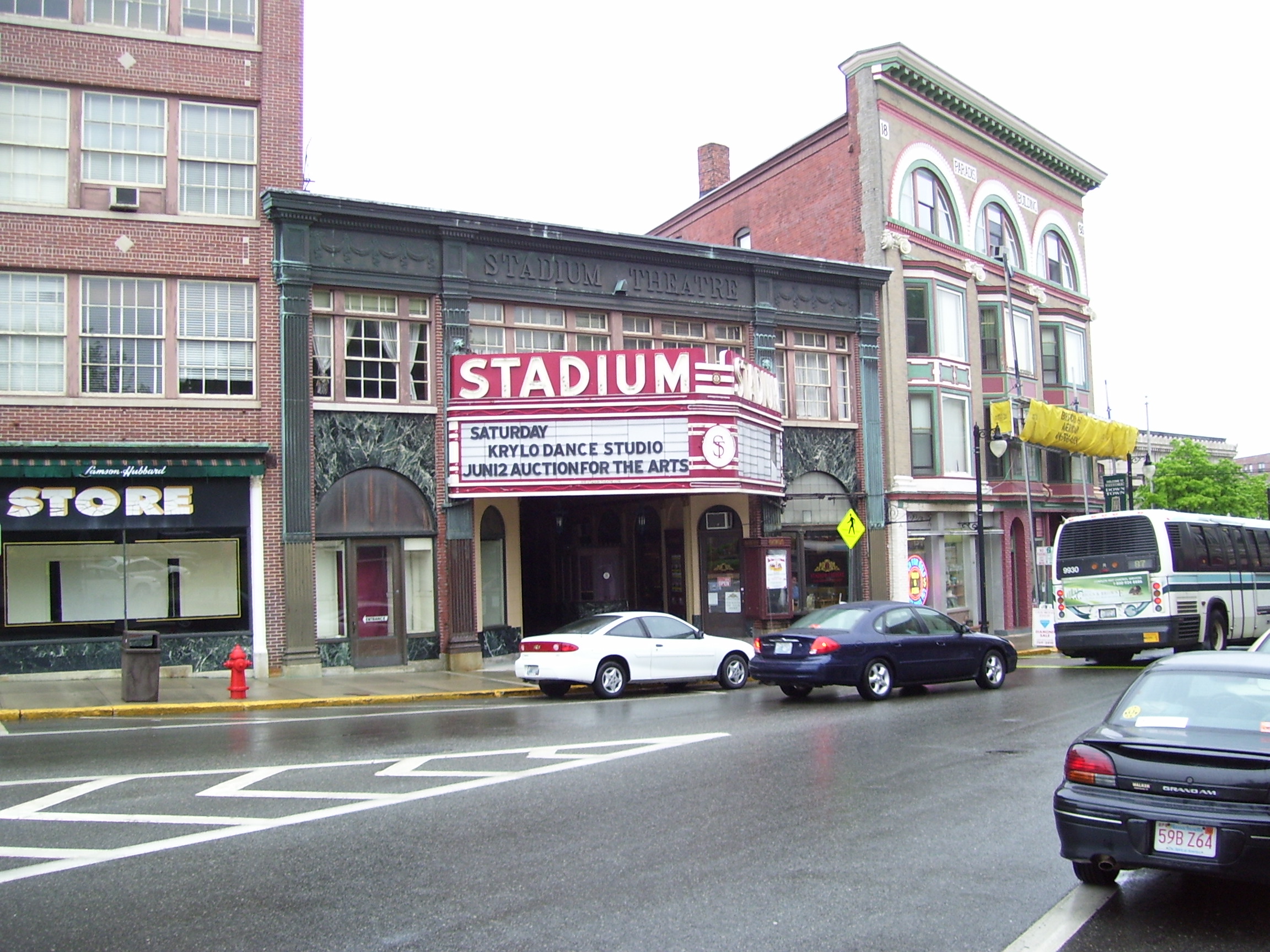
Stadium Building |
|
01976-06-30June 30, 1976 |
329 Main St.
42°00′19″N 71°30′46″W / 42.005278°N 71.512778°W / 42.005278; -71.512778 (Stadium Building) |
Woonsocket |
|
| 166 |
Ira B. Sweet House |
|
02010-01-15January 15, 2010 |
38 Esmond St.
41°52′31″N 71°30′13″W / 41.875369°N 71.503639°W / 41.875369; -71.503639 (Ira B. Sweet House) |
Smithfield |
|
| 167 |
Moses Taft House |
|
02009-03-20March 20, 2009 |
111 East Wallum Lake Road
41°57′59″N 71°43′02″W / 41.966389°N 71.717361°W / 41.966389; -71.717361 (Moses Taft House) |
Burrillville |
|
| 168 |
Three Dog Site, RI-151 |
|
01984-11-01November 1, 1984 |
Address Restricted
|
North Smithfield |
|
| 169 |
Todd Farm |
|
01983-02-10February 10, 1983 |
670 Farnum Pike
41°57′57″N 71°32′26″W / 41.965833°N 71.540556°W / 41.965833; -71.540556 (Todd Farm) |
North Smithfield |
|
| 170 |
Lewis Tower House |
|
01982-08-30August 30, 1982 |
2199 Mendon Rd.
41°57′14″N 71°26′33″W / 41.953889°N 71.4425°W / 41.953889; -71.4425 (Lewis Tower House) |
Cumberland |
|
| 171 |
Tower-Flagg Barn Complex |
|
01998-05-20May 20, 1998 |
100 Abbott Run Valley Rd.
41°57′33″N 71°23′34″W / 41.959167°N 71.392778°W / 41.959167; -71.392778 (Tower-Flagg Barn Complex) |
Cumberland |
|
| 172 |
U.S. Post Office |
|
01979-05-30May 30, 1979 |
295 Main St.
42°00′17″N 71°30′46″W / 42.004722°N 71.512778°W / 42.004722; -71.512778 (U.S. Post Office) |
Woonsocket |
Now part of YMCA |
| 173 |
Union Village Historic District |
|
01978-07-28July 28, 1978 |
West of Woonsocket on RI 146A
41°59′28″N 71°32′13″W / 41.991111°N 71.536944°W / 41.991111; -71.536944 (Union Village Historic District) |
Woonsocket |
|
| 174 |
Valley Falls Mill |
|
01978-04-26April 26, 1978 |
1363 Broad St.
41°53′55″N 71°23′20″W / 41.898611°N 71.388889°W / 41.898611; -71.388889 (Valley Falls Mill) |
Central Falls |
|
| 175 |
Valley Falls Mill, Office and Bath House |
|
01978-04-26April 26, 1978 |
1359 and 1361-63 Broad St.
41°53′54″N 71°23′22″W / 41.898333°N 71.389444°W / 41.898333; -71.389444 (Valley Falls Mill, Office and Bath House) |
Central Falls |
|
| 176 |
Phillip Walker House |
|
01972-06-24June 24, 1972 |
432 W. Massasoit Ave.
41°49′49″N 71°21′50″W / 41.830278°N 71.363889°W / 41.830278; -71.363889 (Phillip Walker House) |
East Providence |
|
| 177 |
Waterman-Winsor Farm |
|
01980-06-27June 27, 1980 |
79 Austin Ave.
41°52′55″N 71°33′45″W / 41.881944°N 71.5625°W / 41.881944; -71.5625 (Waterman-Winsor Farm) |
Smithfield |
|
| 178 |
Westcote |
|
01988-08-03August 3, 1988 |
101 Mountain Laurel Dr.
41°45′19″N 71°28′21″W / 41.755278°N 71.4725°W / 41.755278; -71.4725 (Westcote) |
Cranston |
|
| 179 |
Nathan Westcott House |
|
01989-01-05January 5, 1989 |
150 Scituate Ave.
41°46′42″N 71°28′46″W / 41.778333°N 71.479444°W / 41.778333; -71.479444 (Nathan Westcott House) |
Cranston |
|
| 180 |
Whipple-Angell-Bennett House |
|
01995-07-28July 28, 1995 |
157 Olney Ave.
41°50′57″N 71°27′54″W / 41.849167°N 71.465°W / 41.849167; -71.465 (Whipple-Angell-Bennett House) |
North Providence |
|
| 181 |
Whipple-Cullen House and Barn |
|
01991-11-14November 14, 1991 |
Old River Rd. south of its junction with George Washington Highway
41°55′49″N 71°26′31″W / 41.930278°N 71.441944°W / 41.930278; -71.441944 (Whipple-Cullen House and Barn) |
Lincoln |
|
| 182 |
Whipple-Jenckes House |
|
01992-11-05November 5, 1992 |
2500 Diamond Hill Rd.
41°57′24″N 71°24′04″W / 41.956667°N 71.401111°W / 41.956667; -71.401111 (Whipple-Jenckes House) |
Cumberland |
|
| 183 |
Whitcomb Farm |
|
01980-11-28November 28, 1980 |
36 Willett Ave.
41°46′37″N 71°21′45″W / 41.776944°N 71.3625°W / 41.776944; -71.3625 (Whitcomb Farm) |
East Providence |
|
| 184 |
Frank Wilbur House |
|
01982-11-24November 24, 1982 |
1273 Park Ave.
41°59′08″N 71°30′59″W / 41.985556°N 71.516389°W / 41.985556; -71.516389 (Frank Wilbur House) |
Woonsocket |
|
| 185 |
Stephen Winsor House |
|
01975-10-06October 6, 1975 |
93 Austin Ave.
41°53′05″N 71°34′29″W / 41.884722°N 71.574722°W / 41.884722; -71.574722 (Stephen Winsor House) |
Smithfield |
|
| 186 |
Arad Wood House |
|
01988-08-03August 3, 1988 |
407 Pontiac Ave.
41°46′30″N 71°26′18″W / 41.775°N 71.438333°W / 41.775; -71.438333 (Arad Wood House) |
Cranston |
|
| 187 |
Woonasquatucket River Site (RI-163) |
|
01984-11-01November 1, 1984 |
Address Restricted
|
Smithville |
|
| 188 |
Woonsocket City Hall |
|
01974-05-01May 1, 1974 |
169 Main St.
42°00′08″N 71°30′53″W / 42.002222°N 71.514722°W / 42.002222; -71.514722 (Woonsocket City Hall) |
Woonsocket |
|
| 189 |
Woonsocket Civil War Monument |
|
01982-11-24November 24, 1982 |
Monument Sq.
42°00′19″N 71°30′47″W / 42.005278°N 71.513056°W / 42.005278; -71.513056 (Woonsocket Civil War Monument) |
Woonsocket |
|
| 190 |
Woonsocket Company Mill Complex |
|
01973-05-07May 7, 1973 |
100-115 Front St.
42°00′05″N 71°30′46″W / 42.001389°N 71.512778°W / 42.001389; -71.512778 (Woonsocket Company Mill Complex) |
Woonsocket |
|
| 191 |
Woonsocket District Courthouse |
|
01982-11-24November 24, 1982 |
24 Front St.
42°00′06″N 71°30′39″W / 42.001667°N 71.510833°W / 42.001667; -71.510833 (Woonsocket District Courthouse) |
Woonsocket |
|
| 192 |
Woonsocket Rubber Company Mill |
|
01989-05-01May 1, 1989 |
60-82 S. Main St.
42°00′00″N 71°31′02″W / 42.0°N 71.517222°W / 42.0; -71.517222 (Woonsocket Rubber Company Mill) |
Woonsocket |
Destroyed in a 2011 fire.[5] |
| 193 |
World War I Memorial |
|
02001-10-19October 19, 2001 |
Junction of Taunton Ave. and Weldon St.
41°49′10″N 71°22′15″W / 41.819444°N 71.370833°W / 41.819444; -71.370833 (World War I Memorial) |
East Providence |
|
 Location of Providence County in Rhode Island
 Category:National Register of Historic Places •
  Portal:National Register of Historic Places