There are 78 properties and districts listed on the National Register in the county, including 1 National Historic Landmark.
| [3] |
Landmark name [4] |
Image |
Date listed |
Location |
City or town |
Summary |
| 1 |
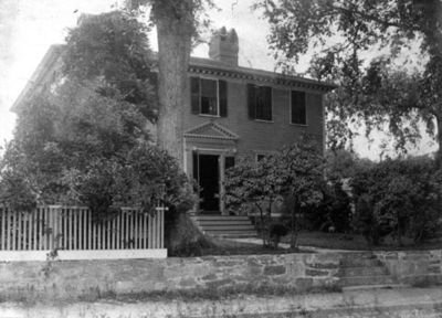
Stephen Allen House |
|
01978-09-20September 20, 1978 |
Sharp St.
41°38′40″N 71°41′30″W / 41.644444°N 71.691667°W / 41.644444; -71.691667 (Stephen Allen House) |
West Greenwich |
|
| 2 |
Anthony Village Historic District |
|
02010-09-20September 20, 2010 |
Washington St. between Battey Ave. and Hazard St. and various properties on 12 adjacent streets and the Pawtuxet River
41°41′39″N 71°33′13″W / 41.694167°N 71.553611°W / 41.694167; -71.553611 (Anthony Village Historic District) |
Coventry |
|
| 3 |
Apponaug Historic District |
|
01984-02-23February 23, 1984 |
3376, 3384, 3387, 3391, 3397-3399, and 3404 Post Rd.
41°38′18″N 71°27′04″W / 41.638333°N 71.451111°W / 41.638333; -71.451111 (Apponaug Historic District) |
Warwick |
|
| 4 |
Armory of the Kentish Guards |
|
01970-04-28April 28, 1970 |
Armory and Peirce Sts.
41°39′44″N 71°27′05″W / 41.662222°N 71.451389°W / 41.662222; -71.451389 (Armory of the Kentish Guards) |
East Greenwich |
|
| 5 |
John Waterman Arnold House |
|
01971-09-10September 10, 1971 |
11 Roger Williams Ave.
41°45′18″N 71°23′56″W / 41.755°N 71.398889°W / 41.755; -71.398889 (John Waterman Arnold House) |
Warwick |
|
| 6 |
Arkwright Bridge |
|
01978-12-12December 12, 1978 |
Crosses the Pawtuxet River at Hill St.
41°43′49″N 71°32′49″W / 41.730278°N 71.546944°W / 41.730278; -71.546944 (Arkwright Bridge) |
West Warwick |
Extends into Providence County |
| 7 |
Isaac Bowen House |
|
01980-06-27June 27, 1980 |
Northeast of Coventry on Maple Valley Rd.
41°43′09″N 71°41′53″W / 41.719167°N 71.698056°W / 41.719167; -71.698056 (Isaac Bowen House) |
Coventry |
|
| 8 |
Joseph Briggs House-Coventry Town Farm |
|
01987-06-18June 18, 1987 |
Town Farm Rd.
41°42′30″N 71°36′55″W / 41.708333°N 71.615278°W / 41.708333; -71.615278 (Joseph Briggs House-Coventry Town Farm) |
Coventry |
|
| 9 |
Richard Briggs Farm |
|
02003-06-06June 6, 2003 |
830 South Rd.
41°36′25″N 71°30′38″W / 41.606944°N 71.510556°W / 41.606944; -71.510556 (Richard Briggs Farm) |
East Greenwich |
|
| 10 |
Budlong Farm |
|
01983-08-18August 18, 1983 |
595 Buttonwoods Ave.
41°41′24″N 71°25′38″W / 41.69°N 71.427222°W / 41.69; -71.427222 (Budlong Farm) |
Warwick |
|
| 11 |
Buttonwoods Beach Historic District |
|
01984-02-23February 23, 1984 |
Roughly bounded by Brush Neck Cove, Greenwich Bay, Cooper and Promenade Aves.
41°41′09″N 71°24′49″W / 41.685833°N 71.413611°W / 41.685833; -71.413611 (Buttonwoods Beach Historic District) |
Warwick |
|
| 12 |
Carbuncle Hill Archaeological District, RI-1072-1079 |
|
01985-09-28September 28, 1985 |
Address Restricted
|
Coventry |
|
| 13 |
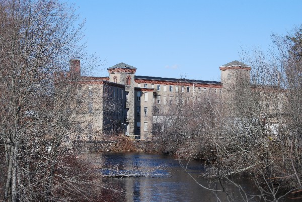
Centreville Mill |
|
02005-06-10June 10, 2005 |
3 Bridal Ave.
41°41′55″N 71°31′15″W / 41.698611°N 71.520833°W / 41.698611; -71.520833 (Centreville Mill) |
West Warwick |
|
| 14 |
Silas Clapp House |
|
01973-05-07May 7, 1973 |
E. Greenwich Ave.
41°40′25″N 71°30′49″W / 41.673611°N 71.513611°W / 41.673611; -71.513611 (Silas Clapp House) |
West Warwick |
|
| 15 |
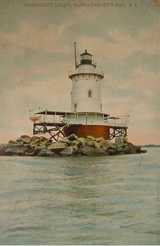
Conimicut Lighthouse |
|
01988-03-30March 30, 1988 |
East of Conimicut Pt. in the Providence River
41°43′01″N 71°20′45″W / 41.716944°N 71.345833°W / 41.716944; -71.345833 (Conimicut Lighthouse) |
Warwick |
|
| 16 |
Cowesett Pound |
|
01987-09-04September 4, 1987 |
Cowesett Rd.
41°41′08″N 71°27′44″W / 41.685556°N 71.462222°W / 41.685556; -71.462222 (Cowesett Pound) |
Warwick |
|
| 17 |
Crompton Free Library |
|
01978-11-20November 20, 1978 |
Main St.
41°41′06″N 71°31′27″W / 41.685°N 71.524167°W / 41.685; -71.524167 (Crompton Free Library) |
West Warwick |
|
| 18 |
Crompton Mill Historic District |
|
02006-07-14July 14, 2006 |
20 Remington St., 53 and 65 Manchester St.
41°41′10″N 71°31′31″W / 41.686111°N 71.525278°W / 41.686111; -71.525278 (Crompton Mill Historic District) |
West Warwick |
|
| 19 |
District Four School |
|
01997-04-14April 14, 1997 |
1515 W. Shore Rd.
41°42′24″N 71°23′03″W / 41.706667°N 71.384167°W / 41.706667; -71.384167 (District Four School) |
Warwick |
|
| 20 |
East Greenwich Historic District |
|
01974-06-13June 13, 1974 |
Roughly bounded by Kenyon Ave., Division, Peirce, and London Sts., Greenwich Cove and Dark Entry Brook
41°39′43″N 71°27′17″W / 41.661944°N 71.454722°W / 41.661944; -71.454722 (East Greenwich Historic District) |
East Greenwich and Warwick |
|
| 21 |
Elizabeth Spring |
|
01983-08-18August 18, 1983 |
Off Forge Rd.
41°38′51″N 71°27′25″W / 41.6475°N 71.456944°W / 41.6475; -71.456944 (Elizabeth Spring) |
Warwick |
|
| 22 |
Forge Farm |
|
01974-01-11January 11, 1974 |
40 Forge Rd.
41°38′19″N 71°27′06″W / 41.638611°N 71.451667°W / 41.638611; -71.451667 (Forge Farm) |
Warwick |
|
| 23 |
Forge Road Historic District |
|
01984-02-23February 23, 1984 |
Forge Rd. from Ives Rd. to the Potowomut River
41°38′18″N 71°27′04″W / 41.638333°N 71.451111°W / 41.638333; -71.451111 (Forge Road Historic District) |
Warwick |
|
| 24 |
Fry's Hamlet Historic District |
|
01985-12-20December 20, 1985 |
2068, 2153, 2196, and 2233 S. County Trail
41°38′21″N 71°29′58″W / 41.639167°N 71.499444°W / 41.639167; -71.499444 (Fry's Hamlet Historic District) |
East Greenwich |
|
| 25 |
Capt. Oliver Gardiner House |
|
01983-08-18August 18, 1983 |
4451 Post Rd.
41°40′10″N 71°26′57″W / 41.669444°N 71.449167°W / 41.669444; -71.449167 (Capt. Oliver Gardiner House) |
Warwick |
|
| 26 |
Gaspee Point |
|
01972-06-08June 8, 1972 |
Off Namquid Dr.
41°44′38″N 71°22′42″W / 41.743889°N 71.378333°W / 41.743889; -71.378333 (Gaspee Point) |
Warwick |
|
| 27 |
Caleb Gorton House |
|
01983-08-18August 18, 1983 |
987 Greenwich Ave.
41°42′30″N 71°27′53″W / 41.708333°N 71.464722°W / 41.708333; -71.464722 (Caleb Gorton House) |
Warwick |
|
| 28 |
Caleb Greene House |
|
01978-11-28November 28, 1978 |
15 Centerville Rd.
41°41′55″N 71°27′39″W / 41.698611°N 71.460833°W / 41.698611; -71.460833 (Caleb Greene House) |
Warwick |
|
| 29 |
Christopher Rhodes Greene House |
|
02007-08-30August 30, 2007 |
2 Potter Court
41°43′49″N 71°32′25″W / 41.730278°N 71.540278°W / 41.730278; -71.540278 (Christopher Rhodes Greene House) |
Coventry |
|
| 30 |
Gen. Nathanael Greene Homestead |
|
01971-10-07October 7, 1971 |
20 Taft St.
41°41′38″N 71°32′36″W / 41.693889°N 71.543333°W / 41.693889; -71.543333 (Gen. Nathanael Greene Homestead) |
Coventry |
|
| 31 |
Moses Greene House |
|
01983-08-18August 18, 1983 |
11 Economy Ave.
41°42′49″N 71°22′16″W / 41.713611°N 71.371111°W / 41.713611; -71.371111 (Moses Greene House) |
Warwick |
|
| 32 |
Peter Greene House |
|
01983-08-18August 18, 1983 |
1124 W. Shore Rd.
41°42′55″N 71°22′34″W / 41.715278°N 71.376111°W / 41.715278; -71.376111 (Peter Greene House) |
Warwick |
|
| 33 |
Richard Wickes Greene House |
|
01983-08-18August 18, 1983 |
27 Homestead Ave.
41°40′51″N 71°22′49″W / 41.680833°N 71.380278°W / 41.680833; -71.380278 (Richard Wickes Greene House) |
Warwick |
|
| 34 |
Greene-Bowen House |
|
01974-05-02May 2, 1974 |
698 Buttonwoods Ave.
41°41′26″N 71°25′19″W / 41.690556°N 71.421944°W / 41.690556; -71.421944 (Greene-Bowen House) |
Warwick |
|
| 35 |
Greene-Durfee House |
|
01983-08-18August 18, 1983 |
1272 W. Shore Rd.
41°42′46″N 71°22′48″W / 41.712778°N 71.38°W / 41.712778; -71.38 (Greene-Durfee House) |
Warwick |
|
| 36 |
Greenwich Cove Site |
|
01980-01-04January 4, 1980 |
Address Restricted
|
Warwick |
|
| 37 |
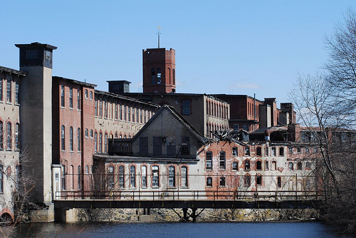
Greenwich Mills |
|
02006-12-20December 20, 2006 |
42 Ladd St.
41°40′01″N 71°26′52″W / 41.666944°N 71.447778°W / 41.666944; -71.447778 (Greenwich Mills) |
Warwick |
|
| 38 |
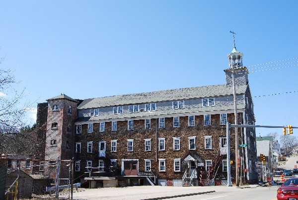
Harris Mill |
|
02007-07-27July 27, 2007 |
618 Main St.
41°43′29″N 71°32′11″W / 41.724817°N 71.536478°W / 41.724817; -71.536478 (Harris Mill) |
Coventry |
|
| 39 |
Hopelands |
|
01983-08-18August 18, 1983 |
Wampanoag Rd.
41°39′27″N 71°25′02″W / 41.6575°N 71.417222°W / 41.6575; -71.417222 (Hopelands) |
Warwick |
|
| 40 |
Hopkins Hollow Village |
|
02010-01-27January 27, 2010 |
Hopkins Hollow Rd., Narrow Ln., and Perry Hill Rd.
41°40′59″N 71°45′06″W / 41.682992°N 71.751686°W / 41.682992; -71.751686 (Hopkins Hollow Village) |
Coventry and West Greenwich |
|
| 41 |
Indian Oaks |
|
01983-08-18August 18, 1983 |
836 Warwick Neck Ave.
41°40′55″N 71°22′35″W / 41.681944°N 71.376389°W / 41.681944; -71.376389 (Indian Oaks) |
Warwick |
|
| 42 |
Interlaken Mill Bridge |
|
01978-12-22December 22, 1978 |
Spans the Pawtuxet River at Arkwright
41°43′41″N 71°32′39″W / 41.728056°N 71.544167°W / 41.728056; -71.544167 (Interlaken Mill Bridge) |
Coventry |
|
| 43 |
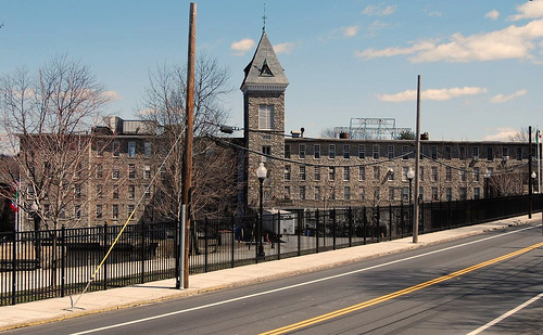
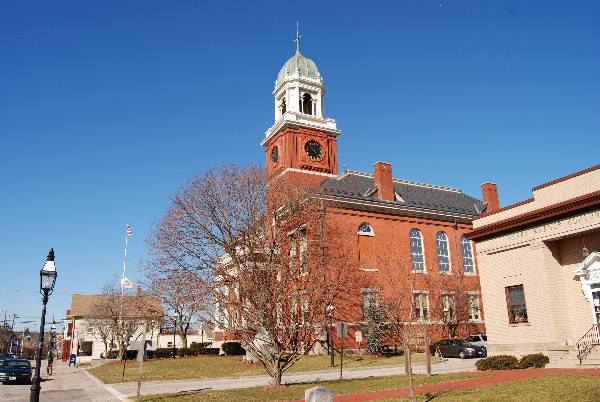
Kent County Courthouse |
|
01970-04-28April 28, 1970 |
127 Main St.
41°39′39″N 71°27′02″W / 41.660833°N 71.450556°W / 41.660833; -71.450556 (Kent County Courthouse) |
East Greenwich |
|
| 44 |
Knight Estate |
|
01984-02-23February 23, 1984 |
486 East Ave.
41°43′06″N 71°28′54″W / 41.718333°N 71.481667°W / 41.718333; -71.481667 (Knight Estate) |
Warwick |
|
| 45 |
Lambert Farm Site, RI-269 |
|
01983-11-03November 3, 1983 |
Address Restricted
|
Warwick |
|
| 46 |
Lippitt Mill |
|
01974-01-11January 11, 1974 |
825 Main St.
41°43′12″N 71°31′38″W / 41.72°N 71.527222°W / 41.72; -71.527222 (Lippitt Mill) |
West Warwick |
|
| 47 |
Massie Wireless Station |
|
02001-10-22October 22, 2001 |
1300 Frenchtown Rd.
41°37′33″N 71°30′45″W / 41.625833°N 71.5125°W / 41.625833; -71.5125 (Massie Wireless Station) |
East Greenwich |
|
| 48 |
Meadows Archeological District |
|
01983-11-03November 3, 1983 |
Address Restricted
|
Warwick |
|
| 49 |
Moosup River Site (RI-1153) |
|
01987-12-10December 10, 1987 |
Address Restricted
|
Coventry |
|
| 50 |
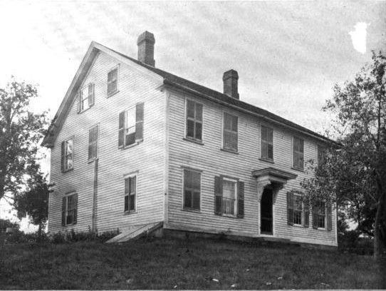
Paine House |
|
01974-05-01May 1, 1974 |
Station St.
41°41′29″N 71°33′54″W / 41.691389°N 71.565°W / 41.691389; -71.565 (Paine House) |
Coventry |
|
| 51 |
Pawtuxet Valley Dyeing Company |
|
02005-11-16November 16, 2005 |
9 Howard Ave.
41°43′25″N 71°32′17″W / 41.723611°N 71.538056°W / 41.723611; -71.538056 (Pawtuxet Valley Dyeing Company) |
Coventry |
|
| 52 |
Pawtuxet Village Historic District |
|
01973-04-24April 24, 1973 |
Bounded roughly by Bayside, S. Atlantic, and Ocean Aves., Pawtuxet and Providence rivers, and Post Rd.
41°45′49″N 71°23′27″W / 41.763611°N 71.390833°W / 41.763611; -71.390833 (Pawtuxet Village Historic District) |
Warwick |
|
| 53 |
Pontiac Mills |
|
01972-06-05June 5, 1972 |
Knight St.
41°43′35″N 71°28′13″W / 41.726389°N 71.470278°W / 41.726389; -71.470278 (Pontiac Mills) |
Warwick |
|
| 54 |
Read School |
|
02002-03-20March 20, 2002 |
1670 Flat River Rd.
41°42′20″N 71°35′50″W / 41.705556°N 71.597222°W / 41.705556; -71.597222 (Read School) |
Coventry |
|
| 55 |
Rhode Island State Airport Terminal |
|
01983-08-18August 18, 1983 |
572 Occupasstuxet Rd.
41°43′54″N 71°25′44″W / 41.731667°N 71.428889°W / 41.731667; -71.428889 (Rhode Island State Airport Terminal) |
Warwick |
|
| 56 |
Christopher Rhodes House |
|
01971-03-31March 31, 1971 |
25 Post Rd.
41°45′49″N 71°23′29″W / 41.763611°N 71.391389°W / 41.763611; -71.391389 (Christopher Rhodes House) |
Warwick |
|
| 57 |
Rice City Historic District |
|
01980-06-09June 9, 1980 |
West of Coventry Center at RI 14 and RI 117
41°42′37″N 71°45′52″W / 41.710278°N 71.764444°W / 41.710278; -71.764444 (Rice City Historic District) |
Coventry |
|
| 58 |
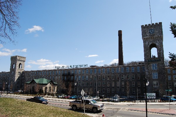
Royal Mill Complex |
|
02004-04-29April 29, 2004 |
125 Providence St.
41°42′49″N 71°31′00″W / 41.713714°N 71.516694°W / 41.713714; -71.516694 (Royal Mill Complex) |
West Warwick |
|
| 59 |
St. Mary's Church and Cemetery |
|
01978-11-21November 21, 1978 |
Church St.
41°41′12″N 71°31′08″W / 41.686667°N 71.518889°W / 41.686667; -71.518889 (St. Mary's Church and Cemetery) |
Crompton |
|
| 60 |
South Main Street Historic District |
|
01987-07-10July 10, 1987 |
Cady, S. Main, and Wood Sts.
41°41′17″N 71°34′03″W / 41.688056°N 71.5675°W / 41.688056; -71.5675 (South Main Street Historic District) |
Coventry |
|
| 61 |
Spencer–Shippee–Lillbridge House |
|
02011-04-20April 20, 2011 |
12 Middle Rd.
41°39′16″N 71°27′51″W / 41.654444°N 71.464167°W / 41.654444; -71.464167 (Spencer–Shippee–Lillbridge House) |
East Greenwich |
New listing; refnum 11000207 |
| 62 |
Tillinghast Mill Site |
|
01988-03-10March 10, 1988 |
Address Restricted
|
East Greenwich |
|
| 63 |
Tillinghast Road Historic District |
|
01988-03-09March 9, 1988 |
Tillinghast Rd.
41°37′03″N 71°30′39″W / 41.6175°N 71.510833°W / 41.6175; -71.510833 (Tillinghast Road Historic District) |
East Greenwich |
|
| 64 |
Trafalgar Site, RI-639 |
|
01983-11-03November 3, 1983 |
Address Restricted
|
Warwick |
|
| 65 |
Valley Queen Mill |
|
01984-01-19January 19, 1984 |
700 Providence St.
41°43′11″N 71°29′29″W / 41.719714°N 71.491469°W / 41.719714; -71.491469 (Valley Queen Mill) |
West Warwick |
|
| 66 |
Gen. James Mitchell Varnum House |
|
01971-08-12August 12, 1971 |
57 Peirce St.
41°39′49″N 71°27′06″W / 41.663611°N 71.451667°W / 41.663611; -71.451667 (Gen. James Mitchell Varnum House) |
East Greenwich |
|
| 67 |
Warwick Civic Center Historic District |
|
01980-06-27June 27, 1980 |
Post Rd.
41°41′57″N 71°27′31″W / 41.699167°N 71.458611°W / 41.699167; -71.458611 (Warwick Civic Center Historic District) |
Warwick |
|
| 68 |
Warwick Lighthouse |
|
01988-03-30March 30, 1988 |
1350 Warwick Neck Ave.
41°40′01″N 71°22′43″W / 41.666944°N 71.378611°W / 41.666944; -71.378611 (Warwick Lighthouse) |
Warwick |
|
| 69 |
Waterman Tavern |
|
01974-07-24July 24, 1974 |
Maple Valley Rd.
41°43′10″N 71°39′37″W / 41.719444°N 71.660278°W / 41.719444; -71.660278 (Waterman Tavern) |
Coventry |
|
| 70 |
John R. Waterman House |
|
01983-08-18August 18, 1983 |
100 Old Homestead Rd.
41°43′16″N 71°23′43″W / 41.721111°N 71.395278°W / 41.721111; -71.395278 (John R. Waterman House) |
Warwick |
|
| 71 |
William Waterman House |
|
01980-11-14November 14, 1980 |
RI 102
41°42′13″N 71°41′51″W / 41.703611°N 71.6975°W / 41.703611; -71.6975 (William Waterman House) |
Coventry |
|
| 72 |
Clement Weaver-Daniel Howland House |
|
01995-11-07November 7, 1995 |
125 Howland Rd.
41°39′32″N 71°28′40″W / 41.658889°N 71.477778°W / 41.658889; -71.477778 (Clement Weaver-Daniel Howland House) |
East Greenwich |
|
| 73 |
West Greenwich Baptist Church and Cemetery |
|
01978-11-28November 28, 1978 |
Plain Meeting House and Liberty Hill Rds.
41°38′16″N 71°45′10″W / 41.637778°N 71.752778°W / 41.637778; -71.752778 (West Greenwich Baptist Church and Cemetery) |
West Greenwich Center |
|
| 74 |
West Winds |
|
01993-05-20May 20, 1993 |
300 Wakefield St.
41°43′53″N 71°30′55″W / 41.731389°N 71.515278°W / 41.731389; -71.515278 (West Winds) |
West Warwick |
|
| 75 |
Col. Micah Whitmarsh House |
|
01971-02-18February 18, 1971 |
294 Main St.
41°39′34″N 71°27′01″W / 41.659444°N 71.450278°W / 41.659444; -71.450278 (Col. Micah Whitmarsh House) |
East Greenwich |
|
| 76 |
Oliver A. Wickes House |
|
01983-08-18August 18, 1983 |
794 Major Potter Rd.
41°40′25″N 71°28′30″W / 41.673611°N 71.475°W / 41.673611; -71.475 (Oliver A. Wickes House) |
Warwick |
|
| 77 |
Wilson-Winslow House |
|
01993-11-04November 4, 1993 |
2414 Harkney Hill Rd.
41°41′09″N 71°40′45″W / 41.685833°N 71.679167°W / 41.685833; -71.679167 (Wilson-Winslow House) |
Coventry |
|
| 78 |
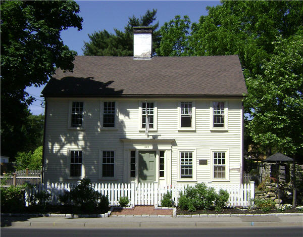
Windmill Cottage |
|
01973-05-22May 22, 1973 |
144 Division St.
41°39′49″N 71°27′23″W / 41.663611°N 71.456389°W / 41.663611; -71.456389 (Windmill Cottage) |
East Greenwich |
|
 Location of Kent County in Rhode Island