- National Register of Historic Places listings in Bedford County, Virginia
-
This list includes properties and districts listed on the National Register of Historic Places in Bedford County, Virginia. Click the "Map of all coordinates" link to the right to view a Google map of all properties and districts with latitude and longitude coordinates in the table below.[1]
-
- This National Park Service list is complete through NPS recent listings posted November 10, 2011.[2]
[3] Landmark name [4] Image Date listed Location City or town Summary 1 Bellevue December 19, 1990 VA 643, 1 mi. E of Goode
37°21′51″N 79°22′09″W / 37.364167°N 79.369167°WGoode 2 Bellevue Rural Historic District November 30, 2005 Bellevue Rd.
37°21′55″N 79°22′19″W / 37.365278°N 79.371944°WForest 3 Big Otter Mill October 30, 1998 VA 122
37°23′27″N 79°30′14″W / 37.390833°N 79.503889°WBedford 4 Brook Hill Farm June 6, 1997 0.75 mi. S of jct. of US 221 and VA 643
37°22′07″N 79°22′17″W / 37.368611°N 79.371389°WForest 5 Cifax Rural Historic District February 20, 1992 Jct. of VA 644 and VA 643 and surrounding valley area
37°25′02″N 79°24′32″W / 37.417222°N 79.408889°WCifax 6 Bowling Eldridge House August 12, 1993 1651 Fox Hill Rd.
37°28′22″N 79°11′55″W / 37.472742°N 79.198725°WLynchburg 7 Elk Hill April 2, 1973 NW of Forest on VA 663
37°24′25″N 79°20′57″W / 37.406944°N 79.349167°WForest 8 Fancy Farm January 7, 1972 On VA 43, N of jct. with VA 682
37°23′53″N 79°33′24″W / 37.398056°N 79.556667°WBedford 9 Hope Dawn October 9, 1974 NW of Lynchburg off VA 761
37°30′00″N 79°13′53″W / 37.5°N 79.231389°WLynchburg 10 Liberty Hall August 12, 2009 12000 E. Lynchburg Salem Turnpike
37°23′07″N 79°44′18″W / 37.385278°N 79.738333°WForest 11 Locust Level December 21, 1990 US 460 W of jct. with VA 695
37°23′07″N 79°44′18″W / 37.385278°N 79.738333°WMontvale 12 Mount Airy December 19, 1990 Jct. of VA 630 and VA 631
37°06′19″N 79°25′01″W / 37.105278°N 79.416944°WLeesville 13 New London Academy April 13, 1972 Near jct. of VA 297 and VA 211
37°18′27″N 79°18′20″W / 37.3075°N 79.305556°WForest 14 New Prospect Church March 31, 2000 4445 Sheep Creek Rd.
37°25′35″N 79°32′44″W / 37.426389°N 79.545556°WBedford 15 Old Rectory July 24, 1973 S of Perrowville on VA 663
37°24′09″N 79°20′15″W / 37.4025°N 79.3375°WPerrowville 16 Olive Branch Missionary Baptist Church May 4, 2007 5982 Joppa Mill Rd.
37°14′54″N 79°37′34″W / 37.248333°N 79.626111°WMoneta 17 Otterburn February 16, 2001 Big Island Rd.
37°22′05″N 79°29′50″W / 37.368056°N 79.497222°WBedford 18 Pleasant View November 15, 2006 5050 Bellevue Rd.
37°20′53″N 79°21′46″W / 37.348056°N 79.362778°WForest 19 Poplar Forest 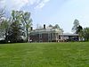
November 12, 1969 S of jct. of Rtes. 661 and 460
37°20′50″N 79°16′15″W / 37.347222°N 79.270833°WLynchburg 20 Rothsay October 30, 1992 US 221 N side, 2000 ft. E of jct. with VA 811
37°21′58″N 79°17′11″W / 37.366111°N 79.286389°WForest 21 Saint Stephen's Episcopal Church November 7, 1985 VA 663
37°22′40″N 79°18′30″W / 37.377778°N 79.308333°WForest 22 Thomas Methodist Episcopal Chapel August 11, 2004 VA 684, Penicks Mill Rd.
37°22′50″N 79°37′38″W / 37.380556°N 79.627222°WThaxton 23 Three Otters September 15, 1970 W of jct. of Rte. 838 and VA 43
37°21′22″N 79°32′46″W / 37.356111°N 79.546111°WBedford 24 Twin Oaks Farm July 5, 2001 VA 2
37°25′44″N 79°37′54″W / 37.428889°N 79.631667°WBedford County 25 Woodbourne July 2, 1973 NE of Forest off VA 609
37°22′15″N 79°16′37″W / 37.370833°N 79.276944°WForest See also
- National Register of Historic Places listings in Virginia
- National Register of Historic Places listings in Bedford, Virginia
- List of National Historic Landmarks in Virginia
References
- ^ The latitude and longitude information provided in this table was derived originally from the National Register Information System, which has been found to be fairly accurate for about 99% of listings. For about 1% of NRIS original coordinates, experience has shown that one or both coordinates are typos or otherwise extremely far off; some corrections may have been made. A more subtle problem causes many locations to be off by up to 150 yards, depending on location in the country: most NRIS coordinates were derived from tracing out latitude and longitudes off of USGS topographical quadrant maps created under the North American Datum of 1927, which differs from the current, highly accurate WGS84 GPS system used by Google maps. Chicago is about right, but NRIS longitudes in Washington are higher by about 4.5 seconds, and are lower by about 2.0 seconds in Maine. Latitudes differ by about 1.0 second in Florida. Some locations in this table may have been corrected to current GPS standards.
- ^ "National Register of Historic Places: Weekly List Actions". National Park Service, United States Department of the Interior. Retrieved on November 10, 2011.
- ^ Numbers represent an ordering by significant words. Various colorings, defined here, differentiate National Historic Landmark sites and National Register of Historic Places Districts from other NRHP buildings, structures, sites or objects.
- ^ "National Register Information System". National Register of Historic Places. National Park Service. . http://nrhp.focus.nps.gov/natreg/docs/All_Data.html.
U.S. National Register of Historic Places Topics Lists by states Alabama • Alaska • Arizona • Arkansas • California • Colorado • Connecticut • Delaware • Florida • Georgia • Hawaii • Idaho • Illinois • Indiana • Iowa • Kansas • Kentucky • Louisiana • Maine • Maryland • Massachusetts • Michigan • Minnesota • Mississippi • Missouri • Montana • Nebraska • Nevada • New Hampshire • New Jersey • New Mexico • New York • North Carolina • North Dakota • Ohio • Oklahoma • Oregon • Pennsylvania • Rhode Island • South Carolina • South Dakota • Tennessee • Texas • Utah • Vermont • Virginia • Washington • West Virginia • Wisconsin • WyomingLists by territories Lists by associated states Other Municipalities and communities of Bedford County, Virginia CDPs 
Unincorporated
communitiesCategories:- Bedford County, Virginia
- National Register of Historic Places in Virginia
- Virginia-related lists
-


Wikimedia Foundation. 2010.