- Narwee railway station
-
 Narwee
Airport & East Hills Line Station code NWE Suburb Narwee Street(s) Hannans Road Distance from Central Station 15.78 km Altitude (above sea level) 40m (asl) m Types of stopping trains Suburban all stops Number of platforms 2 Number of tracks 2 Platform arrangement 1 island Type of station Ground Ticket barriers No Transfers available None Disabled access 
No Station facilities Link Narwee is a railway station on the Airport and East Hills Line of the CityRail network. Located in the Sydney suburb of Narwee, it serves a residential area.
Contents
History
The station opened on 23 December 1931 with the opening of the single track portion of the East Hills railway line between Kingsgrove and Herne Bay (now Riverwood).[1] Initially, services were operated by steam trains or rail motors. The line line through Narwee was electrified in 1939 and duplicated in 1948.
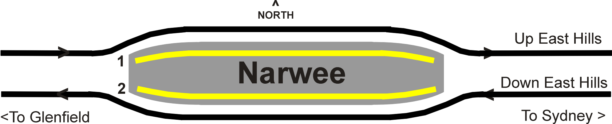
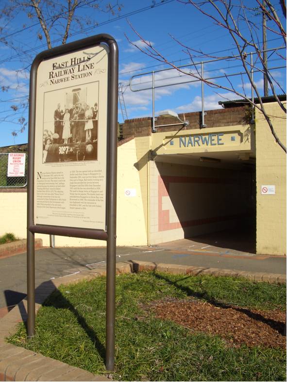
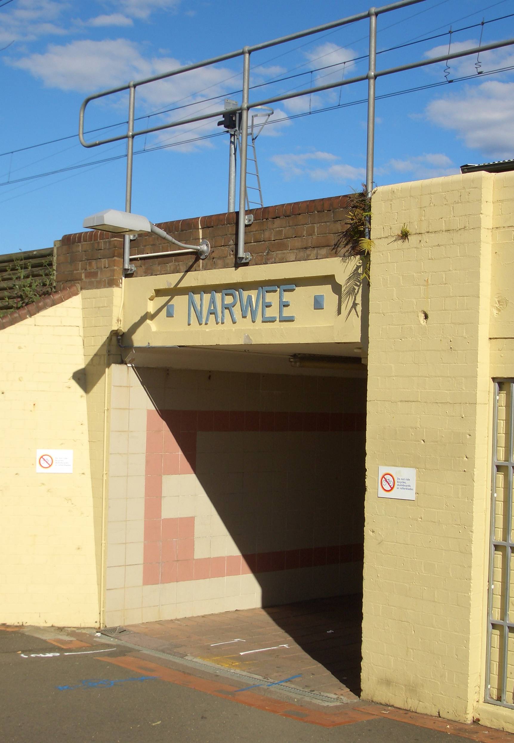
Like all original East Hills line stations, Narwee has an island platform. It has several features which are unique amongst the original East Hills line stations. Firstly, it is accessed by an underpass subway, which provides access from Hannans Road in the north and to Broadarrow Road in the south. Secondly, the platform has a substantial original brick station building set back from the entrance along the western end of the platform, which contains toilet facilities and a now-closed ticket office. The ticket office window was set into the side of the building rather than facing the direction of the entrance. In the late 1980s a newer brick station office building was constructed closer to the station entrance. In the early 1990s, a passenger shelter was constructed between these two buildings, along with a general station revamp which included a shelter over the subway entrance and new tiling in the passenger subway. In 2007, LCD passenger information monitors were installed. By 2010, it is proposed that four tracks will pass through Narwee as a result of quadruplication between Kingsgrove and Revesby as part of the Clearways Project.[2]
Platforms and services
 Diagram of track arrangement
Narwee is served by local all-stations services between the City Circle and the Revesby, the frequency of which is every 15 minutes during weekday daytimes, and half-hourly at nights and weekends/public holidays[3].
The station is served by two to four trains per hour each way, with additional trains during weekday peak hours.
Platform Line Stopping Pattern Notes 
Airport & East Hills Line All stations services to Central and the City Circle via the Airport 
Airport & East Hills Line All stations services to Revesby Transport links
Punchbowl Bus Company runs two routes via Narwee railway station:
- Route 940 - Between Hurstville station and Bankstown station
- Route 941 - Between Hurstville station and Bankstown station
NightRide runs one route via Narwee station:
- Route N20 - Between Riverwood station and Rockdale station
Gallery
-

entrance
-

Narwee railway station subway
-

Historical information at the entrance to the station
See also
Preceding station CityRail Following station Riverwoodtowards MacarthurAirport and East Hills Line towards CentralNotes and references
- ^ "East Hills Line". Nswrail.net. http://www.nswrail.net/lines/show.php?name=NSW:east_hills. Retrieved 3 January 2007.
- ^ "Kingsgrove-Revesby Quadruplication". Transport Intrastructure Development Corporation. http://www.tidc.nsw.gov.au/ViewSite.aspx?PageID=469. Retrieved 21 January 2007.
- ^ "CityRail Timetables". CityRail. http://www.cityrail.info/timetables/#landingPoint. Retrieved 22 April 2007.
Coordinates: 33°56′51″S 151°04′12″E / 33.947383°S 151.069946°E
Categories:- Railway stations in Sydney
- Railway stations opened in 1931


Wikimedia Foundation. 2010.