- Narwee railway station, Sydney
Cityrail Station alt|code=NWE|station_name=Narwee
servicearea=Airport_&_East_Hills_Line|servicearea_color=#East Hills line colour|servicearea_textcolor=white|suburb=Narwee|street=Hannans Rd|distance=15.78|altitude=40m (asl)|traintype=Suburban all stops|platforms=2|tracks=2|platform_arr=1 island|stationtype=Ground|gates=No|connect=None|disabled=No|facilities= [http://www.cityrail.info/facilities/facilities.jsp?n=199&giveOutput=true&facility= Link] |Narwee is a railway station on the Airport and East Hills Line of the
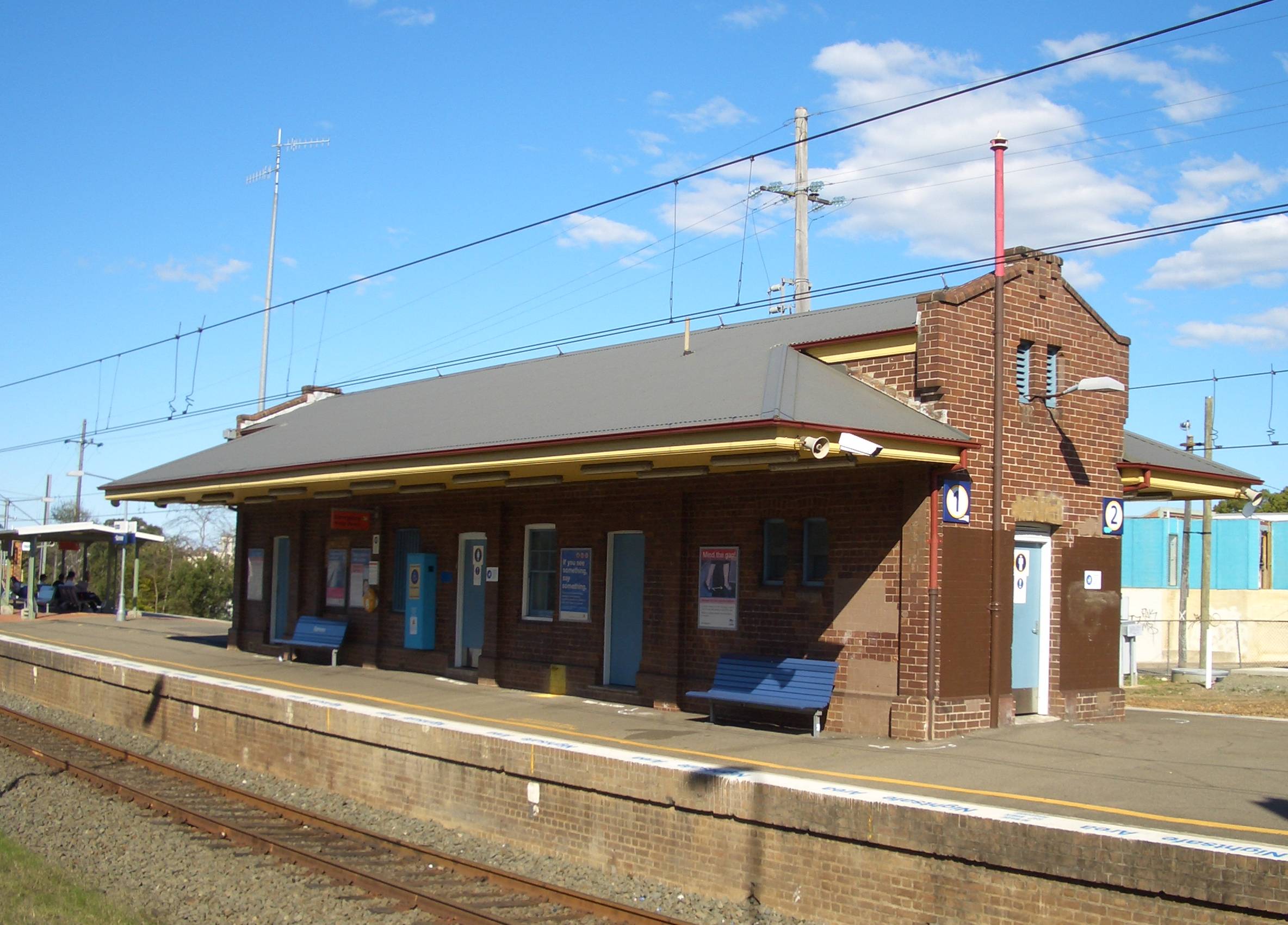
CityRail network. Located in theSydney suburb of Narwee, it serves a residential area. It opened on23 December ,1931 with the opening of the single track portion of the East Hills railway line between Kingsgrove and Hearne Baycite web|work=Nswrail.net| title=East Hills Line|url=http://www.nswrail.net/lines/show.php?name=NSW:east_hills| accessdate=3 January| accessyear=2007] (now Riverwood). Initially, services were operated by steam trains or rail motors. The line line through Narwee was electrified in 1939 and duplicated in 1948.Like all original East Hills line stations, Narwee has an island platform. It has several features which are unique amongst the original East Hills line stations. Firstly, it is accessed by an underpass subway, which provides access from Hannans Road in the north and to Broadarrow Road in the south. Secondly, the platform has a substantial original brick station building set back from the entrance along the western end of the platform, which contains toilet facilities and a now-closed ticket office. The ticket office window was set into the side of the building rather than facing the direction of the entrance. In the late 1980s a newer brick station office building was constructed closer to the station entrance. In the early 1990s, a passenger shelter was constructed between these two buildings, along with a general station revamp which included a shelter over the subway entrance and new tiling in the passenger subway. In 2007, LCD passenger information monitors were installed. By 2010, it is proposed that 4 tracks will pass through Narwee as a result of quadruplication between Kingsgrove and Revesby as part of the Clearways Projectcite web|work=Transport Intrastructure Development Corporation| title=Kingsgrove-Revsby Quadruplication|url=http://www.tidc.nsw.gov.au/ViewSite.aspx?PageID=469| accessdate=21 January| accessyear=2007] .
Platforms/Services
Narwee is served by local all-stations services between the City Circle and East Hills, the frequency of which is every 15 minutes during weekday daytimes, and half-hourly at nights and weekends/public holidayscite web| work=CityRail | title=CityRail Timetables | url=http://www.cityrail.info/timetable/index.jsp| accessdate=22 April | accessyear=2007] .
Platform 1:
*East Hills line colour>Airport & East Hills Line - all stations and limited stops services to Central and theCity Circle (anticlockwise).Platform 2:
*East Hills line colour>Airport & East Hills Line - all stations and limited stops services to East Hills, Glenfield, Campbelltown and Macarthur.Transport Links
Punchbowl Bus Company runs two routes via Narwee railway station:
*Route 940 - Between Hurstville station and Bankstown station.
*Route 941 - Between Hurstville station and Bankstown station.
NightRide runs one route via Narwee station:
*Route N20 - Between Riverwood station and Rockdale station.Gallery
ee also
*
*Railways in Sydney Notes and References
Wikimedia Foundation. 2010.