- Mueang Songkhla District
-
Mueang Songkhla
เมืองสงขลา— Amphoe — Amphoe location in Songkhla Province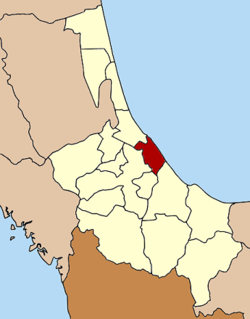
Coordinates: 7°12′25″N 100°35′47″E / 7.20694°N 100.59639°ECoordinates: 7°12′25″N 100°35′47″E / 7.20694°N 100.59639°E Country  Thailand
Province Songkhla Seat Tambon Muban Amphoe established Area – Total 171.9 km2 (66.4 sq mi) Population (2006) – Total 163,072 – Density 948.7/km2 (2,457.1/sq mi) Time zone THA (UTC+7) Postal code 90000 Geocode 9001 Mueang Songkhla (Thai: เมืองสงขลา) is the capital district (Amphoe Mueang) of Songkhla Province, southern Thailand.
Geography
 A Fishermen Village in Tambon Bo Yang
Neighboring districts are (from the south clockwise) Chana, Na Mom, Hat Yai and Singhanakhon of Songkhla Province. To the east is the Gulf of Thailand.
The northern part of the district is the Songkhla Lake.
History
The name Songkhla is actually the Thai corruption of Singgora, its original name means 'the city of lions' in Malay. This refers to a lion-shaped mountain near the city of Songkhla.
Administration
The district is subdivided into 6 subdistricts (tambon), which are further subdivided into 46 villages (muban). The city (thesaban nakhon) Songkhla covers the whole tambon Bo Yang. There are further 5 Tambon administrative organizations (TAO).
No. Name Thai name Villages Inh. 1. Bo Yang บ่อยาง - 74,875 2. Khao Rup Chang เขารูปช้าง 10 38,662 3. Ko Taeo เกาะแต้ว 9 10,608 4. Phawong พะวง 8 24,130 5. Thung Wang ทุ่งหวัง 10 10,343 6. Ko Yo เกาะยอ 9 4,454 Mueang Songkhla - Sathing Phra - Chana - Na Thawi - Thepha - Saba Yoi - Ranot - Krasae Sin - Rattaphum - Sadao - Hat Yai - Na Mom - Khuan Niang - Bang Klam - Singhanakhon - Khlong Hoi Khong
Categories:- Songkhla
- Amphoe of Songkhla
- Southern Thailand geography stubs


Wikimedia Foundation. 2010.