- Mueang Phichit District
-
Mueang Phichit
เมืองพิจิตร— Amphoe — Amphoe location in Phichit Province
Coordinates: 16°26′18″N 100°21′0″E / 16.43833°N 100.35°ECoordinates: 16°26′18″N 100°21′0″E / 16.43833°N 100.35°E Country  Thailand
Province Phichit Seat Nai Mueang Area – Total 738.9 km2 (285.3 sq mi) Population (2008) – Total 112,779 – Density 153.0/km2 (396.3/sq mi) Time zone THA (UTC+7) Postal code 66000 Geocode 6601 Mueang Phichit (Thai: เมืองพิจิตร) is the capital district (Amphoe Mueang) of Phichit Province, northern Thailand.
Contents
Geography
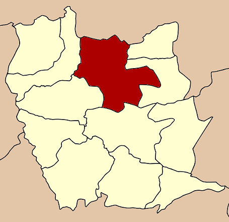
Neighboring districts are (from the east clockwise) Sak Lek, Wang Sai Phun, Taphan Hin, Pho Prathap Chang, Sam Ngam of Phichit Province and Bang Krathum of Phitsanulok Province.
History
1917 the district was renamed from Mueang to Tha Luang (ท่าหลวง).[1] 1938 it was renamed to Mueang Phichit.[2]
Administration
The district is subdivided into 16 subdistricts (tambon), which are further subdivided into 134 villages (muban). The town (thesaban mueang) Phichit covers the whole tambon Nai Mueang. There are three more subdistrict municipalities (thesaban tambon) - Tha Lo and Hua Dong each cover parts of the same-named tambon, and Wang Krot parts of tambon Ban Bung. There are further 15 Tambon administrative organizations (TAO).
No. Name Thai Villages Inh.[3] 1. Nai Mueang ในเมือง - 23,521 2. Phai Khwang ไผ่ขวาง 8 3,727 3. Yan Yao ย่านยาว 10 6,048 4. Tha Lo ท่าฬ่อ 7 5,582 5. Pak Thang ปากทาง 9 5,945 6. Khlong Khachen คลองคะเชนทร์ 10 8,480 7. Rong Chang โรงช้าง 7 5,800 8. Mueang Kao เมืองเก่า 9 5,876 9. Tha Luang ท่าหลวง 10 6,355 10. Ban Bung บ้านบุ่ง 7 7,462 11. Kha Mang ฆะมัง 12 6,368 12. Dong Pa Kham ดงป่าคำ 9 4,930 13. Hua Dong หัวดง 9 7,044 15. Pa Makhap ป่ามะคาบ 14 8,518 19. Sai Kham Ho สายคำโห้ 5 2,579 20. Dong Klang ดงกลาง 9 4,544 Missing numbers are tambon which now form Sak Lek district.
References
- ^ "ประกาศกระทรวงมหาดไทย เรื่อง เปลี่ยนชื่ออำเภอ" (in Thai). Royal Gazette 34 (0 ก): 40–68. 1917-04-29. http://www.ratchakitcha.soc.go.th/DATA/PDF/2460/A/40.PDF.
- ^ "พระราชกฤษฎีกาเปลี่ยนนามจังหวัด และอำเภอบางแห่ง พุทธศักราช ๒๔๘๑" (in Thai). Royal Gazette 55 (0 ก): 658–666. 1938-11-14. http://www.ratchakitcha.soc.go.th/DATA/PDF/2481/A/658.PDF.
- ^ "Population statistics 2008". Department of Provincial Administration. http://www.dopa.go.th/xstat/p5166_01.html.
External links
- amphoe.com (Thai)
Categories:- Amphoe of Phichit
- Northern Thailand geography stubs
Wikimedia Foundation. 2010.