- Mueang Phetchabun District
-
Mueang Phetchabun
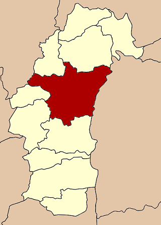
เมืองเพชรบูรณ์— Amphoe — Amphoe location in Phetchabun Province
Coordinates: 16°26′35″N 101°8′57″E / 16.44306°N 101.14917°ECoordinates: 16°26′35″N 101°8′57″E / 16.44306°N 101.14917°E Country  Thailand
Province Phetchabun Seat Tambon Muban Amphoe established Area - Total 2,281.0 km2 (880.7 sq mi) Population (2000) - Total 211,227 - Density 92.6/km2 (239.8/sq mi) Time zone THA (UTC+7) Postal code 67000 Geocode 6701 Mueang Phetchabun (Thai: เมืองเพชรบูรณ์) is the capital district (Amphoe Mueang) of Phetchabun Province, northern Thailand.
Contents
History
Mueang Phetchabun was an ancient frontier city, established in Sukhothai era. Prince Damrong Rajanubhab found the old forts on the both banks of the Pa Sak River, same landscaping as Mueang Phitsanulok. Inside the old city has a Wat Mahathat, the symbol of an important city.
During the thesaphiban administrative reform, the province Phetchabun was merged with Lom Sak, and became part of the Monthon Phetchabun in 1899. Monthon Phetchabun was included to be a part of Monthon Phitsanulok in 1904 and re-established in 1907. The monthon was again included to Phitsanulok in 1915.
Due to its strategic location, in 1943 (World War II period) Mueang Phetchabun was planned to become the new capital of Thailand, named Nakhonban Phetchabun (นครบาลเพชรบูรณ์). However this plan of Prime Minister Field Marshal Plaek Phibunsongkhram did not get approval of the parliament, thus it continued to be a district as before.
Geography
Neighboring districts are (from the sorth clockwise) Nong Phai, Chon Daen, Wang Pong of Phetchabun province, Noen Maprang of Phitsanulok Province, Khao Kho, Lom Sak of Phetchabun province again, Khon San and Nong Bua Daeng of Chaiyaphum Province.
The Tat Mok National Park(อุทยานแห่งชาติตาดหมอก) is located in the district.
The main water resource is the Pa Sak River.
Administration
The district is subdivided into 17 subdistricts (tambon). The town (thesaban mueang) Phetchabun covers the complete tambon Nai Mueang. There are two more townships (thesaban tambon) - Tha Phon and Wang Chomphu, both covering parts of the same-named tambon. There are further 16 Tambon administrative organizations (TAO).
1. Nai Mueang ในเมือง 2. Tabo ตะเบาะ 3. Ban Tok บ้านโตก 4. Sadiang สะเดียง 5. Pa Lao ป่าเลา 6. Na Ngua นางั่ว 7. Tha Phon ท่าพล 8. Dong Mun Lek ดงมูลเหล็ก 9. Ban Khok บ้านโคก 10. Chon Phrai ชอนไพร 11. Na Pa นาป่า 12. Na Yom นายม 13. Wang Chomphu วังชมภู 14. Nam Ron น้ำร้อน 15. Huai Sakae ห้วยสะแก 16. Huai Yai ห้วยใหญ่ 17. Rawing ระวิง See also
Mueang Phetchabun · Chon Daen · Lom Sak · Lom Kao · Wichian Buri · Si Thep · Nong Phai · Bueng Sam Phan · Nam Nao · Wang Pong · Khao Kho
Categories:- Amphoe of Phetchabun
- Northern Thailand geography stubs
Wikimedia Foundation. 2010.