- Marchand, Louisiana
-
Marchand, Louisiana is a small unincorporated community in the state of Louisiana and within Ascension Parish. It is located on State Highway 75 that runs north and south on the east bank of the Mississippi River. Intersecting Bowden and Whitney Roads are located near the center of the community. The area is composed mainly of farm and ranch lands located between major petrochemical plants. It obtained its name because the community is located on land that once was part of the Jean Baptiste Marchand plantation.
References
Google, Inc. title = Marchand, LA, USA Google Maps – Marchand, Louisiana (Map). Cartography by Google, Inc. http://maps.google.co.uk/maps?f=q&source=s_q&hl=en&geocode=&q=Marchand,+LA,+USA&sll=53.800651,-4.064941&sspn=15.268214,53.569336&ie=UTF8&hq=&hnear=Marchand,+Ascension,+Louisiana,+United+States&z=15 title = Marchand, LA, USA. Retrieved 2008-03-01.
Coordinates: 30°8′57.7″N 90°59′39.3″W / 30.149361°N 90.99425°W
Municipalities and communities of Ascension Parish, Louisiana Cities 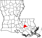
Town Unincorporated
communitiesAben | Acy | Barmen | Barton | Belle Helene | Bowden | Brittany | Bruly McCall | Bullion | Burnside | Claybank | Cofield | Cornerview | Darrow | Duckroost | Duplessis | Dutchtown | Galvez | Geismar | Hillaryville | Hobart | Hohen Solms | Hope Villa | Lake | Lemannville | Little Prairie | Marchand | McCall | McElroy | Modeste | Mount Houmas | Noel | Oak Grove | Palo Alto | Philadelphia Point | Prairieville | St. Amant | St. Elmo | Smoke Bend | Southwood | Weber City
Categories:- Unincorporated communities in Louisiana
- Populated places in Ascension Parish, Louisiana

Wikimedia Foundation. 2010.