- Dutchtown, Louisiana
-
Dutchtown Unincorporated community Country United States State Louisiana Parish Ascension Elevation 13 ft (4 m) Coordinates 30°15′16″N 90°59′19″W / 30.25444°N 90.98861°W Timezone CST (UTC-6) - summer (DST) CDT (UTC-5) Area code 225 
 Location of Dutchtown in Louisiana
 Location of Louisiana in the United States
Dutchtown, Louisiana is an unincorporated area of Ascension Parish, Louisiana.
Municipalities and communities of Ascension Parish, Louisiana Parish seat: Donaldsonville Cities 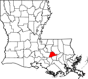
Town Unincorporated
communitiesAben | Acy | Barmen | Barton | Belle Helene | Bowden | Brittany | Bruly McCall | Bullion | Burnside | Claybank | Cofield | Cornerview | Darrow | Duckroost | Duplessis | Dutchtown | Galvez | Geismar | Hillaryville | Hobart | Hohen Solms | Hope Villa | Lake | Lemannville | Little Prairie | Marchand | McCall | McElroy | Modeste | Mount Houmas | Noel | Oak Grove | Palo Alto | Philadelphia Point | Prairieville | St. Amant | St. Elmo | Smoke Bend | Southwood | Weber City
Categories:- Populated places in Ascension Parish, Louisiana
- Baton Rouge metropolitan area
- Unincorporated communities in Louisiana
- Louisiana geography stubs


Wikimedia Foundation. 2010.