- Carlisle, Ohio
Infobox Settlement
official_name = Carlisle, Ohio
settlement_type =City
nickname =
motto =
imagesize = 250px
image_caption = Aerial view of Carlisle
image_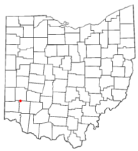
mapsize = 250px
map_caption = Location of Carlisle, Ohio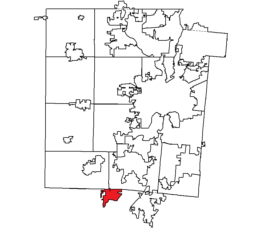
mapsize1 = 250px
map_caption1 = Location withinMontgomery County, Ohio subdivision_type = Country
subdivision_name =United States
subdivision_type1 = State
subdivision_name1 =Ohio
subdivision_type2 = Counties
subdivision_name2 = Warren, Montgomerygovernment_footnotes =
government_type =
leader_title =
leader_name =
leader_title1 =
leader_name1 =
established_title =
established_date =unit_pref = Imperial
area_footnotes =
area_magnitude =
area_total_km2 = 9.2
area_land_km2 = 8.8
area_water_km2 = 0.4
area_total_sq_mi = 3.6
area_land_sq_mi = 3.4
area_water_sq_mi = 0.2population_as_of = 2000
population_footnotes =
population_total = 5121
population_density_km2 = 581.0
population_density_sq_mi = 1504.7timezone = Eastern (EST)
utc_offset = -5
timezone_DST = EDT
utc_offset_DST = -4
elevation_footnotes = GR|3
elevation_m = 213
elevation_ft = 699
latd = 39 |latm = 34 |lats = 47 |latNS = N
longd = 84 |longm = 19 |longs = 9 |longEW = Wpostal_code_type =
ZIP code
postal_code = 45005
area_code = 937
blank_name = FIPS code
blank_info = 39-12168GR|2
blank1_name = GNIS feature ID
blank1_info = 1056767GR|3
website =
footnotes =Carlisle is a small city located in the southwestern part of the
U.S. state ofOhio in northwestern Warren and southern Montgomery counties. As of the 2000 census, the city's population was 5,121, up from 4,872 in 1990. It is inFranklin Township, Warren County, Ohio andGerman Township, Montgomery County, Ohio .The Warren County portion of Carlisle is part of the Cincinnati–Middletown, OH-KY-IN Metropolitan Statistical Area, while the Montgomery County portion is part of the Dayton, OH Metropolitan Statistical Area.
Geography
Carlisle is located at coor dms|39|34|47|N|84|19|9|W|city (39.579836, -84.319288)GR|1.
According to the
United States Census Bureau , the city has a total area of 3.6square mile s (9.2km² ), of which, 3.4 square miles (8.8 km²) of it is land and 0.2 square miles (0.4 km²) of it (4.49%) is water.Demographics
As of the
census GR|2 of 2000, there were 5,121 people, 1,849 households, and 1,475 families residing in the village. Thepopulation density was 1,504.7 people per square mile (581.5/km²). There were 1,937 housing units at an average density of 569.2/sq mi (220.0/km²). The racial makeup of the village was 98.38% White, 0.23% African American, 0.18% Native American, 0.29% Asian, 0.06% Pacific Islander, 0.14% from other races, and 0.72% from two or more races. Hispanic or Latino of any race were 0.57% of the population.There were 1,849 households out of which 36.9% had children under the age of 18 living with them, 66.9% were married couples living together, 8.9% had a female householder with no husband present, and 20.2% were non-families. 16.4% of all households were made up of individuals and 5.3% had someone living alone who was 65 years of age or older. The average household size was 2.74 and the average family size was 3.07.
In the village the population was spread out with 26.5% under the age of 18, 8.2% from 18 to 24, 31.1% from 25 to 44, 24.9% from 45 to 64, and 9.3% who were 65 years of age or older. The median age was 36 years. For every 100 females there were 102.2 males. For every 100 females age 18 and over, there were 100.5 males.
The median income for a household in the village was $45,446, and the median income for a family was $50,599. Males had a median income of $36,544 versus $26,300 for females. The
per capita income for the village was $19,358. About 6.4% of families and 8.4% of the population were below thepoverty line , including 10.4% of those under age 18 and 8.4% of those age 65 or over.The city is in the Carlisle Local school district. Telephone service is provided through the Franklin and Germantown exchanges.
References
Further reading
*Elva R. Adams. "Warren County Revisited". [Lebanon, Ohio] : Warren County Historical Society, 1989.
*"The Centennial Atlas of Warren County, Ohio". Lebanon, Ohio: The Centennial Atlas Association, 1903.
*Mabel Eldridge and Dudley Bryant. "Franklin in the Great Miami Valley". Edited by Harriet E. Foley. Franklin, Ohio: Franklin Area Historical Society, 1982.
*Harriet E. Foley, editor. "Carlisle: The Jersey Settlement in Ohio, 1800-1990". 2nd ed. [Carlisle, Ohio?] : The Editor, 1990.
*Josiah Morrow. "The History of Warren County, Ohio". Chicago: W.H. Beers, 1883. (Reprinted several times)
*"Ohio Atlas & Gazetteer". 6th ed.Yarmouth, Maine : DeLorme, 2001. ISBN 0-89933-281-1
*William E. Smith. "History of Southwestern Ohio: The Miami Valleys". New York: Lewis Historical Publishing, 1964. 3 vols.
*Warren County Engineer's Office. "Official Highway Map 2003". Lebanon, Ohio: The Office, 2003.External links
* [http://www.carlisleoh.org City website]
* [http://www.carlisle-local.k12.oh.us/ Carlisle Local School District]
Wikimedia Foundation. 2010.