- Magarao, Camarines Sur
-
Magarao — Municipality — Map of Camarines Sur showing the location of Magarao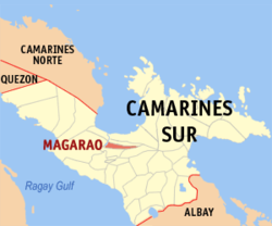 Location in the Philippines
 Magarao
Coordinates: 13°40′N 123°11′E / 13.667°N 123.183°ECoordinates: 13°40′N 123°11′E / 13.667°N 123.183°E Country Philippines Region Bicol Region (Region V) Province Camarines Sur District 2nd district(Central Bay) Founded 1570 Barangays 15 Government – Mayor Area – Total 39.01 km2 (15.1 sq mi) Population (2007) – Total 22,515 – Density 577.2/km2 (1,494.8/sq mi) Time zone PST (UTC+8) ZIP code Income class 4th class municipality; partially urban Magarao is a 4th class municipality in the province of Camarines Sur, Philippines. According to the 2007 census, it has a population of 22,515 people.
Contents
History
Magarao derived its name from a species of thorny wild bush called "garao-garao" which abundantly grows in the area. This type of plant no longer exists today as it was believed that the inhabitants of Magarao hindered its growth and propagation because of its thorny appearance.
It was a group of Franciscan missionaries who founded the town in 1570 although missionary work continued only in the year 1690.
Barangays
Magarao is politically subdivided into 15 barangays.
- Barobaybay
- Bell (Pob.)
- Carangcang
- Carigsa
- Casuray
- Montserrat (Pob.)
- Ponong
- San Francisco (Pob.)
- San Isidro (Pob.)
- San Juan (Pob.)
- San Miguel
- San Pantaleon (Pob.)
- Santa Lucia (Pob.)
- Santa Rosa
- Santo Tomas (Pob.)
Socio-Economic Profile
At present, Magarao belongs to the fifth class municipality although there are improvements being made by the local government to hasten its developmental stage. The town, through the initiative of its local officials, allows its constituents to engage into worthwhile activities by providing for them training and seminar workshops on various livelihood projects like ceramics training, papermaking, handicrafts and other community-based industries.
This was made possible due to the combined efforts made by the local government of Magarao and the provincial government of Camarines Sur through the Provincial Livelihood Training, Research and Development Program. PLTRD is geared towards providing community-based industries, identifying projects for product development and skills training and also conducting seminar and workshops for the various livelihood projects.
The residents of Magarao has immersed themselves in opportunities which would not just serve benefits for them but would obviously boost their town's economic condition.
casuray, one barangay in Magarao, though unknown to many, is the place where a rare variety of luscious watermelon thrives abundantly. Farmers, at present, are planning out projects out of this water-melon industry.
Dialects
Bicol dialect: generally used; Tagalog, Hiligaynon (Bisaya) and Ilocano are used by a few.
Religion
Mainly Roman Catholic.
Transportation Facilities
Coastal barangays are served by bancas that ply from the wharf near Naga City to the barangays of Ponong, Barobaybay and Carigsa along the Bicol River and in the estuarine areas.
Power and Electricity
Power and electricity is supplied by the Camarines Sur Electric Cooperative (CASURECO).
External links
- Philippine Standard Geographic Code
- 2000 Philippine Census Information
- 2007 Philippine Census Information
- Official Site of the Province of Camarines Sur
Municipalities Component city - Iriga
Independent component city (Administratively independent from the province, but grouped under Camarines Sur by the National Statistics Office)Categories:- Municipalities of Camarines Sur


Wikimedia Foundation. 2010.