- Tigaon, Camarines Sur
-
Tigaon — Municipality — Map of Camarines Sur showing the location of Tigaon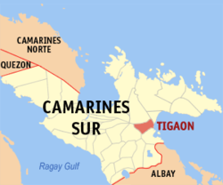 Location in the Philippines
 Tigaon
Coordinates: 13°38′N 123°30′E / 13.633°N 123.5°ECoordinates: 13°38′N 123°30′E / 13.633°N 123.5°E Country Philippines Region Bicol Region (Region V) Province Camarines Sur District 3rd district(Partido) Founded Barangays 23 Government – Mayor Arnulfo Bryan B. Fuentebella (NPC) Area – Total 91.02 km2 (35.1 sq mi) Population (2007) – Total 45,509 – Density 500/km2 (1,295/sq mi) Time zone PST (UTC+8) ZIP code Income class 3rd class municipality; partially urban Tigaon is a 3rd class municipality in the province of Camarines Sur, Philippines. According to the 2007 census, it has a population of 45,509 people. It is located between Mt. Isarog and the Lagonoy Gulf. The economy is based on agricultural products like rice, corn, sugar cane, abaca fiber, fishery and piggery. Tigaon is also known for its cottage industry, especially high quality ships-in-bottles. The main tourist attractions are the Mt. Isarog Jungle Park at Barangay Concocep and several beach resorts.
Contents
History
In the early years of 19th century, Camarines Sur was divided into four districts by the Spaniards. This division include the districts of Bikol, Rinconanda, Yraya and Mambulao. The mission of Tigaon in the part of Mount Isarog belonged to the Bikol district. The history of this town, according to written accounts, was considered to be confusing as there are conflicting records with regards to its establishment as a municipality.
Although, in 1794, Tigaon gained her independence and was appointed a parish priest in the person of Fray Jose de Buensalida. Fray de Buensalida brought into existence the recognition of St. Claire of Assisi as the town's patroness, marking August 12 as her feastday.
Prominent families controlled the vast haciendas in Tigaon. The mestizo clans of the Garchitorena and the Estela owned these haciendas.
Notable residents
Prominent people came from this town. Don Andres Garchitorena, Governor and one of Aguinaldo's general; Don Mariano Garchitorena, Governor and Secretary of Agriculture and Commerce; Justice Francis E. Garchitorena, SandiganBayan Justice; Jomari Yllana and Anjo Yllana, actors. Marcos' appointed Ambassador to the Court of Saint James, England, Jose Manuel Estela Stilianopoulos was also born in this town.
Barangays
Tigaon is politically subdivided into 23 barangays.
- Abo
- Cabalinadan
- Caraycayon
- Casuna
- Consocep
- Coyaoyao
- Gaao
- Gingaroy
- Gubat
- Huyonhuyon
- Libod
- Mabalodbalod
- May-Anao
- Panagan
- Poblacion
- Salvacion
- San Antonio
- San Francisco
- San Miguel
- San Rafael
- Talojongon
- Tinawagan
- Vinagre
Socio-Economic Profile
Dialect
- Partido dialect
Religion
- There are 8 dominant religious groups in the locality, namely: - Roman Catholic - Members of Church of God International (Ang Dating Daan) - Seventh Day Adventist - The Church of Jesus Christ of Latter Day Saints - Jehovah's Witnesses - Jesus Miracle Crusade - Iglesia Ni Cristo - United Church of Christ in the Philippines- Jesus the Loving shephered Church and a group of Born-Again Christian.
Housing
- Has an existing Rural BLISS I in Caraycayon with an area of 2.5 hectares and DAR Settlement Project in San Rafael
- There are on-going and proposed socialized housing projects
Education
- One college, Santa Clara College (formerly Santa Clara Academy), supervised by the Dominican Sisters.
- Five 5 secondary schools (1 private, 4 public)
Trade and Commerce
- Commercial establishments include the ff:
- - 2 banks are presently operating - 6 pawnshops - 6 hardware stores - a number of self service supermarkets - 5 drug stores - food chains and restaurants - pension house A Central Business District will soon to rise catering to a warehouse, food chain and an open market.
- Presence of a state-of-the-art slaughterhouse
- Presence of Information Technology Centers
Agricultural Sector
- Agricultural with abundant supply of palay, corn,root crops, sugarcane, coconut, citrus, vegetables, fish and other marine products,livestock and poultry products are also available
Tourism
- Tourist destinations include the following: - Consocep Mountain Resort - Beach resorts in Brgys. Casuna, Ranso - Falls: Kawa-kawa, Tumaguiti and Bulalakaw falls - Other proposed projects including construction of tourist inns, natural swimming pools and rest houses
Transportation Facilities
- Mode of transportation is mainly by land
- 71.456 kilometers of road classified as National, Provincial, Municipal and Barangay roads
- Presence of a bus terminal where air- conditioned as well as ordinary buses have regular trips to Manila and other provincial key cities and other light air-conditioned vehicles available for hire
Water Supply
- Has an existing Water District which is now under the Partido Development Authority (PDA)
- Several spring development project and free flowing wells
Power and Electricity
- CASURECO IV with its main office in Tigaon supplies power requirement in all Partido towns
Communication Facilities
Facilities include the following:
- Long distance and domestic calls
- Fax machines, Internet and VHF radios
- Local cable TV services
- Key-host of SMART and GLOBE Communications, Inc
- Emergence of computer shops
- Internet
External links
- Philippine Standard Geographic Code
- Philippine Census Information
- 2007 Philippine Census Information
- Official Site of the Province of Camarines Sur
Municipalities Baao • Balatan • Bato • Bombon • Buhi • Bula • Cabusao • Calabanga • Camaligan • Canaman • Caramoan • Del Gallego • Gainza • Garchitorena • Goa • Lagonoy • Libmanan • Lupi • Magarao • Milaor • Minalabac • Nabua • Ocampo • Pamplona • Pasacao • Pili • Presentacion • Ragay • Sagñay • San Fernando • San Jose • Sipocot • Siruma • Tigaon • TinambacComponent city IrigaIndependent component city (Administratively independent from the province, but grouped under Camarines Sur by the National Statistics Office)Categories:- Municipalities of Camarines Sur


Wikimedia Foundation. 2010.