- Arucas, Las Palmas
-
Arucas — Municipality — 

Coordinates: 28°07′00″N 15°31′00″E / 28.11667°N 15.51667°ECoordinates: 28°07′00″N 15°31′00″E / 28.11667°N 15.51667°E Autonomous region Canary Islands Province Las Palmas Island Gran Canaria Area - Total 33.01 km2 (12.7 sq mi) some sources list 33.39 km² Elevation 240 m (787 ft) Population (2004) - Total 33,701 - Density 1,020.9/km2 (2,644.2/sq mi) Postal code Municipal code E-35006 Arucas is a Canary Islands municipality in the province of Las Palmas. It is situated in the north of Gran Canaria. Arucas is a suburb of Las Palmas city.
Arucas's area is 33.01 km² with a population of about 33,701 (ISTAC, 2003) and its density is 1,009.31/km² making the second most populated municipality in the island.
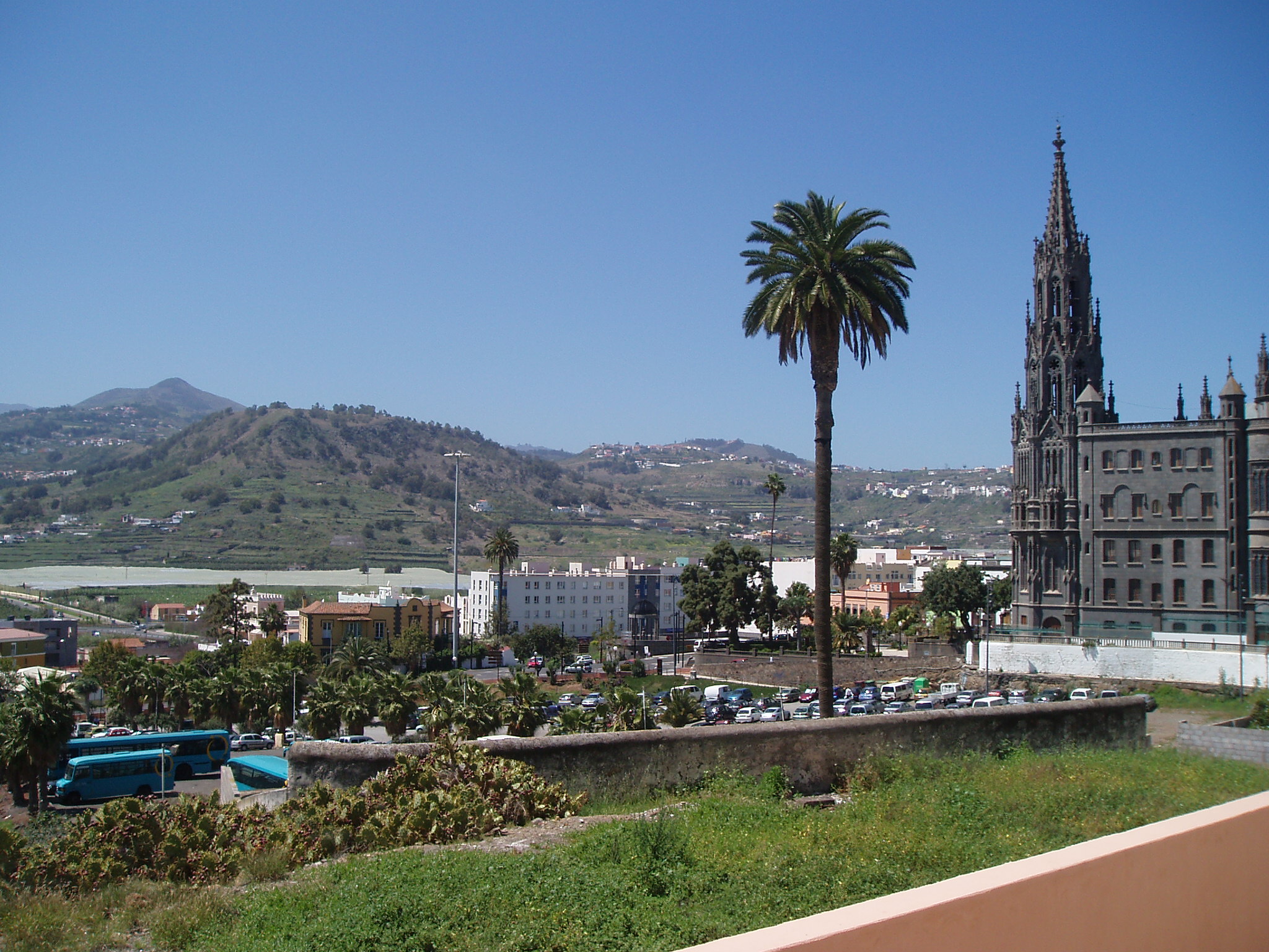
Arucas is situated in the mountains and the valleys, the farmlands cover parts of Arucas, the mountains cover the southern part and the valleys in the northern part. Farmlands are within the coastline, the Atlantic Ocean lies to the north. Arucas is located W of Las Palmas de Gran Canaria and serves an interchange with the GC2, N of the GC30, E of Gáldar and NW of Telde. The main industry are agriculture, businesses and tourism.
Contents
Geography
- Location:
- Latitude: 29.11667 (29°7") N
- Longitude: 15.51667 (15°31') W
- Altitude:
- Lowest: Atlantic Ocean
- Centre: 240 m
- Highest: southern part
- Name of inhabitants: Aruquenses
- Postal code: -
Historical populations Year Pop. ±% 1991 26,974 — 1996 29,179 +8.2% 2001 32,466 +11.3% 2002 32,917 +1.4% 2003 33,449 +1.6% 2004 33,701 +0.8% Sites of interest
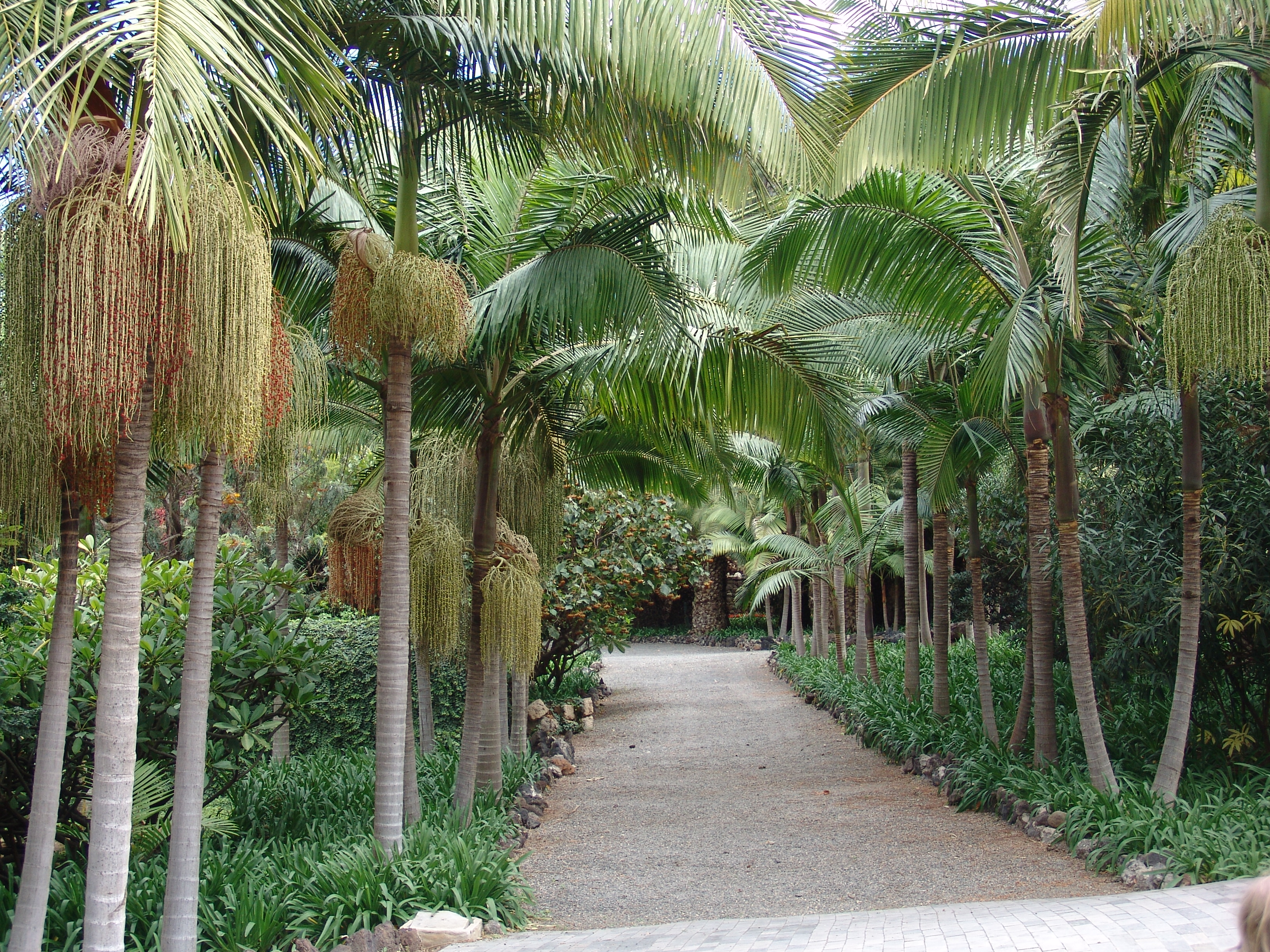
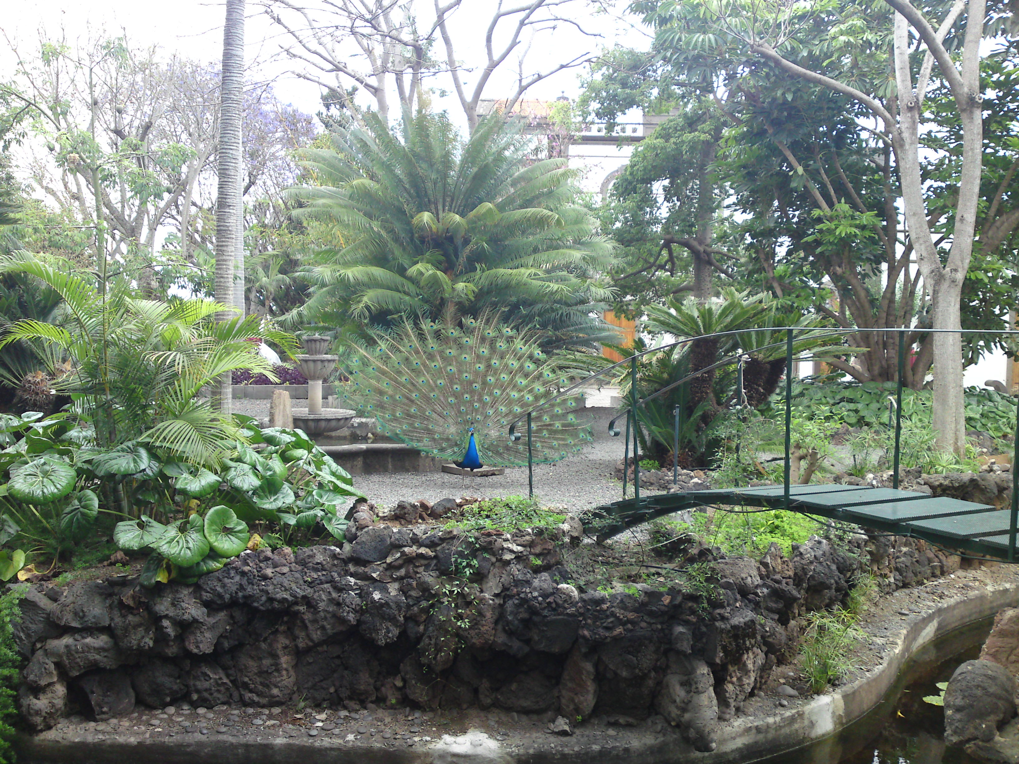
 The Botanical Garden in Arucas.
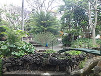 Known as the "Jardín de la Marquesa de Arucas", the Botanical Garden features more than 500 plant species.[1]
The Church of San Juan Bautista the leading architectural and social monument in the municipality. It was built entirely in Arucas stone by local master masons, and it dates from 1909. Apart from the wealth of the carved stone columns and column heads, there are also some beautiful stained glass windows, the works of Canary Island painter Cristobal Hernandez de Quintana, and an extraordinary carving of the Reclining Christ, by Manuel Ramos.[2] To the north is the Montaña de Arucas which is thought to be the area where courageous Doramas the Guanche leader was killed in 1481 by Pedro de Vera in the Battle of Arucas. Arucus is known for the production of rum.[3]
History and Information
Arucas was rebuilt in 1480 after being completely destroyed in 1478. Since the 15th century, the main crop of the Arucas area was sugar cane. Rum was produced here long before sugar plantations were cultivated in Cuba. One of the main features of modern-day Arucas is its rum factory.[4] Arucas boomed with the demand for cochinilla (a beatle feeding off cactus pear, crushed to produce red dye) in the second half of the 19th century.
Other
Arucas has schools, lyceums, gymnasia, churches: the famous Arucas cathedral, a post office and squares (plazas). There is also a Botanical Garden, the Jardín de la Marquesa de Arucas.
- Church of San Juan Bautista (also vulgarly known as Catedral de Arucas due to its big size) built entirely in Arucas stone by local master masons, and it dates from 1909 (Initial Configuration from the XVII century). Apart from the wealth of the carved stone columns and column heads, there are also some beautiful stained glass windows, the works of Canary Island painter Cristobal Hernandez de Quintana, and an extraordinary carving of the Reclining Christ, by Manuel Ramos.[2]
- Jardín de la Marquesa de Arucas - Botanical Garden in Arucas.
See also
- Grand Canary
- List of municipalities in Las Palmas
References
External links
- English version of Arucas tourism site
- Map and aerial photos
- Street map: Street map from Mapquest, MapPoint, Google or Yahoo! Maps
- Satellite images: Google or Microsoft Virtual Earth - image now available

Moya Atlantic Ocean Firgas 
Las Palmas de Gran Canaria  Arucas

Teror Municipalities of Gran Canaria Agaete • Agüimes • Artenara • Arucas • Firgas • Gáldar • Ingenio • Mogán • Moya • Las Palmas de Gran Canaria • San Bartolomé de Tirajana • San Nicolás de Tolentino • Sta. Brígida • Sta. Lucía de Tirajana • Sta. María de Guía • Tejeda • Telde • Valleseco • Valsequillo • Vega de San Mateo Categories:
- Municipalities in Las Palmas
- Canary Islands
- Populated places established in the 1480s
- 1481 establishments
- Location:
Wikimedia Foundation. 2010.