Arrow Canyon Range

Arrow Canyon Range

Geobox|Range
name = Arrow Canyon Range
native_name =
other_name =
category = Mountain Range
etymology =


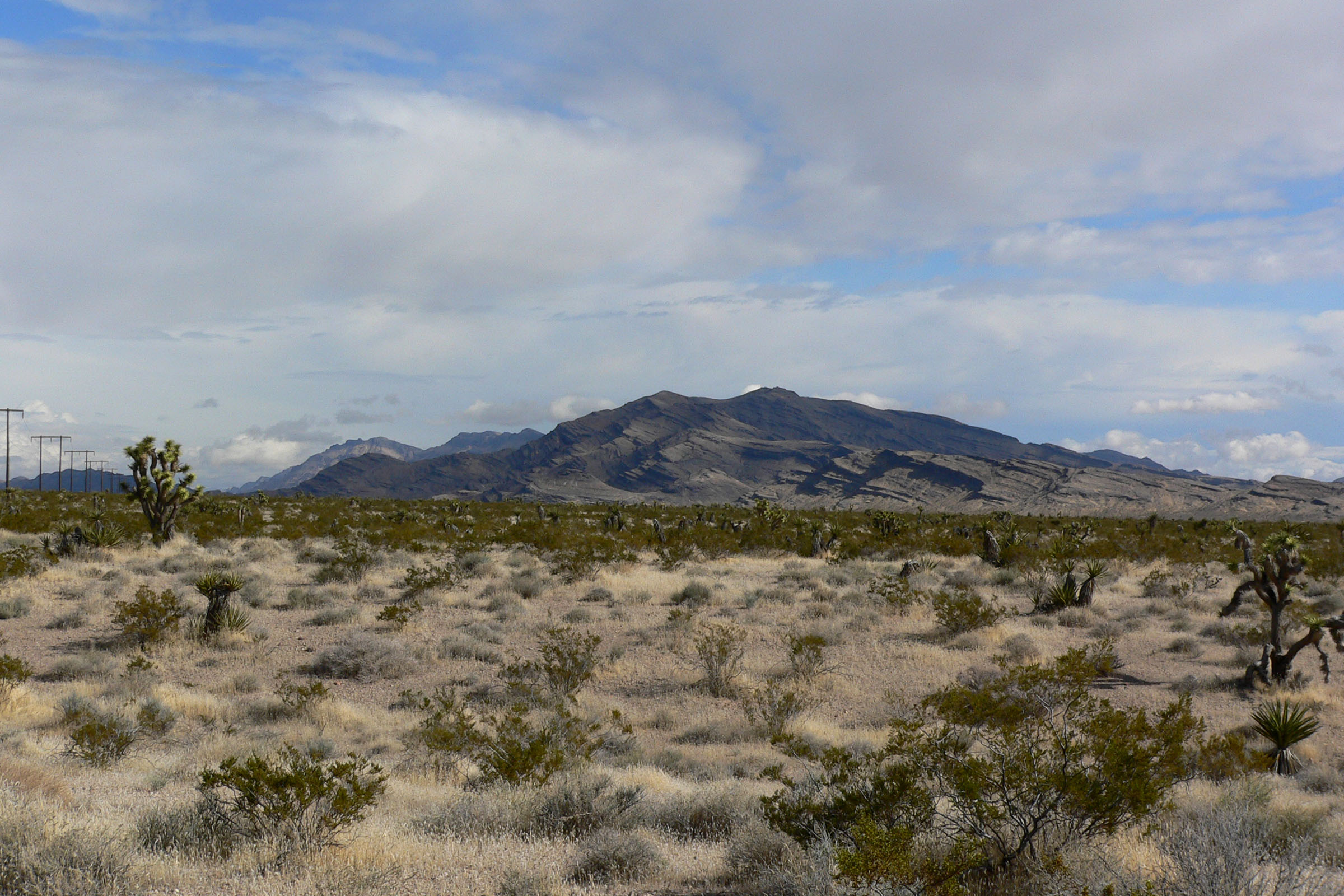
image_caption = Seen from the south
country = United States
state = Nevada
region =
district = Clark County
municipality =
topo_

topo_maker = USGS
range =
border =
part =
city =
landmark =
river =
lat_d = 36 | lat_m = 40 | lat_s = 24.888 | lat_NS = N
long_d = 114 | long_m = 51 | long_s = 46.003 | long_EW = W
highest =
highest_location = | highest_region = | highest_country =
highest_elevation = 1219
highest_lat_d = | highest_lat_m = | highest_lat_s = | highest_lat_NS =
highest_long_d = | highest_long_m = | highest_long_s = | highest_long_EW =
lowest =
lowest_location = | lowest_region = | lowest_country =
lowest_elevation_imperial =
lowest_lat_d = | lowest_lat_m = | lowest_lat_s = | lowest_lat_NS =
lowest_long_d = | lowest_long_m = | lowest_long_s = | lowest_long_EW =
length_imperial = | length_orientation =
width_imperial = | width_orientation =
height_imperial =
area_imperial =
timezone = Pacific | utc_offset = -8
timezone_DST = PDT | utc_offset_DST = -7
geology =
orogeny =
period =
biome =
plant =
animal =
free = | free_type =


map_caption = location of Arrow Canyon Range in Nevada cite gnis|845107|Arrow Canyon Range]
map_background =
map_locator = Nevada
website =
footnotes =
The Arrow Canyon Range is a small mountain range that runs south to north in Clark County, Nevada, United States. Its length is approximately 25 miles at a latitude 36˚35' - 36˚47', and its width is roughly 7 miles at a longitude of 114˚54' - 114˚47'. The base elevation is 3,000 ft, and it rises to 4,953 ft at its peak. It runs parallel to Highway 93, where the western front is easily viewed along the entire length.

Like many mountain ranges in southern Nevada, it has the distinctive bare gray limestone formations common in the region. The dark band towards the upper third is tilted and broken, showing the intense geologic activity from the past.


Wikimedia Foundation. 2010.

Игры ⚽ Нужна курсовая?

Look at other dictionaries:

  • Arrow Canyon Wilderness — Infobox protected area | name = Arrow Canyon Wilderness iucn category = Ib caption = locator x = 41 locator y = 91 location = Nevada, USA nearest city = Glendale, Nevada lat degrees = lat minutes = lat seconds = lat direction = N long degrees =… …   Wikipedia

  • North Black Rock Range Wilderness — Coordinates: 41°26′15.634″N 119°2′20.665″W / 41.43767611°N 119.03907361°W / 41.43767611; 119.03907361 …   Wikipedia

  • Operation Dewey Canyon — Part of the Vietnam War …   Wikipedia

  • List of mountain ranges of Nevada — There are 313 named mountain ranges in Nevada, some of them quite small but still constituting distinct biomes.*Adobe Range *Anchorite Hills *Antelope Range (Pershing County) *Antelope Range (White Pine County) *Antelope Range (Nye County)… …   Wikipedia

  • Frank Zappa — Infobox Musical artist Name = Frank Zappa Img capt = Frank Zappa, Ekeberghallen, Oslo, January 16, 1977. Photo by Helge Øverås Img size = Background = solo singer Birth name = Frank Vincent Zappa Alias = Born = December 21, 1940 Baltimore,… …   Wikipedia

  • Заппа, Фрэнк — Для термина «Zappa» см. другие значения. Фрэнк Заппа Frank Zappa …   Википедия

  • Death Valley National Park — IUCN Category II (National Park) …   Wikipedia

  • National Landscape Conservation System — The National Landscape Conservation System (NLCS) is a 27 million acres (110,000 km2) collection of the lands considered to be the crown jewels of the American west. NLCS is also known as National Conservation Lands. These lands represent 10% of… …   Wikipedia

  • North Jackson Mountains Wilderness — Coordinates: 41°21′40.641″N 118°28′11.576″W / 41.36128917°N 118.46988222°W / 41.36128917; 118.46988222 …   Wikipedia

  • Desert National Wildlife Refuge — Coordinates: 36°46′00″N 115°26′00″W / 36.7666667°N 115.4333333°W / 36.7666667; 115.4333333 …   Wikipedia

Share the article and excerpts

Direct link
Do a right-click on the link above
and select “Copy Link”