- Nagtipunan, Quirino
-
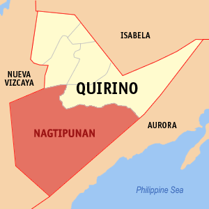
Nagtipunan — Municipality — Map of Quirino showing the location of Nagtipunan. Location in the Philippines
 Nagtipunan
Coordinates: 16°13′N 121°36′E / 16.217°N 121.6°ECoordinates: 16°13′N 121°36′E / 16.217°N 121.6°E Country  Philippines
Region Cagayan Valley (Region II) Province Quirino District Lone District Founded Barangays 16 Government – Mayor Nieverose Camma Meneses Area – Total 1,588.92 km2 (613.5 sq mi) Population (2007) – Total 20,443 – Density 12.9/km2 (33.3/sq mi) Time zone PST (UTC+8) ZIP code 3405 Income class first class Population Census of Nagtipunan Census Pop. Rate 1995 12,509 — 2000 17,027 6.84% 2007 20,443 2.55% Nagtipunan is a first class municipality in the province of Quirino, Philippines. Nagtipunan is the youngest town in the province yet the fastest in terms of population growth and development. According to the latest census, it has a population of 20,443 people in 3,484 households.
As the largest municipality in the province, it occupies a land area of 1588.92 square kilometers, nearly half of the province itself.
The municipality is known for its natural beauty, thus, it's dubbed as the tourism capital of the province of Quirino.
Contents
Barangays
Nagtipunan is politically subdivided into 16 barangays.
- Anak
- Dipantan
- Dissimungal
- Guino (Giayan)
- Keat
- La Conwap (Guingin)
- Landingan
- Mataddi
- Matmad
- Ponggo (Urban)
- San Dionisio II
- San Pugo
- San Ramos
- Sangbay
- Wasid
- Asaklat
A Brief History of Nagtipunan
The Municipality of Nagtipunan was formerly a part of Maddela
It was created on February 25, 1983 by virtue of Batas Pambansa No. 345 and approved in a plebiscite held on September 24, 1983.
The town’s name was derived from the native word meaning “convergence point,” in reference to several major tributaries of the Cagayan River in Aurora, Nueva Vizcaya and Qurino meeting at points within this area.
Places to go
The refreshing, 50 m. high Mactol Falls, in Brgy. San Pugo, is the Cagayan River headwater. It is located 22 km from Pongo (a 2.5-hr. drive) and has a 22-m. deep basin surrounded by rock formations and a lush forest. It suited for swimming and picnicking.
Victoria Falls, in Brgy. Sangbay, is believed to be a source of the mighty Cagayan River which bisects the valley and ends at the Aparri Delta.
Also found in Nagtipunan is the famous “BIMMAPOR,” a rock formation similar to a sunken ship, of which only the upper decks are protruding from the ground.
The Cagayan River, one of the cleanest bodies of water in the Philippines, which flows from Brgy. San Pugo down to Brgy. Ponggo where TATIMBANG, APANG, AGUK, BIMMAPOR and PUCTAD are found.
The glamorous PUSUAC cave and watershed in Brgy. Ponggo.
And the Nagtipunan Municipal Hall (One of the most beautiful tourist spots in Region II).
External links
- QuirinoProvince.org
- Philippine Standard Geographic Code
- 1995 Philippine Census Information
- 2000 Philippine Census Information
- 2007 Philippine Census Information
Municipalities - Aglipay
- Cabarroguis
- Diffun
- Maddela
- Nagtipunan
- Saguday
Categories:- Municipalities of Quirino

Wikimedia Foundation. 2010.