Hongdo

Hongdo

Infobox Korean settlement
title =
tablewidth =
context =

logowidth =


imgwidth = 240
imgcaption =
hangul = 홍도
hanja = 紅島
rr = Hongdo
mr = Hongto
area_km2 = 6.47
areanote =
elevation_m =
elevationnote =
pop = 710
popnote =
popyear = 2001
popden_km2 =
popdennote =
gov =
mayor =
capital =
divs =
region =
dialect =


mapwidth =
mapcaption =
text =

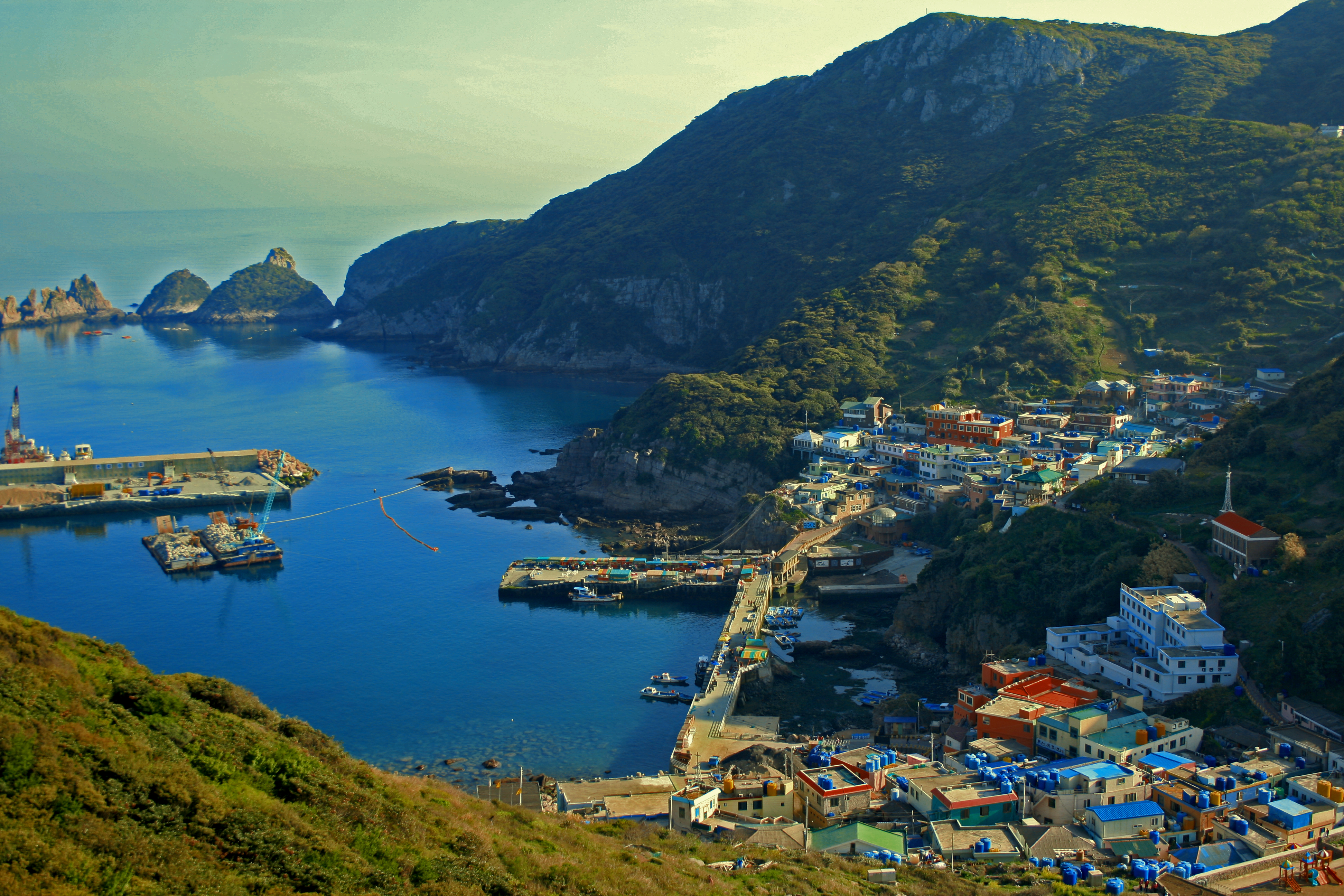
Hongdo is an island in the Yellow Sea located off 115km from the southwest coast of Mokpo port, Jeollanam-do, South Korea. It covers an area of 6.47㎢ and consists of stiff mountain ranges, the highest peaks of which are Gitdaebong (깃대봉 378m) and Yangsanbong (양산봉 231m).cite web|url=http://www.encyber.com/search_w/ctdetail.php?masterno=172062&contentno=172062 |title=홍도 紅島|publisher=Doosan Encyber |accessdate=2008-05-12 |languauge=Korean] It is within the administrative boundaries of Sinan County, Jeollanam-do, South Korea. The island's 6.47 km² are home to about 710 people.cite web|url=http://eng.shinan.go.kr/tour/index.html?page=01 |title=Hongdo|publisher=Sinan County official website|accessdate=2008-05-12 |languauge=English]

Gallery

ee also

*Jang Bo-go
*Islands of South Korea
*List of Korea-related topics

References

External links

* [http://eng.shinan.go.kr/tour/index.html?page=01 Hongdo] at the official site of Sinan County government


Wikimedia Foundation. 2010.

Игры ⚽ Нужно сделать НИР?

Look at other dictionaries:

  • Hongdo — Hong do / Isla Hong 홍도 Hong do Localización País …   Wikipedia Español

  • Mokpo — 목포   Municipal City   Korean transcription(s)  – Hangul 목포시  – Hanja 木浦市  –  …   Wikipedia

  • Dadohaehaesang National Park — 다도해해상국립공원, 多島海海上國立公園 Dadohaehaesang National Park IUCN Category II (National Park) …   Wikipedia

  • Хондо (остров) — Хондо кор. 홍도 …   Википедия

  • Ssirum — Koreanische Schreibweise Hangeul: 씨름 Revidiert: Ssireum McCune R.: Ssirŭm …   Deutsch Wikipedia

  • Sinan County, Jeollanam-do — Infobox Korean settlement imgwidth = 230 imgcaption = A town in Heuksando, one of the island in Sinan county hangul=신안군 hanja=linktext|新|安|郡 rr=Sinan gun mr=Sinan kun area km2=653.13 pop=53,150 popyear=2001 popden km2=81 divs=1 eup , 13 myeon… …   Wikipedia

  • Ssireum — The painting titled Sangbak (상박; 相撲) drawn by Kim Hong do illustrates people gathering around to watch a ssireum competition in the late 18th century. Also known as gakjeo; gakhui; gakryeok; gakgii; chiuhui; sangbak; jaenggyo …   Wikipedia

  • Danwon — Infobox Korean name width=126px hangul=김홍도 hanja=金弘道 rr=Kim Hong do mr=Gim Hong do hangulho=단원, 단구, 서호, 고면거사, or 첩취옹 hanjaho=檀園, 丹邱, 西湖, 高眠居士, or 輒醉翁 rrho=Danwon, Dan gu, Seoho, Gomyeon geosa, or Cheopchwiong mrho=Tanwŏn, Tan gu, Sŏho Komyŏn gŏsa …   Wikipedia

  • Yeonsangun of Joseon — Yeonsan gun is also the name of a county in North Hwanghae province, North Korea Infobox Korean name hangul=연산군 hanja=燕山君 rr=Yeonsan gun mr=Yŏnsan gun hangulborn=이융 hanjaborn=李隆 rrborn=I Yung mrborn=I YungYeonsan gun (1476 – 1506, r. 1494 1506),… …   Wikipedia

  • National parks of South Korea — …   Wikipedia

Share the article and excerpts

Direct link
Do a right-click on the link above
and select “Copy Link”