River Shannon — The River Shannon ( Sionainn or Sionna in Irish) is, at 386 km (240 miles), the longest river in Ireland. [http://www.discoverireland.com/gb/about ireland/nature/ Accessed: 22nd July, 2008] [http://encarta.msn.com/encyclopedia… … Wikipedia
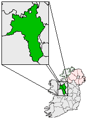
County Roscommon — Not to be confused with Roscommon County, Michigan, United States. County Roscommon Contae Ros Comáin … Wikipedia
Лекарроу — Деревня Ирландии Лекарроу англ. Lecarrow, ирл. An Leithcheathr Страна … Википедия
List of towns and villages in the Republic of Ireland — This is a link page for cities and towns in Ireland, including villages, townships or urban centres in Dublin. Cities are shown in bold; see Cities in Ireland for an independent list. See also : * List of towns in the Republic of Ireland/Largest… … Wikipedia
Knockcroghery — Infobox Irish Place name = Knockcroghery gaeilge = Cnoc an Chrocaire crest motto = map pin coords = left: 66px; top: 79px north coord = 53.5667 | west coord = 8.1 | irish grid = M934574 area = | elevation = 82 m province = Connacht county =… … Wikipedia
Old Town, County Roscommon — Old Town an Seanbhaile Town … Wikipedia
Passage West — Infobox Irish Place name = Passage West gaeilge = An Pasáiste Thiar crest motto = map pin coords = left: 137px; top: 64px north coord = 51.871300 west coord = 8.335200 irish grid = W767687 area = elevation = 5 m (16 ft) province = Munster county … Wikipedia
Tarmonbarry — Termonbarry Tearmann Bearaigh Town … Wikipedia
Cloonfad — Cluain Fada Town … Wikipedia
Clare Island — NASA Geocover 2000 (Satellitenaufnahme) Gewässer Atlantischer Ozean … Deutsch Wikipedia