Common Cottongrass

Common Cottongrass

Taxobox
name = Common Cottongrass


image_width = 240px
regnum = Plantae
divisio = Magnoliophyta
classis = Liliopsida
ordo = Poales
familia = Cyperaceae
genus = "Eriophorum"
species = "E. angustifolium"
binomial = "Eriophorum angustifolium"
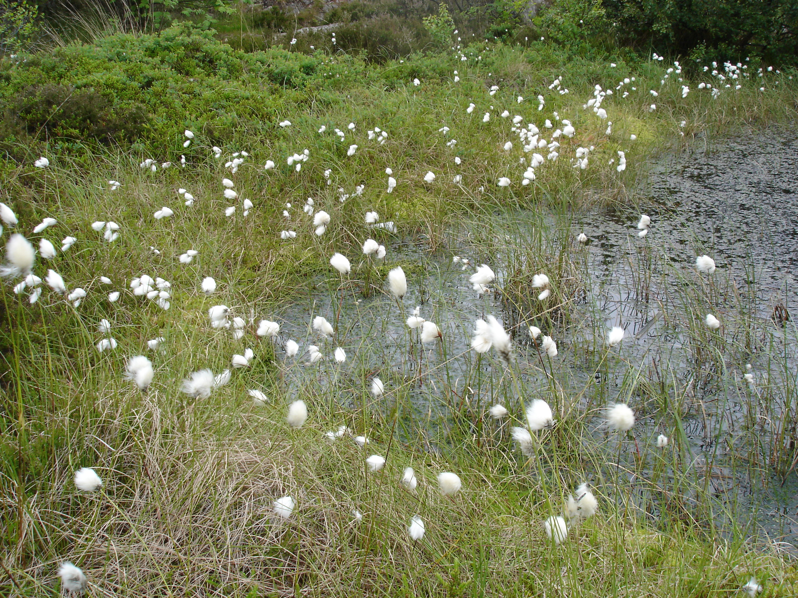
binomial_authority = Honck.

Common cottongrass ("Eriophorum angustifolium" Honck., syn. "E. polystachion" L.) is a plant from the sedge (Cyperaceae) family, so even though it looks like a form of grass, technically it is not. It grows in acidic wetlands and peat bogs all over northern parts of Europe, Asia and North America. The flowering stem is 20-70 cm tall, and has three to five cotton-like inflorescences hanging from the top. It is also sometimes referred to as multi-headed bog cotton.

The presence of cottongrass is a useful indicator to hikers of potentially dangerous deep peat bogs to be avoided.

External links

* [http://www.bioimages.org.uk/HTML/T50120.HTM More images of common cottongrass]

References

* Bo Nylén. Nordens Flora (second edition). Prisma. Stockholm. År 2000. ISBN 91-518-3821-4 (kart), ISBN 91-518-3823-0 (htf)


Wikimedia Foundation. 2010.

Игры ⚽ Поможем решить контрольную работу

Look at other dictionaries:

  • Eriophorum angustifolium — Common Cottongrass Scientific classification Kingdom: Plantae (unranked) …   Wikipedia

  • Eriophorum — scheuchzeri Scientific classification Kingdom …   Wikipedia

  • Maujahn Moor — Coordinates: 53°05′39″N 11°02′35″E / 53.09417°N 11.04306°E / 53.09417; 11.04306 …   Wikipedia

  • List of Latin and Greek words commonly used in systematic names — Contents 1 List of words 1.1 A 1.2 B 1.3 C …   Wikipedia

  • Flora of Scotland — The flora of Scotland is an assemblage of native plant species including over 1,600 vascular plants, more than 1,500 lichens and nearly 1,000 bryophytes. The total number of vascular species is low by world standard but lichens and bryophytes are …   Wikipedia

  • Ballynahone Bog — is a raised bog, situated in County Londonderry, Northern Ireland, about 3km south of Maghera, on low lying ground immediately north of the Moyola River about 14km from its mouth at Lough Neagh. It is one of the largest lowland raised bogs in… …   Wikipedia

  • British NVC community M20 — NOTOC NVC community M20 ( Eriophorum vaginatum raised and blanket mire) is one of the mire communities in the British National Vegetation Classification system.It is a comparatively localised community. There are two subcommunities.Community… …   Wikipedia

  • Chat Moss — Coordinates …   Wikipedia

  • Southrepps — Infobox UK place official name= Southrepps country= England region= East of England shire district= North Norfolk shire county= Norfolk civil parish= Southrepps static static image caption = St James Parish Church, Southrepps population= 758… …   Wikipedia

  • Lambert's Castle — Location map Dorset lat=50.78713 long= 2.89509 width=180 float=right caption= Lambert s Castle shown within Dorset (gbmapping|SY370990)Lambert s Castle is an Iron Age hill fort in Dorset, England.The fort rises to a height of 256 m on a broad… …   Wikipedia

Share the article and excerpts

Direct link
Do a right-click on the link above
and select “Copy Link”