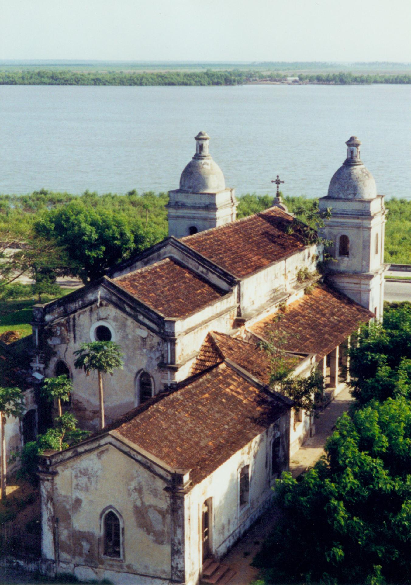
- Quelimane
Infobox Settlement
official_name = Quelimane
other_name =
native_name =
nickname =
motto =
imagesize = 260px
image_caption =
flag_size =
image_
seal_size =
image_shield =
shield_size =
image_blank_emblem =
blank_emblem_size =
mapsize =
map_caption =
pushpin_
pushpin_label_position =
pushpin_mapsize =240
subdivision_type = Country
subdivision_name = MOZ
subdivision_type1 = Provinces
subdivision_name1 =Zambezia Province
subdivision_type2 = District
subdivision_name2 =
government_type =
leader_title =
leader_name =
leader_title1 =
leader_name1 =
established_title =
established_date =
established_title2 =
established_date2 =
established_title3 =
established_date3 =
area_magnitude =
unit_pref =
area_footnotes =
area_total_km2 =
area_land_km2 =
area_water_km2 =
area_total_sq_mi =
area_land_sq_mi =
area_water_sq_mi =
area_water_percent =
area_urban_km2 =
area_urban_sq_mi =
area_metro_km2 =
area_metro_sq_mi =
population_as_of = 2007
population_footnotes =
population_note =
settlement_type =
population_total = 192 876
population_density_km2 =
population_density_sq_mi =
population_metro =
population_density_metro_km2 =
population_density_metro_sq_mi =
population_urban =
population_density_urban_km2 =
population_density_urban_mi2 =
timezone =
utc_offset =
timezone_DST =
utc_offset_DST =
latd= 17|latm= 52|lats=35 |latNS=S
longd=36 |longm=53|longs=14 |longEW=E
elevation_footnotes =
elevation_m =
elevation_ft =
postal_code_type =
postal_code =
area_code =
website =
footnotes =Quelimane (pronounced "Kelly-mane") is a
seaport inMozambique . It is the administrativecapital of theZambezia Province and the province's largest city, and stands 25 km from the mouth of theRio dos Bons Sinais (or "River of the Good Signs"). The river was named whenVasco da Gama , on his way toIndia , reached it and saw "good signs" that he was on the right path. The town was the end point ofDavid Livingstone 's famous west-to-east crossing of south-central Africa in 1856. Portuguese is the official language of Mozambique, and many residents of the areas surrounding Quelimane speak Portuguese. The most common local language is Chuabo. Quelimane, along with much of Zambezia Province, is extremely prone to floods during Mozambique's rainy season. The most recent bout of severe flooding took place in January 2007.History
The town originated as a
Swahili trade centre. Quelimane, which was founded byMuslim traders as a slave market, is one of the oldest cities in the country. In the 16th century, the Portuguese founded a trading station at Quelimane.Sisal plantations were organized by German planters in the beginning of the 20th century. The town started to grow and new infrastructure was built by the Portuguese authorities. By 1970, Quelimane,Portuguese Mozambique , had 71,786 inhabitants.Mozambique become independent from Portugal in 1975, after the April 1974
Carnation Revolution atLisbon . Although its location on the Rio dos Bons Sinais is less important today than in the past, it remains a major town with a largehospital , twocathedral s, amosque , and a public university for teachers. Due to its heat, humidity, and distance from the beach, Quelimane is not among Mozambique's major tourist destinations. However, its status as a provincial capital and the fourth-largest city in Mozambique and the increasing ease of access by plane (Linhas Aéreas de Moçambique runs daily flights andAir Corridor flights run approximately every other day) and road contribute to a small but relatively steady stream of visitors. In addition, Quelimane is home to branches of many NGOs, including [http://www.wvi.org/wvi/home.htm World Vision International] , [http://www.heifer.org Heifer International] , and [http://www.savethechildren.org.uk Save the Children UK] . Frequent visits from foreign aid consultants, workers, and government officials also contribute to the economy, and the city received a further boost when Quelimane hosted the Ninth AnnualFrelimo Party Convention in November 2006.Demographics
See also
*
Railway stations in Mozambique External links
*
* [http://www.go2africa.com/mozambique/beira/quelimane/ Quelimane, Mozambique from go2africa.com]
* [http://quelimane.no.sapo.pt] [http://www.zambezia.co.mz] [http://quelimane.blogs.sapo.pt]
References
* [http://www.fallingrain.com/world/MZ/9/Quelimane.html FallingRain Map - elevation = 1m (Red dots are railways)]
Wikimedia Foundation. 2010.

