- Maungatapere
-
Maungatapere 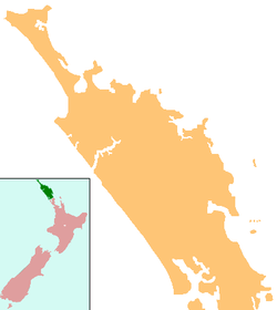
 Maungatapere
Coordinates: 35°45′18″S 174°12′28″E / 35.755°S 174.20778°ECoordinates: 35°45′18″S 174°12′28″E / 35.755°S 174.20778°E Country New Zealand Region Northland Region District Whangarei District Population (2006) - Total 1,278 Maungatapere is a settlement in Northland, New Zealand. State Highway 14 runs through it. Whangarei is 11 km to the east, and Tangiteroria is 18 km to the south west. A hill called Maungatapere with a summit 359 m above sea level is southwest of the settlement.[1][2]
The population was 1278 in the 2006 Census, an increase of 225 from 2001.[3]
Contents
History
Thomas Elmsley bought 60,000 acres (24,000 ha) of land in Maungatapere and northern Wairoa from Te Tirarau in 1839, and in 1840 he and the brothers Henry and Charles Walton came with workers to establish farms in the area. Henry Walton's farm was on the slopes of Maungatapere hill and was called "Maungatapere Park".[4] After the Flagstaff War, Walton employed former soldiers to build stone walls which are still a feature of the area. Henry Walton married Kohura, Te Tirarau's niece, in 1846. After she died in childbirth, he married her sister, Pehi, but she died in a measles epidemic in 1856. Walton built a road between Maungatapere and Whangarei in 1858. He also became involved in coal mining and shipbuilding, and was one of the partners in the timber mill at Te Kopuru. Walton was one of the founding shareholders in the Bank of New Zealand. In 1863 became a member of the New Zealand Legislative Council and two years later he was elected to the Auckland Provincial Council. However, in 1867 he left New Zealand and returned to England.[5]
Education
Maungatapere School is a coeducational full primary (years 1-8) school with a decile rating of 9 and a roll of 193.[6] The school celebrated its 125th jubilee in 2004.[7]
Notes
- ^ Peter Dowling (editor) (2004). Reed New Zealand Atlas. Reed Books. pp. map 7. ISBN 0-7900-0952-8.
- ^ Roger Smith, GeographX (2005). The Geographic Atlas of New Zealand. Robbie Burton. pp. map 24. ISBN 1-877333-20-4.
- ^ Quickstats about Maungatapere
- ^ Pickmere, Nancy Preece (1986). Whangarei: The Founding Years. pp. p 32.
- ^ Pickmere, p 51-58. Maungatapere Park was eventually sold for subdivision into farms.
- ^ "Te Kete Ipurangi - Maungatapere School". Ministry of Education. http://www.tki.org.nz/e/schools/display_school_info.php?school_id=1048.
- ^ "Maungatapere School 125th Jubilee" ([dead link] – Scholar search). Education Gazette New Zealand 83 (3). 23 February 2004. http://www.edgazette.govt.nz/notices.php/?id=602087.
External links
Categories:- Populated places in New Zealand
- Whangarei District

Wikimedia Foundation. 2010.