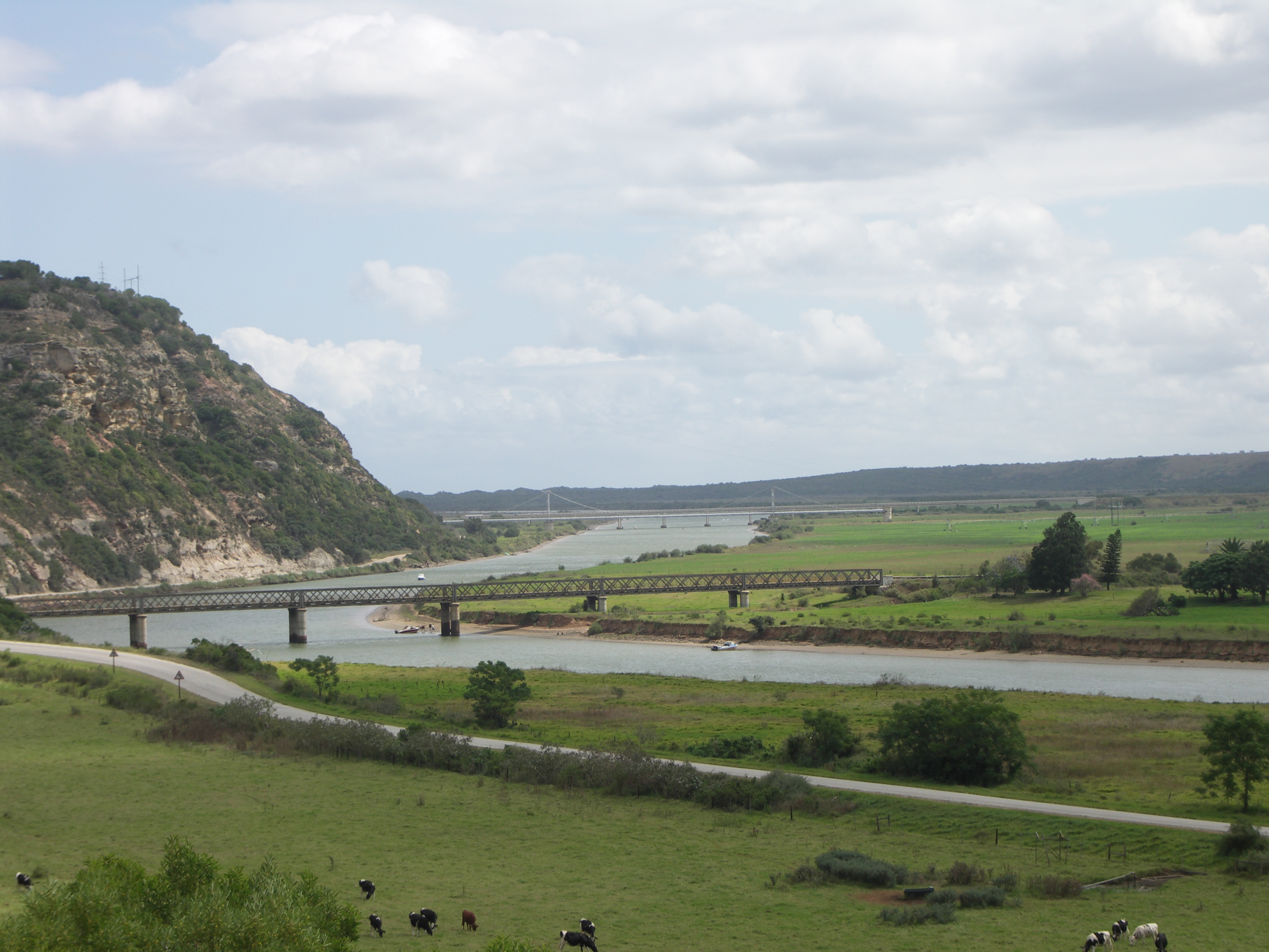
- Gamtoos River
Geobox|River
state_type = Province
name = Gamtoos River
native_name =
other_name =
category =
etymology =
nickname =

image_caption = Gamtoos River near its mouth into theIndian Ocean betweenPort Elizabeth andJeffreys Bay
country = RSA
state = Eastern Cape
region =
district =
municipality =
parent =
tributary_left =
tributary_right =
city =
landmark =
source = _
source_location = | source_region = | source_country =
source_elevation =
source_lat_d = | source_lat_m = | source_lat_s = | source_lat_NS =
source_long_d = | source_long_m = | source_long_s = | source_long_EW =
source1 =
source1_location = | source1_region = | source1_country =
source1_elevation =
source1_lat_d = | source1_lat_m = | source1_lat_s = | source1_lat_NS =
source1_long_d = | source1_long_m = | source1_long_s = | source1_long_EW =
source_confluence =
source_confluence_location = | source_confluence_region = | source_confluence_country =
source_confluence_elevation =
source_confluence_lat_d = | source_confluence_lat_m = | source_confluence_lat_s = | source_confluence_lat_NS =
source_confluence_long_d = | source_confluence_long_m = | source_confluence_long_s = | source_confluence_long_EW =
mouth = Indian Ocean
mouth_location = St. Francis Bay| mouth_region = Eastern Cape| mouth_country = South Africa
mouth_elevation = 0
mouth_lat_d = 33 | mouth_lat_m = 58 | mouth_lat_s = 8.75 | mouth_lat_NS = S
mouth_long_d = 25 | mouth_long_m = 1 | mouth_long_s = 58.08| mouth_long_EW = E
length =
width =
depth =
volume =
watershed =
discharge =
discharge_max =
discharge_min =
free = | free_type =
map_caption =
map_background =
map_locator =
map_locator_x =
map_locator_y =
website =
footnotes =Gamtoos River is situated in the
Eastern Cape Province ofSouth Africa and is approximately 645 km long with a catchment area of 34,635 km². The name Gamtoos is probably derived from aKhoikhoi clan whose name was given by early Dutch settlers as "Gamtousch".Although the rainfall in the catchment area is low it supports a commercial irrigated agriculture in the lower catchment in which oranges,
tobacco ,citrus fruit andvegetable s are grown. Where the Gamtoos river enters theIndian Ocean betweenJeffreys Bay andPort Elizabeth there is the Gamtoos River Mouth Nature Reserve. The towns ofHankey , the oldest town situated in the Gamtoos river valley andPatensie is situated in the lower catchment. Further inland are the towns ofSteytlerville ,Joubertina , Uniondale,Willowmore andMurraysburg .Sarah Baartman - the "Hottentot Venus" - was born around 1789 in the vicinity of the Gamtoos river.References
ee also
External links
Wikimedia Foundation. 2010.
