Molnaszecsőd

Molnaszecsőd
Molnaszecsőd
File:Molnaszecsőd címer.jpg
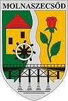
Coat of arms
Molnaszecsőd is located in Hungary
Molnaszecsőd
Location of Molnaszecsőd in Hungary
Coordinates: 47°2′44.92″N 16°40′36.59″E / 47.0458111°N 16.6768306°E / 47.0458111; 16.6768306
Country Hungary
Region Western Transdanubia
County Vas
Subregion Körmendi
Rank Village
Area
 – Total 11.69 km2 (4.5 sq mi)
Time zone CET (UTC+1)
 – Summer (DST) CEST (UTC+2)
Postal code 9912
Area code +36 94

Molnaszecsőd is a village in Vas county, Hungary.

Coordinates: 47°03′N 16°41′E / 47.05°N 16.683°E / 47.05; 16.683


Wikimedia Foundation. 2010.

Игры ⚽ Поможем решить контрольную работу

Look at other dictionaries:

  • Molnaszecsőd — Administration …   Wikipédia en Français

  • Döröske — Seal …   Wikipedia

  • Vas County — Infobox Hungarian county name =Vas region =Western Transdanubia seat = Szombathely area = 3336 population = 261,900 density = 78 cities = 216Vas (German: Eisenburg , Slovenian Železna županija ) is the name of an administrative county (comitatus… …   Wikipedia

  • Szentgotthárd — City centre with the Rába River …   Wikipedia

  • Csepreg — Sea …   Wikipedia

  • Őriszentpéter — Coat of arms Country …   Wikipedia

  • Magyarszecsőd — Magyarszecsőd …   Wikipedia

  • Kleingebiet Körmend — Das Kleingebiet Körmend (ungarisch Körmendi kistérség) ist eine ungarische Verwaltungseinheit (LAU 1) innerhalb des Komitats Vas. Der Verwaltungssitz ist in Körmend. Gemeinden Csákánydoroszló Daraboshegy Döbörhegy Döröske Egyházashollós… …   Deutsch Wikipedia

  • Liste der Gemeinden im Komitat Vas — Diese Liste umfasst die Städte und weitere Orte des Komitats Vas in Ungarn. Städte und Einwohnerzahlen Die Angaben beruhen auf der Volkszählung von 2001. Szombathely: 81.920 Sárvár: 15.519 Körmend: 12.802 Celldömölk: 11.589 Kőszeg: 11.844… …   Deutsch Wikipedia

  • Acsád — Héraldique Administration …   Wikipédia en Français

Share the article and excerpts

Direct link
Do a right-click on the link above
and select “Copy Link”