Chentouf

Chentouf
Chentouf
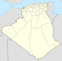
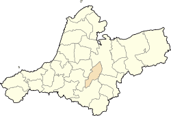
Location of Chentouf within Aïn Témouchent province
Coordinates: 35°18′13″N 1°01′46″W / 35.30361°N 1.02944°W / 35.30361; -1.02944
Country Algeria
Province Aïn Témouchent
Area
 - Total 57.63 km2 (22.3 sq mi)
Population (2010[1])
 - Total 2,940
Time zone West Africa Time (UTC+1)

Chentouf is a municipality in northwestern Algeria.

References

  1. ^ Site officiel de la wilaya d'Aïn Témouchent


Wikimedia Foundation. 2010.

Игры ⚽ Поможем сделать НИР

Look at other dictionaries:

  • Chentouf — Ajouter une image Administration Pays  Algerie !Algérie Wilaya Aïn Témouchent …   Wikipédia en Français

  • Bouchentouf — Le nom doit être décomposé en Bou Chentouf (Chentouf est également un nom de famille en Afrique du Nord). Bou (abû) signifie en principe le père de , mais peut aussi avoir le sens de homme . Quant à Chentouf, le nom existe en kabyle (acentuf)… …   Noms de famille

  • Aïn Témouchent Province — Infobox Algerian Province name1 = Aïn Témouchent name2 = عين تموشنت provincecode = 46 areacode = 27 capital = Aïn Témouchent districts = 8 municipalities = 28 wali = Mr. Bouderbali Mohamed president = Mr. Tikhmarine Lakhdar (FLN) order = 1 E+8 m² …   Wikipedia

  • Nouredine el Fahtni — Born August 15, 1982 (1982 08 15) (age 29) Midar, Morocco Charge(s) Terrorism, Weapon Charges Penalty 5 years and 4 years imprisonment (different cases) …   Wikipedia

  • Communes of Algeria — Algeria This article is part of the series: Politics and government of Algeria Constitution President (List …   Wikipedia

  • Hammam Bou Hadjar District — Infobox Algerian District map1 = DZ 46.svg map2 = Sin mapa.svg name1 = Hammam Bou Hadjar name2 = حمام بوحجر province = Aïn Témouchent capital = Hammam Bou Hadjar municipalities = 4 code = chef = area1 = area2 = population = 46 298 popyear = 1998… …   Wikipedia

  • Chaabet El Ham — Location of the commune within Aïn Témouchent province Coordinates …   Wikipedia

  • Oued Berkeche — Location within Aïn Témouchent province Coordinates …   Wikipedia

  • Oued Sabah — Location within Aïn Témouchent province Coordinates …   Wikipedia

  • Ouled Boudjemaa — Location within Aïn Témouchent province Coordinates …   Wikipedia

Share the article and excerpts

Direct link
Do a right-click on the link above
and select “Copy Link”