- Chatyndy
-
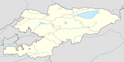
Chatyndy Coordinates: 39°44′0″N 72°12′0″E / 39.733333°N 72.2°ECoordinates: 39°44′0″N 72°12′0″E / 39.733333°N 72.2°E Country Kyrgyzstan Province Osh Province Elevation 4,013 m (13,166 ft) Time zone UTC +5 Chatyndy is a village in the Osh Province of Kyrgyzstan.
Nearby towns and villages include Tengizbay (4 miles), Lyangar (7 miles) and Noruskel' (11 miles).
External links
Categories:- Populated places in Osh Province
- Osh geography stubs
Wikimedia Foundation. 2010.

