Oytal

Oytal
Oytal
Oytal is located in Kyrgyzstan
Oytal
Location in Kyrgyzstan
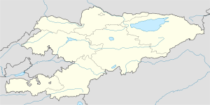
Coordinates: 40°24′N 74°6′E / 40.4°N 74.1°E / 40.4; 74.1Coordinates: 40°24′N 74°6′E / 40.4°N 74.1°E / 40.4; 74.1
Country Kyrgyzstan
Province Osh Province
Elevation 2,650 m (8,694 ft)


Oytal is a town in southern Kyrgyzstan. It is located in Osh Province to the east of the Alai Mountains and towards the west of the Tian Shan mountain range.

Nearby towns and villages include Kara-Gonush (11.6 nm), Taldy-Su (10.9 nm), Karatash (10.1 nm) Terek (3.9 nm), Bura-Chaty (5.0 nm) and Kok-Makday (8.9 nm).


External links


Wikimedia Foundation. 2010.

Игры ⚽ Поможем решить контрольную работу

Look at other dictionaries:

  • Oytal — Blick ins Oytal vom Gleitweg aus Das Oytal ist ein mit dem Oybach bei Gruben im Markt Oberstdorf vom Trettachtal in östliche Richtung abzweigendes Tal im Oberallgäu in den Allgäuer Alpen. Am Oybach führt der Dr. Hohenadl Weg entlang. Eine… …   Deutsch Wikipedia

  • Oytal — Original name in latin Oytal Name in other language Ojtal, Oytal, Ойтал State code KZ Continent/City Asia/Almaty longitude 42.90573 latitude 73.26972 altitude 675 Population 9821 Date 2012 02 28 …   Cities with a population over 1000 database

  • Oytal, Issyk Kul — Oytal …   Wikipedia

  • Gunzesrieder Ach — f1 Allgäuer Alpen Lage der Allgäuer Alpen innerhalb der Ostalpen Höchster Gipfel Großer Krottenkopf (2.657  …   Deutsch Wikipedia

  • Konstanzer Ach — f1 Allgäuer Alpen Lage der Allgäuer Alpen innerhalb der Ostalpen Höchster Gipfel Großer Krottenkopf (2.657  …   Deutsch Wikipedia

  • Schwarzmilzferner — f1 Allgäuer Alpen Lage der Allgäuer Alpen innerhalb der Ostalpen Höchster Gipfel Großer Krottenkopf (2.657  …   Deutsch Wikipedia

  • Wasserfälle in Deutschland — Lainbachfälle bei Kochel am See Tatzelwurm Wasserfall …   Deutsch Wikipedia

  • Allgäuer Alpen — f1 Allgäuer Alpen Lage der Allgäuer Alpen innerhalb der Ostalpen Höchster Gipfel Großer Krottenkopf (2.657&# …   Deutsch Wikipedia

  • Rädlergrat — Himmelhorn Himmelhorn mit seiner Südwand und dem Rädlergrat vom Weg von der Käseralpe zum Wildenfeld. Rechts der Vorgipfel des Schneck …   Deutsch Wikipedia

  • Bahnhof Oberstdorf — Wappen Deutschlandkarte …   Deutsch Wikipedia

Share the article and excerpts

Direct link
Do a right-click on the link above
and select “Copy Link”