- Mariarano
-
Mariarano Location in Madagascar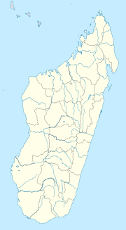
 Mariarano
Coordinates: 15°29′S 46°42′E / 15.483°S 46.7°E Country  Madagascar
Region Boeny District Mahajanga II Elevation[1] 37 m (121 ft) Population (2001)[2] - Total 6,000 Time zone EAT (UTC3) Mariarano is a town and commune (Malagasy: kaominina) in Madagascar. It belongs to the district of Mahajanga II, which is a part of Boeny Region. The population of the commune was estimated to be approximately 6,000 in 2001 commune census.[2]
Only primary schooling is available. The majority 50% of the population of the commune are farmers, while an additional 10% receives their livelihood from raising livestock. The most important crops are rice and sugarcane, while other important agricultural products are bananas and cassava. Services provide employment for 5% of the population. Additionally fishing employs 35% of the population.[2]
References and notes
- ^ Estimated based on DEM data from Shuttle Radar Topography Mission
- ^ a b c "ILO census data". Cornell University. 2002. http://www.ilo.cornell.edu/ilo/data.html. Retrieved 2008-03-03.
Ambato-Boeni 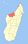
Mahajanga Mahajanga II Ambalabe Befanjava · Ambalakida · Andranoboka · Bekobay · Belobaka · Betsako · Boanamary · Mahajamba Usine · MariaranoMarovoay Mitsinjo Soalala Coordinates: 15°29′S 46°42′E / 15.483°S 46.7°E

This Boeny location article is a stub. You can help Wikipedia by expanding it.

