- Quiindy
infobox city
name = Quiindy
official_name =
department = Paraguarí
image_shield =Coat_of_arms_of_Paraguay.svg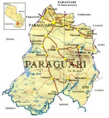
mapsize = 200px
subdivision_type = Country
subdivision_name =Paraguay
subdivision_type1 = Department
subdivision_name1 = Paraguarí
country = Paraguay
leader_title = Intendente Municipal
leader_name = Juan Bautista Bogado Vera
elevation_m =
distance = 103
established_title = Founded
established_date =1733
founder =
population_as_of = 2008
population_note =
population_total = 16.074
population_metro =
population_urban =
population_density_km2 = 46
population_density_sq_mi = 22.20
area_magnitude =
area_total_sq_mi =
area_total_km2 = 885
area_land_sq_mi =
area_land_km2 =
area_water_sq_mi =
area_water_km2 =
area_water_percent =
area_urban_sq_mi =
area_urban_km2 =
area_metro_sq_mi =
area_metro_km2 =
timezone = -4 Gmt
utc_offset =
timezone_DST =
utc_offset_DST =
postal_code_type = Postal code
postal_code = 4240
area_code = (595) (536)
web =
latd = 25 | latm = 25| lats = 26| latNS = S
longd = 56 | longm = 35 | long = 57| longEW = W Quiindy is one of the districts of theParaguarí Department ,Paraguay . Is about 103 kilometers away fromAsunción .You can get to this city following the Route 1 "Mariscal Francisco Solano López". The city is bordered by beautiful, crystalline streams, the Tobatingua and the Yacareby among the most important.
Near the city is the well-known Ypoá lake, a natural reserve highly rich in fauna and flora, one of the most important of the country.
Area
This district has an area of 885 square kilometers, a total population of 19,643 inhabitants and a population density of 22.70 inhabitants per square kilometer.
Economy
His population dedicates the most to the cattle and agricultural production, outstanding in the cultivation of sugar-cane that makes it famous for its Paraguayan "caña". Also has cultivation of
grapes ,cotton ,manioc , also works in stock-breeding of cows, sheeps, pigs and horses.Quiindy is famous for the manufacture of balls. The inhabitants dedicates to the manufacture of leather balls, one of the most important economic activities of the district.
Roads and Communication
The Route 1 "Mariscal Francisco Solano López" is the main asphalted road that crosses all of the
Paraguarí Department and connectsAsunción with the district and other locations of the department.The other roads are terraced and join the districts between them and with the capital of the department.
Has the telephonic services from Copaco and mobile telephony, besides various communication media and the journals from the capital of the country.
How to get there
Starting from
Asunción , following the Route 1 "Mariscal Francisco Solano López" until get to the capital of theParaguarí Department , you keep following the road passing through the districts ofCarapeguá ,San Roque González de Santacruz , finally getting to Quiindy.Geography
This district is located in the middle of the
Paraguarí Department .In this district are also located:
* Cerro Ita Ybaté.
* Cerro Pytá.
* Cerro Santo Tomás.
* Cerro Trinchera Cué.Limits
* North: The San Roque González de Santacruz district.
* South: The Caapucú district.
* East: The Ybycuí district.
* West: TheYpoá lake and the National Park, also theCentral Department and theÑeembucú Department .Hydrography
Many streams flows through this district, among them the Ñandupay, the Zanja Jú, the Tobatinguá, the Yacarey, the Tacuary, the Itary, the Mbusyi and the Mbói Kuatiá.
In the zone of the Ypoá lake and the Parana-mí lake are many estuaries such as the Ypoá estuary.
Demography
According to the General Office of Statistics, Polls and Census, Quiindy has a total population of 19,643 inhabitants (10,233 males and 9,410 females), from which the 74.66% of the population is settled on the rural zone. From the total of occupied houses, 51.46% correspond to the rural sector.
The main social-demographic indicators says:
* Population under 15 years old: 34.5%.
* Average of kids per woman: 3.1 kids.
* Average of illiterates: 8.6%
* Population occupied in the primary sector: 45.1%
* Population occupied in the secondary sector: 17,8%
* Population occupied in the tertiary sector: 35.6%
* Percentage of houses with electricity service: 83.9%
* Percentage of houses with water service: 40.0%Population with unsatisfied basic needs in:
* Education: 6.9%.
* Sanitary infrastructure: 18.0%.
* Housing quality: 30.1%.Tourism
As adventure and ecological tourism can be mentioned the Ypoá lake and the National Park, places ready to the deployment of safaris and walks, and with beautiful beaches.
The Paraná-mí lake has crystalline waters and beaches for a pleasant breaks.
The ancient church build in the time of the Franciscan Reductions in the 16th Century always looks exquisite because of thee magnificence of its construction.
Ypoa Lake National Park
it was created by decree of the Executive State Nro. 43,681 dated
May 29th of1992 . Is located between the departments of Paraguarí, Central and Ñeembucú, and a portion of the districts of Caapucú, Villa Oliva, San Roque González de Santacruz and Quiindy. It has a total area of 1,000 square kilometres and is 150 kilometers away fromAsunción .One of the objectives is the preservation and protection of the wetlands of Ñeembucú and of the biodiversity of ecosystems and characteristic species of it. Also protects natural landscapes of and exceptional beauty.
The occupation of the area is really old, a sample of that is the oriental coast with extensive strings formed by accumulation of mollusc valves, predominating Ampllaria and Diplodon, and rests of campfires made by primitive inhabitants.
The vegetation in this area is related directly with the eco-region of Ñeembucú, where can be found species such as espinillo, palo negro, ingá, lapacho, yvyra ovi, among others. Also pacurí and al yuasy-iy can be found. The riparian an aquatic vegetation is formed by camalote, caña brava, pirí, among others.
Its fauna is very variate with species such as the toucanos, ñandú, suruku'a, inambú, mbiguá, chahá, taguatí, caburé, carpincho, rabbits, monkeys, guazutí, stags, agurá, crocodiles, teja, snakes and others.
References
* [http://world-gazetteer.com/wg.php?x=&men=gcis&lng=en&des=wg&geo=-179&srt=npan&col=abcdefghinoq&msz=1500&pt=c&va=x World Gazeteer: Paraguay] – World-Gazetteer.com
* Tiempos del mundo.
* Geografía del Paraguay.
* Che Retá Paraguay.
* Datos del la DGEEC.
* ABC Color.
* EVP - Wikipedia
* [http://www.evp.edu.py/index.php?title=Portada Enciclopedia Virtual Paraguaya - Portal]External links
* [http://www.senatur.gov.py/ SENATUR]
* [http://www.dgeec.gov.py// Dirección General de Encuestas, Estadísticas y Censos]

Wikimedia Foundation. 2010.