Gyulagarak

Gyulagarak

Infobox Settlement
official_name = Gyulagarak Գյուլագարակ
native_name =
pushpin_

mapsize =150px
subdivision_type = Country
subdivision_name = Armenia
subdivision_type1 = Province
subdivision_name1 = Lori
leader_title =
leader_name =
established_title =
established_date =
area_total_km2 =
area_footnotes =
population_as_of = 2008
population_total =2290
population_density_km2 =
timezone =
utc_offset =
timezone_DST =
utc_offset_DST =
latd=40 |latm=57 |lats=55.86 |latNS=N
longd=44|longm= 28|longs=12.80 |longEW=E
coordinates_display = inline, title
coordinates_type = type:city_region:AM


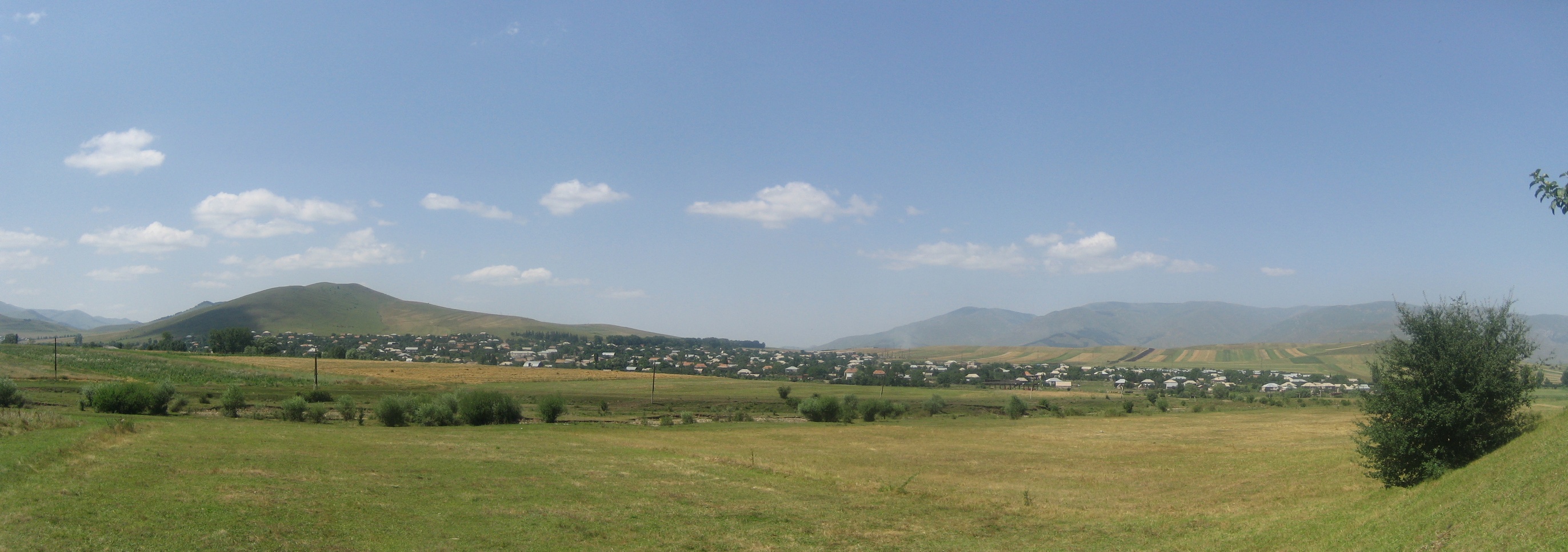
image_caption = Panorama of Gyulagarak from near Hobardzi
imagesize = 300px
elevation_m = 1360
area_code =
website =

Gyulagarak ( _hy. Գյուլագարակ, also Romanized as Gyulagorak; formerly, Gyulabarrak) is a village in the Lori province of Armenia.

Gyulagarak is near the Stepanavan Dendropark.

ee Also

Towns nearby

* Stepanavan

Villages nearby

* Garrgarr
* Hobardzi
* Vardablur
* Amrakits
* Lori Berd

References

*GEOnet2|32FA881E6F9F3774E0440003BA962ED3
* [http://world-gazetteer.com/wg.php?x=&men=gcis&lng=en&des=wg&srt=npan&col=abcdefghinoq&msz=1500&geo=-17 World Gazeteer: Armenia] – World-Gazetteer.com
*ArmenianCensus|162


Wikimedia Foundation. 2010.

Игры ⚽ Нужно сделать НИР?

Look at other dictionaries:

  • Gyulagarak — 40° 57′ 56″ N 44° 28′ 13″ E / 40.965517, 44.470222 …   Wikipédia en Français

  • Gyulagarak — Original name in latin Gyulagarak Name in other language Gjulagarak, Gyulabarrak, Gyulagarak, Gyulagorak, Гюлагарак State code AM Continent/City Asia/Yerevan longitude 40.96715 latitude 44.47144 altitude 1366 Population 2109 Date 2012 01 17 …   Cities with a population over 1000 database

  • Hobardz — Hobardzi Հոբարձի Panorama of Hobardzi from the main road into the village …   Wikipedia

  • Gargar, Armenia — Gargar Գարգառ Gargar as seen from Pushkin Pass …   Wikipedia

  • Yerevan — For other uses, see Yerevan (disambiguation). Coordinates: 40°11′00″N 44°31′00″E …   Wikipedia

  • List of botanical gardens — A botanical garden is a place where plants, especially ferns, conifers and flowering plants, are grown and displayed for the purposes of research, conservation, and education. This distinguishes them from parks and pleasure gardens where plants,… …   Wikipedia

  • Odzun — Օձուն …   Wikipedia

  • Vanadzor — Seal …   Wikipedia

  • Nor Hachn — Coordinates: 40°18′07″N 44°34′59″E / 40.30194°N 44.58306°E / 40.30194; 44.58306 …   Wikipedia

  • Akhtala — For the town in Kotayk Province, see Hrazdan; for the nearby town sometimes also called Akhtala, see Verin Akhtala. Coordinates: 41°08′N 44°46′E / 41.133°N 44.767°E …   Wikipedia

Share the article and excerpts

Direct link
Do a right-click on the link above
and select “Copy Link”