- Wythmail
Geobox|Lost Settlement
name = Wythmail
category = Lost settlement
image_caption = The location of Wythmail
symbol =
country =England
state =Northamptonshire
region =East of England
district = Wellingborough
municipality =Orlingbury
location = West of the village of Orlingbury close to Wythmail Park farm
elevation =
prominence =
established =
date =
owner =
public =
visitation =
visitation_date =
free = | free_type =
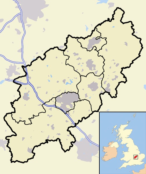
map_caption = Wythmail withinNorthamptonshire
map_background =
map_locator =
map_locator_x =61
map_locator_y =50
website =
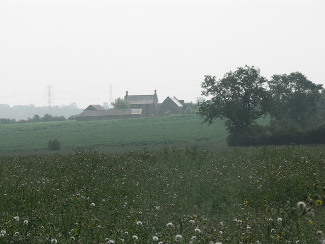
footnotes =Map Ref: SP842721The deserted village of Wythmail is located 4.5 miles south ofKettering in the Englishcounty ofNorthamptonshire . The village ofOrlingbury is 1.1 miles to the east. Wythmail was part of the parish of Orlingbury.History
In the
Domesday Book it is recorded that there were 17 inhabitants in Wythmail and was assessed for 2½ hides; the village was also recorded as having a priest, however the manor was certainly included as part of Orlingbury. ["An Inventory of Archaeological Sites in Central Northamptonshire" (1979) HMSO, page 118, ISBN 0 11 700842 7] Records of 1220 rate the village as having 12 ploughs and it was mentioned in theNomina Villarum of 1316. A manorial chapel was referenced here in 1357. The village was assessed in conjunction with Orlingbury in the 1334 Subsidy Returns and in the 1377 Poll Tax. By 1614 the land here had become a park which existed until 1657. By 1720 only one house was left in the village.What remains
Today there are no traces of the village to be seen, having been completely obliterated by modern farming methods. However traces of the earthwork outline of the village and its streets can be clearly seen on an aerial photograph of the site taken by the RAF in 1947.
References
Wikimedia Foundation. 2010.