- Puerto Rico Highway 2
Infobox road
marker_
state=
highway_name=
name_notes=
type=
route=PRI-2
alternate_name=PR-2, PRI-2
maint=Puerto Rico Dept. of Transportation and Public Works (DTOP)
section=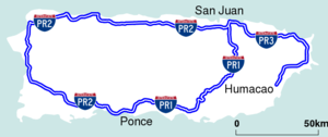
length_mi=
length_round=
length_ref=
length_notes=
established=
decommissioned=
direction_a=
terminus_a=
beltway_city=
junction=
direction_b=
terminus_b=
counties=
rural_municipalities=
cities=
system=Puerto Rico Interstate Highway System
spur_type=
spur_of=
previous_type=
previous_route=
next_type=
next_route=
browse=
commons=
customcommons=Puerto Rico Highway 2, or PR-2 is the longest highway in the Commonwealth of Puerto Rico and connects San Juan to
Ponce paralleling the coast of Puerto Rico in the north (west of San Juan), west, and south (west of Ponce). It connects cities such asGuaynabo ,Bayamón ,Manatí ,Arecibo ,Aguadilla ,Mayagüez ,San Germán andYauco . It is 230 kilometers long, and it is at least two lanes-per direction in its entire length.Puerto Rico Highways 2 and 22
Due to the high population density on the northern coast of Puerto Rico, a new,
limited access highway PR-22 (also known as "Autopista de Diego") was built parallel to highway PR-2. The goal was to reduce congestion on highway PR-2. Highway PR-22 has several exits that provide access to highway PR-2. Highway PR-22 ends in the town of Hatillo, just west of the city of Arecibo. In Hatillo, highway PR-2 actually meets highway PR-22. During the course of its entire length, from San Juan to Hatillo, the two highways run parallel with each other, and they are never more than 10 kilometers apart.Hatillo to Mayagüez
West of PR-22's termination in Hatillo, PR-2 becomes a primary road and meets several important highways that serve the center of the island such as PR-119, PR-110 and PR-112. This stretch of the highway contains a multitude of stop lights. In Aguadilla, it turns south on its course towards Mayagüez. The trip from Aguadilla to Mayagüez takes about 25 minutes, and has few stop lights.
Mayagüez
PR-2 is the only main highway in Mayagüez, which is one of the most populated cities in Puerto Rico. PR-102 and PR-64 serve as by-pass routes, but PR-102 only has direct access to PR-2 via
Puerto Rico Highway 63 , and after that it goes to Cabo Rojo, going several kilometers far from PR-2. PR-2 is the main road to access theUniversity of Puerto Rico at Mayagüez .Freeway
PR-2 becomes a controlled-access freeway from Hormigueros to Ponce, and has several exits in the cities of San German,
Sabana Grande ,Guanica , Yauco,Guayanilla andPeñuelas before becoming a divided highway again in Ponce. Several at-grade intersections have recently being closed to open new constructed exits in Hormigueros and west San Germán leaving just few intersections to work at, but the conversion segment in Ponce still is considerably incomplete, which means that several years remain for the whole new freeway which will begin just southeast of Mayagüez nearMayagüez Mall to PR-2's intersection with PR-52 in Ponce to be open for traffic. After this segment is completed, there will be no at-grade intersections from San Juan to Mayagüez going through the south coast.Municipalities in Puerto Rico
The following is the list of municipalities/towns which PR-2 pass through:
San Juan
Guaynabo
Bayamón
Toa Baja
Dorado
Vega Alta Vega Baja
Manatí
Barceloneta
Arecibo
Hatillo
Camuy
Quebradillas
Isabela
Aguadilla
Aguada
Añasco
Mayagüez
Hormigueros
San Germán
Sabana Grande
Guánica
Yauco
Guayanilla
Peñuelas
Ponce
ee also
*
Puerto Rico Highway 1
*Puerto Rico Highway 10
*Puerto Rico Highway 22
*Puerto Rico Highway 52

Wikimedia Foundation. 2010.