- Mahavanona
-
Mahavanona Location in Madagascar
 Mahavanona
Coordinates: 12°27′S 49°22′E / 12.45°S 49.367°E Country  Madagascar
Region Diana District Antsiranana II Elevation[1] 115 m (377 ft) Population (2001)[2] - Total 12,075 Time zone EAT (UTC3) Mahavanona is a town and commune (Malagasy: kaominina) in Madagascar. It belongs to the district of Antsiranana II, which is a part of Diana Region. According to 2001 commune census the population of Mahavanona was 12,075.[2]
Primary and junior level secondary education are available in town. The majority 52% of the population are farmers, while an additional 46% receives their livelihood from raising livestock. The most important crop is rice, while other important products are bananas and maize. Services provide employment for 1% of the population. Additionally fishing employs 1% of the population.[2]
References and notes
- ^ Estimated based on DEM data from Shuttle Radar Topography Mission
- ^ a b c "ILO census data". Cornell University. 2002. http://www.ilo.cornell.edu/ilo/data.html. Retrieved 2008-02-13.
Ambanja Ambalahonko · Ambanja · Ambodimanga · Ambohimarina · Ankatafa · Ankingameloko · Anorotsangana · Antafiambotry · Antranokarany · Antsakoamanondro · Antsatsaka · Antsirabe · Bemanevika Est · Bemaneviky West · Djangoa · Maherivaratra · Marotolana · Marovato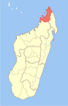
Ambilobe Antsiranana I Antsiranana II Andrafiabe · Andranofanjava · Andranovondronina · Anivorano Nord · Ankarangona · Anketrakabe · Antsahampano · Antsalaka · Bobasakoa · Joffreville · Mahalina · Mahavanona · Mangaoka · Mosorolava · Ramena · SadjoavatoNosy Be Coordinates: 12°27′S 49°22′E / 12.45°S 49.367°E

This Diana Region of Madagascar location article is a stub. You can help Wikipedia by expanding it.

