- Montfleur
-
Montfleur

 MontfleurLocation within Franche-Comté region
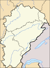 Montfleur
Administration Country France Region Franche-Comté Department Jura Arrondissement Lons-le-Saunier Canton Saint-Julien Statistics Elevation 327–590 m (1,073–1,940 ft) Land area1 7.88 km2 (3.04 sq mi) Population2 153 (2006) - Density 19 /km2 (49 /sq mi) INSEE/Postal code 39353/ 39320 1 French Land Register data, which excludes lakes, ponds, glaciers > 1 km² (0.386 sq mi or 247 acres) and river estuaries. 2 Population without double counting: residents of multiple communes (e.g., students and military personnel) only counted once. Coordinates: 46°19′50″N 5°26′14″E / 46.3305555556°N 5.43722222222°E
Montfleur is a commune in the Jura department in Franche-Comté in eastern France.
See also
References
Categories:- Jura (department) geography stubs
- Communes of the Jura department


Wikimedia Foundation. 2010.