- Mueda District
-
Mueda District — District — District location in Mozambique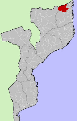
Country  Mozambique
Province Cabo Delgado Province Capital Mueda Area – Total 14,150 km2 (5,463.3 sq mi) Population (1997) – Total 98,654 Time zone EAT (UTC+3) Mueda is a district of the province of Cabo Delgado, in Moçambique. The capital is the town of Mueda.
The district of Mueda is limited to the north by the Tanzania atarvés of the river Rovuma, to the west by the district of Mecula in the province of Niassa, to the south by the districts of Montepuez and Meluco, and to the east by the districts of Muidumbe, Mocimboa da Praia and Nangade.
In accordance with the Census of 1997, the district has 98,654 inhabitants and an area of 14,150 km².
Capital: MaputoCabo Delgado Gaza Inhambane Funhalouro · Govuro · Homoine · Inharrime · Inhassoro · Jangamo · Mabote · Massinga · Morrumbene · Panda · Vilanculos · ZavalaManica Maputo Nampula Niassa Sofala Tete Zambezia Alto Molocue · Chinde · Gilé · Gurué · Ile · Inhassunge · Lugela · Maganja da Costa · Milange · Mocuba · Mopeia · Morrumbala · Namacurra · Namarroi · Nicoadala · PebaneExternal links
- Government profile (Portuguese)
Coordinates: 11°38′S 39°37′E / 11.633°S 39.617°ECategories:- Geography of Mozambique
- Cabo Delgado Province
- Mozambique geography stubs

Wikimedia Foundation. 2010.