- Canons Ashby (lost settlement)
Geobox|Lost Settlement
name = Deserted village of Canons Ashby
category = Lost Settlement
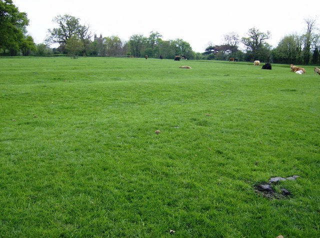
image_caption =The site of the lost settlement of Canons Ashby
symbol =
country =England
state =Northamptonshire
region =East Midlands
district =Daventry
municipality =Canons Ashby
location = 8.3 miles south of Daventry
elevation =
prominence =
established =
date =
owner =
public =
visitation =
visitation_date =
free = | free_type =
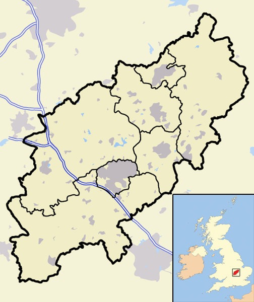
map_caption = Canons Ashby withinNorthamptonshire
map_background =
map_locator =
map_locator_x =19
map_locator_y =83
website =
footnotes =Map Ref: SP576507The lost village of Canons Ashby is located in ground to the north of
Canons Ashby House in the Englishcounty ofNorthamptonshire . Today there is still a small village around the house but this is located away from the original settlement.History
The lost village of Canons Ashby is listed in the
Domesday book of 1086 with a recorded population of 16. In 1105 an Augustinian priory was founded here at the southern end of the village. The priory soon became the owner of most of the parish. In 1301, 18 residents had paid the Lay Subsidy, which was a tax based on the value of lands and possessions and was used to raise money for the Crown to facilitate such things as payment of military forces and building of ships. In 1316 the village has an entry in theNomina Villarum , ["An Inventory of Archaeological Sites in North-West Northamptonshire", (1981) HMSO, page 22, census information. ISBN 0 11 700900 8] which was a list made of all cities, boroughs and townships, and the lords of them, which was carried out forKing Edward III . In 1343 there were 41 houses in the village. In 1377 thePoll Tax was paid by 82 people of the village. The prior of the nearby priory enclosed some land of the village depriving it of 100 acres and destroying three houses. ["An Inventory of Archaeological Sites in North-West Northamptonshire", page 35.] In 1492 the prior evicted another 24 people from their homes. By 1524 there were only 21 residents eligible for tax and by 1535 this number had dropped to nine. On the dissolution of the monasteries in 1537 the village and the priory came into the ownership of Sir Francis Bryon who in turn sold it to Sir John Cope a year later. This probably saw the demise of the village as Cope is recorded as having 2,000sheep upon the parish. TheHearth Tax returns of 1674 show only five tax-payers in the parish. ["An Inventory of Archaeological Sites in North-West Northamptonshire", Hearth tax returns.]Remains Today
The surviving earthworks on the site are in good condition and indicate the large size of this lost village. The original main street was on the line of the north-south running lane that still leads past Canons Ashby House. There are
hollow way s that cross the lane east to west indicating other village thoroughfares. To the east of this hollow way there are a series of embankedpaddock s and platforms of former buildings. Over the whole of the site there are the same sort of features and with close scrutiny the format of the village can almost be made out. Over the years several shards ofmedieval pottery have been found, dating from the 13th and 14th centuries.References
Wikimedia Foundation. 2010.