Kerrville Municipal Airport
- Kerrville Municipal Airport
Infobox Airport
name = Kerrville Municipal Airport
nativename = Louis Schreiner Field
nativename-a =
nativename-r =
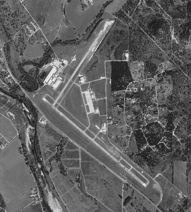
image-width =
caption =
IATA = ERV
ICAO = KERV
type = City of Kerrville, Texas
owner =
operator = 1616
city-served =
location =
elevation-f = 297
elevation-m =
coordinates = Coord|29|58|36.23|N|099|05|08.44|W|type:airport_region:US|display=inline,title
website =
metric-elev =
metric-rwy =
r1-number = 12/30
r1-length-f = 6,000
r1-length-m = 1,829
r1-surface = Asphalt
r2-number = 3/21
r2-length-f = 4,047
r2-length-m = 1,234
r2-surface = Asphalt
stat-year =
stat1-header =
stat1-data =
stat2-header =
stat2-data =
footnotes = Kerrville Municipal Airport (AKA Louis Schreiner Field) Airport codes|ERV|KERV is a general aviation airport located 5 miles SE of Kerrville, Texas.
It is owned and operated by the city of Kerrville, Texas.
History
The airport was opened in February 1943 as Louis Schreiner Field and was used by the United States Army Air Forces as a training base. At the end of the war the airfield was determined to be excess by the military and turned over to the local government for civil use.
See also
* Texas World War II Army Airfields
References
* [http://www.airnav.com/airport/KERVL AirNav.Com - Kerrville Municipal Airport/Louis Schreiner Field (KERV)]
* Thole, Lou (1999), Forgotten Fields of America : World War II Bases and Training, Then and Now - Vol. 2. Publisher: Pictorial Histories Pub, ISBN 1575100517
External links
* [http://www.kerrvilleairport.org/ Kerrville Municipal Airport Website]
Wikimedia Foundation.
2010.
Look at other dictionaries:
Список аэропортов штата Техас — Соединённых Штатов Америки, сгруппированных по типу. Содержит все гражданские и военные аэропорты штата. Некоторые частные и ныне не используемые аэропорты могут находиться в списке (например, если ФАА зафиксированы коммерческие перевозки или… … Википедия
Texas World War II Army Airfields — Infobox Military Structure name=Texas World War II Army Airfields partof = World War II location= coordinates= caption= type=Army Airfields code= built=1940 1944 builder= materials= height= used= 1940 Present demolished= condition= ownership=… … Wikipedia
Liste Des Codes AITA Des Aéroports/E — Liste des codes AITA des aéroports internationaux. Le code de deux lettres qui suit la ville est la subdivision du pays (région, État…) selon la norme ISO 3166 2. Liste des codes AITA des aéroports : A B C D E F G H I J K L M N O P Q R S T … Wikipédia en Français
Liste des codes AITA des aeroports/E — Liste des codes AITA des aéroports/E Liste des codes AITA des aéroports internationaux. Le code de deux lettres qui suit la ville est la subdivision du pays (région, État…) selon la norme ISO 3166 2. Liste des codes AITA des aéroports : A B… … Wikipédia en Français
Liste des codes AITA des aéroports/E — Liste des codes AITA des aéroports internationaux. Le code de deux lettres qui suit la ville est la subdivision du pays (région, État…) selon la norme ISO 3166 2. Liste des codes AITA des aéroports : A B C D E F G H I J K L M N O P Q R S T … Wikipédia en Français
Liste des codes aita des aéroports/e — Liste des codes AITA des aéroports internationaux. Le code de deux lettres qui suit la ville est la subdivision du pays (région, État…) selon la norme ISO 3166 2. Liste des codes AITA des aéroports : A B C D E F G H I J K L M N O P Q R S T … Wikipédia en Français
Texas State Highway 27 — Infobox TX State Highway type=State route=27 length mi=39.1TxDOT|SH|27|accessdate=2008 03 03] length km=62.9 formed=1919cite map|url=http://www.tsl.state.tx.us/arc/maps/images/map6183.jpg|title=State of Texas Highway Map|publisher=Texas State… … Wikipedia
List of World War II topics (K) — # K 25 # K ration # K class submarine (Soviet) # K is for Killing # K. P. K. Menon # K?ichi Kido # K?ichi Shiozawa # K?ki Hirota # K?s? Abe # K?saku Aruga # K?tar? Nakamura # KA BAR # Ka tzetnik # Kaarlo Mäkinen # Kaba Diawara # Kabaty # Kabayama … Wikipedia
Laredo, Texas — City of Laredo City … Wikipedia
Transportation in Houston — Roads and highways= Urban sprawl and hot, humid summers have made automobiles the favored means of transportation in Houston, Texas.Houston’s freeway system includes 575.5 miles of freeways and expressways in the 10 county metro area. [http://www … Wikipedia