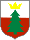
Gmina Czastary

Gmina Czastary
Gmina Czastary
Czastary Commune
—  Gmina  —

Coat of arms
Coordinates (Czastary): 51°15′33″N 18°19′10″E / 51.25917°N 18.31944°E / 51.25917; 18.31944Coordinates: 51°15′33″N 18°19′10″E / 51.25917°N 18.31944°E / 51.25917; 18.31944
Country  Poland
Voivodeship Łódź
County Wieruszów
Seat Czastary
Area
 – Total 62.67 km2 (24.2 sq mi)
Population (2006)
 – Total 4,041
 – Density 64.5/km2 (167/sq mi)
Website http://www.czastary.pl/

Gmina Czastary is a rural gmina (administrative district) in Wieruszów County, Łódź Voivodeship, in central Poland. Its seat is the village of Czastary, which lies approximately 13 kilometres (8 mi) east of Wieruszów and 99 km (62 mi) south-west of the regional capital Łódź.

The gmina covers an area of 62.67 square kilometres (24.2 sq mi), and as of 2006 its total population is 4,041.

Villages

Gmina Czastary contains the villages and settlements of Chorobel, Czastary, Dolina, Jaworek, Józefów, Kąty, Kniatowy, Krajanka, Krzyż, Nalepa, Parcice, Przywory, Radostów Drugi, Radostów Pierwszy and Stępna.

Neighbouring gminas

Gmina Czastary is bordered by the gminas of Biała, Bolesławiec, Łubnice, Sokolniki and Wieruszów.

References


Wikimedia Foundation. 2010.

Игры ⚽ Поможем сделать НИР

Look at other dictionaries:

  • Czastary —   Village   …   Wikipedia

  • Czastary — Czastary …   Deutsch Wikipedia

  • Gmina Biała, Łódź Voivodeship — Infobox Settlement name = Gmina Biała other name = Biała Commune settlement type = Gmina total type = Total image shield = POL gmina Biała COA.svg subdivision type = Country subdivision name = POL subdivision type1 = Voivodeship subdivision name1 …   Wikipedia

  • Gmina Wieruszów — Infobox Settlement name = Gmina Wieruszów other name = Wieruszów Commune settlement type = Gmina total type = Total image shield = subdivision type = Country subdivision name = POL subdivision type1 = Voivodeship subdivision name1 = Łódź… …   Wikipedia

  • Gmina Bolesławiec, Łódź Voivodeship — Infobox Settlement name = Gmina Bolesławiec other name = Bolesławiec Commune settlement type = Gmina total type = Total image shield = POL gmina Bolesławiec COA.svg subdivision type = Country subdivision name = POL subdivision type1 = Voivodeship …   Wikipedia

  • Gmina Łubnice, Łódź Voivodeship — Infobox Settlement name = Gmina Łubnice other name = Łubnice Commune settlement type = Gmina total type = Total image shield = subdivision type = Country subdivision name = POL subdivision type1 = Voivodeship subdivision name1 = Łódź subdivision… …   Wikipedia

  • Gmina Sokolniki — Infobox Settlement name = Gmina Sokolniki other name = Sokolniki Commune settlement type = Gmina total type = Total image shield = subdivision type = Country subdivision name = POL subdivision type1 = Voivodeship subdivision name1 = Łódź… …   Wikipedia

  • List of Polish gminas/C — *Gmina Cedry Wielkie (rural, Gdańsk County, Pomeranian Voivodeship, 124.28 km², 6,156) *Gmina Cedynia (urban rural, Gryfino County, West Pomeranian Voivodeship, 180.38 km², 4,343) *Gmina Cegłów (rural, Mińsk County, Masovian Voivodeship, 95.74… …   Wikipedia

  • Chorobel —   Settlement   …   Wikipedia

  • Dolina, Łódź Voivodeship — For other places with the same name, see Dolina. Dolina   Settlement   …   Wikipedia

Share the article and excerpts

Direct link
Do a right-click on the link above
and select “Copy Link”