Gmina Dalików

Gmina Dalików
Gmina Dalików
Dalików Commune
—  Gmina  —

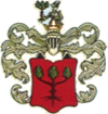
Coat of arms
Coordinates (Dalików): 51°52′55″N 19°6′13″E / 51.88194°N 19.10361°E / 51.88194; 19.10361Coordinates: 51°52′55″N 19°6′13″E / 51.88194°N 19.10361°E / 51.88194; 19.10361
Country  Poland
Voivodeship Łódź
County Poddębice
Seat Dalików
Area
 – Total 112.7 km2 (43.5 sq mi)
Population (2006)
 – Total 3,650
 – Density 32.4/km2 (83.9/sq mi)

Gmina Dalików is a rural gmina (administrative district) in Poddębice County, Łódź Voivodeship, in central Poland. Its seat is the village of Dalików, which lies approximately 10 kilometres (6 mi) east of Poddębice and 28 km (17 mi) north-west of the regional capital Łódź.

The gmina covers an area of 112.7 square kilometres (43.5 sq mi), and as of 2006 its total population is 3,650.

Villages

Gmina Dalików contains the villages and settlements of Bardzynin, Brudnów, Brudnów Stary, Budzynek, Dąbrówka Nadolna, Dalików, Domaniew, Domaniewek, Fułki, Gajówka-Kolonia, Gajówka-Parcel, Gajówka-Wieś, Idzikowice, Kołoszyn, Kontrewers, Krasnołany, Krzemieniew, Kuciny, Madaje Stare, Oleśnica, Psary, Sarnów, Wilczyca, Zdrzychów and Złotniki.

Neighbouring gminas

Gmina Dalików is bordered by the gminas of Aleksandrów Łódzki, Lutomiersk, Parzęczew, Poddębice and Wartkowice.

References


Wikimedia Foundation. 2010.

Игры ⚽ Поможем решить контрольную работу

Look at other dictionaries:

  • Dalików —   Village   …   Wikipedia

  • Dalików — Dalików …   Deutsch Wikipedia

  • Dalikow — Dalików Dalików Pays  Pologne Voïvodie Powiat Gmina …   Wikipédia en Français

  • Gmina Poddębice — Infobox Settlement name = Gmina Poddębice other name = Poddębice Commune settlement type = Gmina total type = Total image shield = POL Poddębice COA.svg subdivision type = Country subdivision name = POL subdivision type1 = Voivodeship subdivision …   Wikipedia

  • Gmina Aleksandrów Łódzki — Infobox Settlement name = Gmina Aleksandrów Łódzki other name = Aleksandrów Łódzki Commune settlement type = Gmina total type = Total image shield = POL Aleksandrów Łódzki COA.svg subdivision type = Country subdivision name = POL subdivision… …   Wikipedia

  • Gmina Lutomiersk — Infobox Settlement name = Gmina Lutomiersk other name = Lutomiersk Commune settlement type = Gmina total type = Total image shield = POL gmina Lutomiersk COA.svg subdivision type = Country subdivision name = POL subdivision type1 = Voivodeship… …   Wikipedia

  • Gmina Wartkowice — Infobox Settlement name = Gmina Wartkowice other name = Wartkowice Commune settlement type = Gmina total type = Total image shield = subdivision type = Country subdivision name = POL subdivision type1 = Voivodeship subdivision name1 = Łódź… …   Wikipedia

  • Gmina Parzęczew — Infobox Settlement name = Gmina Parzęczew other name = Parzęczew Commune settlement type = Gmina total type = Total image shield = POL gmina Parzęczew COA.svg subdivision type = Country subdivision name = POL subdivision type1 = Voivodeship… …   Wikipedia

  • List of Polish gminas/D — *Gmina Dąbie (urban rural, Koło County, Greater Poland Voivodeship, 130.06 km², 6,644) *Gmina Dąbie (rural, Krosno Odrzańskie County, Lubusz Voivodeship, 170.04 km², 5,068) *Gmina Dąbrowa (rural, Mogilno County, Kuyavian Pomeranian Voivodeship,… …   Wikipedia

  • Liste ehemals deutsch besiedelter Orte im Raum Łódź — Dies ist eine Liste von Orten in der engeren Umgebung von Łódź, die früher einen nennenswerten deutschen Bevölkerungsanteil hatten. Ein großer Teil dieser ehemaligen deutschen Dörfer, die im Umkreis von etwa 30 km um den Stadtkern liegen, ist… …   Deutsch Wikipedia

Share the article and excerpts

Direct link
Do a right-click on the link above
and select “Copy Link”